

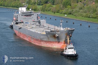
ECO YOSEMITE PARK
Tanker

Current Trip
KRUSN
| Time Travelled | 2 days |
|---|---|
| Remaining Time | --- |
| Distance Travelled | 667.45 nm |
| Remaining Distance | --- |
| AVG Speed | 12 Knots |
| MAX Speed | 14.2 Knots |
| AVG Wind | 13.5 knots |
| MAX Wind | 28.9 knots |
| MIN Temp | 16.5°C / 61.7°F |
| MAX Temp | 27.9°C / 82.22°F |
| Dybgang | 8.8 m |
| Position Modtaget | 2 d siden |
Current Position
| Longitude | 129.20068° |
|---|---|
| Latitude | 34.71808° |
| Status | Under way using engine |
| Fart | 11.8 Knots |
| Kurs | 207.6° |
| Område | Japan Sea |
| Station | T-AIS |
| Position Modtaget | 2 d siden |
Information
The current position of ECO YOSEMITE PARK is in Japan Sea with coordinates 34.71808° / 129.20068° as reported on 2025-06-11 23:05 by AIS to our vessel tracker app. The vessel's current speed is 11.8 Knots
The vessel ECO YOSEMITE PARK (IMO: 9877573, MMSI: 538008580) is a Tanker It's sailing under the flag of [MH] Marshall Is.
In this page you can find informations about the vessels current position, last detected port calls, and current voyage information. If the vessels is not in coverage by AIS you will find the latest position.
The current position of ECO YOSEMITE PARK is detected by our AIS receivers and we are not responsible for the reliability of the data. The last position was recorded while the vessel was in Coverage by the Ais receivers of our vessel tracking app.
The current draught of ECO YOSEMITE PARK as reported by AIS is 8.8 meters
Weather
| Temperature | 27.7°C / 81.86°F |
|---|---|
| Wind Speed | 27 knots |
| Direction | 238° WSW |
| Pressure | 1007.7 hPa |
| Humidity | 82.8 % |
| Cloud Coverage | 100 % |


Featured Company
Last Trips
Events
| Tid | Hændelsen | Detaljer | Position / Dest | Info |
|---|---|---|---|---|
| 2025-06-11 23:10 | Status er ændret | Default Under way using engine |
34.70390 / 129.19200
KRUSN
|
Fart: 11.8 kn Kurs: 207.6° |
| 2025-06-11 23:05 | Ændre havområde | Japanese part of the Japan Sea South Korean part of the Japan Sea |
34.71808 / 129.20068
Japan Sea
|
Fart: 11.8 kn Kurs: 207.6° |
| 2025-06-11 23:05 | Status er ændret | Under way using engine Default |
34.71808 / 129.20068
KRUSN
|
Fart: 11.8 kn Kurs: 210° |
| 2025-06-11 23:05 | Indenfor Dækning |
34.71808 / 129.20068
Japan Sea
|
Fart: 11.8 kn Kurs: 207.6° |
|
| 2025-06-11 23:05 | Udenfor Dækning |
34.71808 / 129.20068
Japan Sea
|
Fart: 11.8 kn Kurs: 207.6° |
|
| 2025-06-11 18:18 | START Sejllads |
35.48135 / 129.39317
[KR] ULSAN
|
Fart: 4.2 kn Kurs: 175° |
|
| 2025-06-11 18:16 | Afsejlet fra sidste havn |
|
35.44249 / 129.40271
KRUSN
|
Fart: 4.2 kn Kurs: 175° |
| 2025-06-10 09:29 | STOP Sejllads |
35.48646 / 129.39140
[KR] ULSAN
|
Fart: 0.1 kn Kurs: 175° |
|
| 2025-06-10 09:21 | Skibe i havn |
|
35.48488 / 129.39247
[KR] ULSAN
|
Fart: 7.3 kn Kurs: 352° |
| 2025-06-10 08:42 | START Sejllads | 2.62 nm, East of ONSAN |
35.43434 / 129.43039
KRUSN
|
Fart: 4.6 kn Kurs: 281° |