
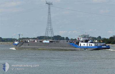
EILTANK 4
Wing in ground
Current Trip
| Trip Time | 3 h, 48 mins |
|---|---|
| Trip Distance | 18.85 nm |
| AVG Speed | 4.8 Knots |
| MAX Speed | 5.6 Knots |
| Dybgang | 0 m |
| AVG Wind | 11.7 knots |
| MAX Wind | 12 knots |
| MIN Temp | 11.4°C / 52.52°F |
| MAX Temp | 14°C / 57.2°F |
| Position Modtaget | 4 m siden |
Current Position
| Longitude | 6.69907° |
|---|---|
| Latitude | 51.21120° |
| Status | Under way using engine |
| Fart | |
| Kurs | --- |
| Område | North Sea |
| Station | T-AIS |
| Position Modtaget | 4 m siden |
Info
Information
The current position of EILTANK 4 is in North Sea with coordinates 51.21120° / 6.69907° as reported on 2025-02-24 23:36 by AIS to our vessel tracker app. The vessel's current speed is 0 Knots and is currently inside the port of NEUSS.
The vessel EILTANK 4 (MMSI: 211489060) is a Wing in ground It's sailing under the flag of [DE] Germany.
In this page you can find informations about the vessels current position, last detected port calls, and current voyage information. If the vessels is not in coverage by AIS you will find the latest position.
The current position of EILTANK 4 is detected by our AIS receivers and we are not responsible for the reliability of the data. The last position was recorded while the vessel was in Coverage by the Ais receivers of our vessel tracking app.
Weather
| Temperature | 9.4°C / 48.92°F |
|---|---|
| Wind Speed | 7 knots |
| Direction | 219° SW |
| Pressure | 1016.4 hPa |
| Humidity | 86.5 % |
| Cloud Coverage | 100 % |
Featured Company
Last Port Calls
| Port | Arrival | Departure | Time In Port |
|---|---|---|---|
| 2025-02-24 16:20 | |||
| 2025-02-24 11:30 | 2025-02-24 12:32 | 1 h | |
| 2025-02-22 20:24 | 2025-02-23 08:54 | 12 h | |
| 2025-02-22 15:05 | 2025-02-22 15:23 | 18 m | |
| 2025-02-20 18:16 | 2025-02-22 07:39 | 1 d | |
| 2025-02-19 08:36 | 2025-02-19 10:04 | 1 h | |
| 2025-02-17 12:25 | 2025-02-18 09:34 | 21 h | |
| 2025-02-15 22:56 | 2025-02-16 08:44 | 9 h | |
| 2025-02-14 07:28 | 2025-02-14 14:54 | 7 h | |
| 2025-02-13 00:37 | 2025-02-13 10:46 | 10 h |
Last Trips
| Origin | Departure | Destination | Arrival | Distance | |
|---|---|---|---|---|---|
| 2025-02-24 13:32 | 2025-02-24 17:20 | 18.85 nm | |||
| 2025-02-23 09:54 | 2025-02-24 12:30 | 102.23 nm | |||
| 2025-02-22 16:23 | 2025-02-22 21:24 | 38.33 nm | |||
| 2025-02-22 08:39 | 2025-02-22 16:05 | 70.40 nm | |||
| 2025-02-19 11:04 | 2025-02-20 19:16 | 79.63 nm | |||
| 2025-02-18 10:34 | 2025-02-19 09:36 | 48.41 nm | |||
| 2025-02-16 09:44 | 2025-02-17 13:25 | 49.69 nm | |||
| 2025-02-14 15:54 | 2025-02-15 23:56 | 106.58 nm | |||
| 2025-02-13 11:46 | 2025-02-14 08:28 | 115.28 nm | |||
| 2025-02-12 07:13 | 2025-02-13 01:37 | 15.56 nm |
Events
| Tid | Hændelsen | Detaljer | Position / Dest | Info |
|---|---|---|---|---|
| 2025-02-24 16:35 | STOP Sejllads |
51.21442 / 6.69590
[DE] NEUSS
|
Fart: 0.3 kn Kurs: 511° |
|
| 2025-02-24 16:20 | Skibe i havn |
|
51.22290 / 6.71624
[DE] NEUSS
|
Fart: 5.1 kn Kurs: 216.1° |
| 2025-02-24 12:32 | Afsejlet fra sidste havn |
|
51.40377 / 6.74482
DEFLV03902CITYX00105
|
Fart: 5.3 kn Kurs: 180.4° |
| 2025-02-24 11:30 | Skibe i havn |
|
51.47200 / 6.68923
[DE] DUISBURG
|
Fart: 5.3 kn Kurs: 162.6° |
| 2025-02-24 09:47 | Indenfor Dækning |
51.57806 / 6.66079
North Sea
|
Fart: 4.8 kn Kurs: 91.1° |
|
| 2025-02-24 04:28 | Udenfor Dækning |
51.80624 / 6.29960
North Sea
|
Fart: 5.6 kn Kurs: 128.6° |
|
| 2025-02-24 03:17 | START Sejllads | 1.29 nm, East of TOLKAMER |
51.84821 / 6.13858
DEFLV03902CITYX00105
|
Fart: 4.6 kn Kurs: 159.9° |
| 2025-02-23 19:05 | STOP Sejllads | 1.38 nm, East of TOLKAMER |
51.85080 / 6.14081
DEFLV03902CITYX00105
|
Fart: Kurs: 511° |
| 2025-02-23 14:13 | START Sejllads | 0.93 nm, North East of TIEL |
51.90034 / 5.45551
DEFLV03902CITYX00105
|
Fart: 3.6 kn Kurs: 162.3° |
| 2025-02-23 14:02 | STOP Sejllads | 1 nm, North East of TIEL |
51.90208 / 5.45443
DEFLV03902CITYX00105
|
Fart: Kurs: 511° |