
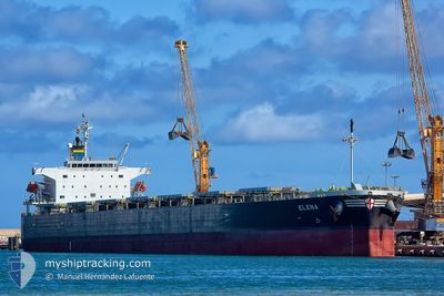
ELENA
Bulk Carrier
Current Trip
| Time Travelled | --- |
|---|---|
| Remaining Time | --- |
| Distance Travelled | 9358.13 nm |
| Remaining Distance | --- |
| AVG Speed | 10.6 Knots |
| MAX Speed | 13.4 Knots |
| AVG Wind | 10.5 knots |
| MAX Wind | 28 knots |
| MIN Temp | 16.1°C / 60.98°F |
| MAX Temp | 29.6°C / 85.28°F |
| Dybgang | 13.8 m |
| Position Modtaget | 4 m siden |
Current Position
| Longitude | 103.98513° |
|---|---|
| Latitude | 1.27981° |
| Status | At anchor |
| Fart | |
| Kurs | 60° |
| Område | Singapore Strait |
| Station | T-AIS |
| Position Modtaget | 4 m siden |
Info
Information
The current position of ELENA is in Singapore Strait with coordinates 1.27981° / 103.98513° as reported on 2026-01-05 18:54 by AIS to our vessel tracker app. The vessel's current speed is 0 Knots
The vessel ELENA (IMO: 9336880, MMSI: 311000157) is a Bulk Carrier that was built in 2009 ( 17 år gamle ). It's sailing under the flag of [BS] Bahamas.
In this page you can find informations about the vessels current position, last detected port calls, and current voyage information. If the vessels is not in coverage by AIS you will find the latest position.
The current position of ELENA is detected by our AIS receivers and we are not responsible for the reliability of the data. The last position was recorded while the vessel was in Coverage by the Ais receivers of our vessel tracking app.
The current draught of ELENA as reported by AIS is 13.8 meters
Weather
| Temperature | 25.6°C / 78.08°F |
|---|---|
| Wind Speed | 11 knots |
| Direction | 10° N |
| Pressure | 1011.9 hPa |
| Humidity | 87.6 % |
| Cloud Coverage | 100 % |
Featured Company
Last Port Calls
Last Trips
| Origin | Departure | Destination | Arrival | Distance |
|---|
Events
| Tid | Hændelsen | Detaljer | Position / Dest | Info |
|---|---|---|---|---|
| 2026-01-05 18:45 | Status er ændret | At anchor Default |
1.27972 / 103.98507
PHU_MY
|
Fart: Kurs: 60° |
| 2026-01-05 18:39 | Status er ændret | Default At anchor |
1.27972 / 103.98506
PHU_MY
|
Fart: Kurs: 60° |
| 2026-01-05 18:27 | Status er ændret | At anchor Default |
1.27981 / 103.98512
PHU_MY
|
Fart: Kurs: 61° |
| 2026-01-05 18:24 | Status er ændret | Default At anchor |
1.27982 / 103.98514
PHU_MY
|
Fart: Kurs: 61° |
| 2026-01-05 17:54 | Status er ændret | At anchor Default |
1.27984 / 103.98507
PHU_MY
|
Fart: Kurs: 63° |
| 2026-01-05 17:42 | Status er ændret | Default At anchor |
1.27985 / 103.98512
PHU_MY
|
Fart: Kurs: 61° |
| 2026-01-05 17:30 | Status er ændret | At anchor Default |
1.27969 / 103.98515
PHU_MY
|
Fart: 0.1 kn Kurs: 55° |
| 2026-01-05 17:27 | Status er ændret | Default At anchor |
1.27957 / 103.98521
PHU_MY
|
Fart: 0.1 kn Kurs: 62° |
| 2026-01-05 17:06 | Status er ændret | At anchor Default |
1.27966 / 103.98514
PHU_MY
|
Fart: Kurs: 67° |
| 2026-01-05 17:05 | Dybgangen er ændret | 13.8 13.3 |
1.27971 / 103.98516
PHU_MY
|
Fart: Kurs: 68° |