
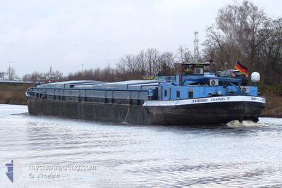
EMANUEL IV
Other Type
Current Trip
RGB
| Time Travelled | 7 h, 1 mins |
|---|---|
| Remaining Time | --- |
| Distance Travelled | 58.59 nm |
| Remaining Distance | --- |
| AVG Speed | 9.4 Knots |
| MAX Speed | 11.8 Knots |
| AVG Wind | 11.8 knots |
| MAX Wind | 15 knots |
| MIN Temp | 12.2°C / 53.96°F |
| MAX Temp | 20.9°C / 69.62°F |
| Dybgang | 2 m |
| Position Modtaget | 21 m siden |
Current Position
| Longitude | 4.62034° |
|---|---|
| Latitude | 51.71568° |
| Status | Under way using engine |
| Fart | 9 Knots |
| Kurs | 250.6° |
| Område | North Sea |
| Station | T-AIS |
| Position Modtaget | 21 m siden |
Info
Information
The current position of EMANUEL IV is in North Sea with coordinates 51.71568° / 4.62034° as reported on 2025-03-21 14:57 by AIS to our vessel tracker app. The vessel's current speed is 9 Knots
The vessel EMANUEL IV (MMSI: 211181050) is a Other Type It's sailing under the flag of [DE] Germany.
In this page you can find informations about the vessels current position, last detected port calls, and current voyage information. If the vessels is not in coverage by AIS you will find the latest position.
The current position of EMANUEL IV is detected by our AIS receivers and we are not responsible for the reliability of the data. The last position was recorded while the vessel was in Coverage by the Ais receivers of our vessel tracking app.
The current draught of EMANUEL IV as reported by AIS is 2 meters
Weather
| Temperature | 20.6°C / 69.08°F |
|---|---|
| Wind Speed | 11 knots |
| Direction | 154° SSE |
| Pressure | 1008.8 hPa |
| Humidity | 45.2 % |
| Cloud Coverage | 92 % |
Featured Company
Last Port Calls
| Port | Arrival | Departure | Time In Port |
|---|---|---|---|
| 2025-03-19 14:34 | 2025-03-21 09:18 | 1 d | |
| 2025-03-17 09:25 | 2025-03-17 09:47 | 21 m | |
| 2025-03-17 06:08 | 2025-03-17 06:54 | 45 m | |
| 2025-03-17 04:50 | 2025-03-17 05:12 | 22 m | |
| 2025-03-04 05:16 | 2025-03-04 05:38 | 22 m | |
| 2025-03-03 18:30 | 2025-03-04 04:07 | 9 h | |
| 2025-03-03 14:28 | 2025-03-03 14:52 | 24 m | |
| 2025-03-01 16:04 | 2025-03-02 04:11 | 12 h | |
| 2025-02-28 18:54 | 2025-03-01 06:57 | 12 h | |
| 2025-02-27 16:25 | 2025-02-28 05:00 | 12 h |
Most Visited Ports (Last year)
| Port | Arrivals | |
|---|---|---|
| 17 | ||
| 17 | ||
| 15 | ||
| 12 | ||
| 9 | ||
| 8 |
Last Trips
| Origin | Departure | Destination | Arrival | Distance | |
|---|---|---|---|---|---|
| 2025-03-17 09:47 | 2025-03-19 14:34 | 201.87 nm | |||
| 2025-03-17 06:54 | 2025-03-17 09:25 | 14.48 nm | |||
| 2025-03-17 05:12 | 2025-03-17 06:08 | 6.95 nm | |||
| 2025-03-04 05:38 | 2025-03-17 04:50 | 96.09 nm | |||
| 2025-03-04 04:07 | 2025-03-04 05:16 | 6.61 nm | |||
| 2025-03-03 14:52 | 2025-03-03 18:30 | 17.55 nm | |||
| 2025-03-02 04:11 | 2025-03-03 14:28 | 98.03 nm | |||
| 2025-03-01 06:57 | 2025-03-01 16:04 | 41.78 nm | |||
| 2025-02-28 05:00 | 2025-02-28 18:54 | 50.19 nm | |||
| 2025-02-26 15:53 | 2025-02-27 16:25 | 84.25 nm |
Events
| Tid | Hændelsen | Detaljer | Position / Dest | Info |
|---|---|---|---|---|
| 2025-03-21 14:58 | Status er ændret | Default Under way using engine |
51.71526 / 4.61844
RGB
|
Fart: 9 kn Kurs: 250.6° |
| 2025-03-21 14:51 | Status er ændret | Under way using engine Default |
51.72042 / 4.64379
RGB
|
Fart: 9.6 kn Kurs: 258° |
| 2025-03-21 14:38 | Indenfor Dækning |
51.72042 / 4.64379
North Sea
|
Fart: 9.5 kn Kurs: 250.6° |
|
| 2025-03-21 13:53 | Status er ændret | Default Under way using engine |
51.79801 / 4.83122
RGB
|
Fart: 9.7 kn Kurs: 232.9° |
| 2025-03-21 13:46 | Udenfor Dækning |
51.80310 / 4.86017
North Sea
|
Fart: 9.7 kn Kurs: 232.9° |
|
| 2025-03-21 12:47 | Status er ændret | Under way using engine Default |
51.82052 / 5.11279
RGB
|
Fart: 11.3 kn Kurs: 246° |
| 2025-03-21 12:22 | Status er ændret | Default Under way using engine |
51.81387 / 5.23121
RGB
|
Fart: 11.6 kn Kurs: 248.1° |
| 2025-03-21 11:15 | START Sejllads | 0.86 nm, North East of TIEL |
51.89898 / 5.45539
RGB
|
Fart: 8.1 kn Kurs: 160.1° |
| 2025-03-21 11:03 | STOP Sejllads | 0.94 nm, North East of TIEL |
51.90090 / 5.45418
RGB
|
Fart: 0.3 kn Kurs: 511° |
| 2025-03-21 09:59 | START Sejllads | 0.47 nm, North West of MAURIK |
51.97584 / 5.40594
RGB
|
Fart: 8.2 kn Kurs: 255.1° |