
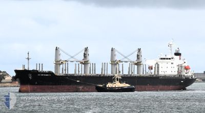
ES INTEGRITY
Cargo
Current Trip
| Trip Time | 8 days |
|---|---|
| Trip Distance | 1501.66 nm |
| AVG Speed | 11.2 Knots |
| MAX Speed | 14.6 Knots |
| Dybgang | 10.1 m |
| AVG Wind | 14.9 knots |
| MAX Wind | 26.8 knots |
| MIN Temp | 16.6°C / 61.88°F |
| MAX Temp | 28.3°C / 82.94°F |
| Position Modtaget | 5 d siden |
Current Position
| Longitude | -54.66217° |
|---|---|
| Latitude | -36.28345° |
| Status | Under way using engine |
| Fart | 10.4 Knots |
| Kurs | 221.6° |
| Område | South Atlantic Ocean |
| Station | T-AIS |
| Position Modtaget | 5 d siden |
Info
Information
The current position of ES INTEGRITY is in South Atlantic Ocean with coordinates -36.28345° / -54.66217° as reported on 2025-02-07 14:57 by AIS to our vessel tracker app. The vessel's current speed is 10.4 Knots and is currently inside the port of NECOCHEA.
The vessel ES INTEGRITY (IMO: 9736963, MMSI: 371608000) is a Cargo It's sailing under the flag of [PA] Panama.
In this page you can find informations about the vessels current position, last detected port calls, and current voyage information. If the vessels is not in coverage by AIS you will find the latest position.
The current position of ES INTEGRITY is detected by our AIS receivers and we are not responsible for the reliability of the data. The last position was recorded while the vessel was in Coverage by the Ais receivers of our vessel tracking app.
The current draught of ES INTEGRITY as reported by AIS is 10.1 meters
Weather
| Temperature | 23.3°C / 73.94°F |
|---|---|
| Wind Speed | 11 knots |
| Direction | 172° S |
| Pressure | 1018.7 hPa |
| Humidity | 33.9 % |
| Cloud Coverage | --- |
Featured Company
Last Port Calls
| Port | Arrival | Departure | Time In Port |
|---|---|---|---|
| 2025-02-11 10:39 | |||
| 2025-01-28 06:53 | 2025-02-03 01:24 | 5 d | |
| 2025-01-19 22:13 | 2025-01-21 18:49 | 1 d | |
| 2025-01-09 17:32 | 2025-01-15 03:04 | 5 d | |
| 2024-12-15 20:53 | 2024-12-17 09:57 | 1 d | |
| 2024-12-01 07:05 |
Most Visited Ports (Last year)
| Port | Arrivals | |
|---|---|---|
| 2 | ||
| 2 | ||
| 2 | ||
| 2 | ||
| 1 | ||
| 1 |
Last Trips
| Origin | Departure | Destination | Arrival | Distance | |
|---|---|---|---|---|---|
| 2025-02-03 01:24 | 2025-02-11 10:39 | 1501.66 nm | |||
| 2025-01-21 18:49 | 2025-01-28 06:53 | 1553.60 nm | |||
| 2025-01-15 03:04 | 2025-01-19 22:13 | 1096.80 nm | |||
| 2024-12-17 09:57 | 2025-01-09 17:32 | 5083.28 nm | |||
| 2024-12-01 07:05 | 2024-12-15 20:53 | 1973.60 nm |
Events
| Tid | Hændelsen | Detaljer | Position / Dest | Info |
|---|---|---|---|---|
| 2025-02-11 13:39 | STOP Sejllads |
-38.57361 / -58.71175
[AR] NECOCHEA
|
Fart: Kurs: 116° |
|
| 2025-02-11 13:39 | Skibe i havn |
|
-38.57361 / -58.71175
[AR] NECOCHEA
|
Fart: 2.2 kn Kurs: 113° |
| 2025-02-11 10:27 | START Sejllads | 6.41 nm, South of NECOCHEA |
-38.67833 / -58.67804
BRVIX
|
Fart: 4.2 kn Kurs: 24° |
| 2025-02-09 21:37 | STOP Sejllads | 6.62 nm, South of NECOCHEA |
-38.68251 / -58.68159
BRVIX
|
Fart: 0.2 kn Kurs: 94° |
| 2025-02-09 20:44 | START Sejllads | 6.56 nm, South of NECOCHEA |
-38.68145 / -58.68136
BRVIX
|
Fart: 3.2 kn Kurs: 110° |
| 2025-02-08 13:18 | STOP Sejllads | 6.81 nm, South of NECOCHEA |
-38.68471 / -58.67589
BRVIX
|
Fart: Kurs: 339° |
| 2025-02-07 15:02 | Status er ændret | Default Under way using engine |
-36.29620 / -54.67551
BRVIX
|
Fart: 10.4 kn Kurs: 221.6° |
| 2025-02-07 14:57 | Ændre havområde | Argentinean part of the South Atlantic Ocean Uruguayan part of the South Atlantic Ocean |
-36.28345 / -54.66217
South Atlantic Ocean
|
Fart: 10.4 kn Kurs: 221.6° |
| 2025-02-07 14:57 | Status er ændret | Under way using engine Default |
-36.28345 / -54.66217
BRVIX
|
Fart: 10.8 kn Kurs: 224° |
| 2025-02-07 14:57 | Udenfor Dækning |
-36.28345 / -54.66217
South Atlantic Ocean
|
Fart: 10.4 kn Kurs: 221.6° |