
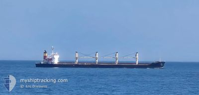
ETNA
Bulk Carrier
Current Trip
| Time Travelled | 6 days |
|---|---|
| Remaining Time | 20 h, 42 mins |
| Distance Travelled | 1569.89 nm |
| Remaining Distance | 271.00 nm |
| AVG Speed | 8.8 Knots |
| MAX Speed | 12.6 Knots |
| AVG Wind | 13.3 knots |
| MAX Wind | 27 knots |
| MIN Temp | 1.4°C / 34.52°F |
| MAX Temp | 15.9°C / 60.62°F |
| Dybgang | 6.3 m |
| Position Modtaget | Nu |
Current Position
| Longitude | 29.00153° |
|---|---|
| Latitude | 40.80450° |
| Status | Under way using engine |
| Fart | 3.5 Knots |
| Kurs | 48° |
| Område | Sea of Marmara |
| Station | T-AIS |
| Position Modtaget | Nu |
Info
Information
The current position of ETNA is in Sea of Marmara with coordinates 40.80450° / 29.00153° as reported on 2025-03-21 15:19 by AIS to our vessel tracker app. The vessel's current speed is 3.5 Knots and is heading at the port of SULINA. The estimated time of arrival as calculated by MyShipTracking vessel tracking app is 2025-03-22 14:01 LT
The vessel ETNA (IMO: 9393618, MMSI: 271052465) is a Bulk Carrier that was built in 2007 ( 18 år gamle ). It's sailing under the flag of [TR] Turkey.
In this page you can find informations about the vessels current position, last detected port calls, and current voyage information. If the vessels is not in coverage by AIS you will find the latest position.
The current position of ETNA is detected by our AIS receivers and we are not responsible for the reliability of the data. The last position was recorded while the vessel was in Coverage by the Ais receivers of our vessel tracking app.
The current draught of ETNA as reported by AIS is 6.3 meters
Weather
| Temperature | 9.7°C / 49.46°F |
|---|---|
| Wind Speed | 13 knots |
| Direction | 58° ENE |
| Pressure | 1026.2 hPa |
| Humidity | 61.4 % |
| Cloud Coverage | 60 % |
Featured Company
Events
| Tid | Hændelsen | Detaljer | Position / Dest | Info |
|---|---|---|---|---|
| 2025-03-21 15:17 | START Sejllads | 8.86 nm, South West of MALTEPE |
40.80476 / 28.99930
ROSUL
|
Fart: 3.1 kn Kurs: 82° |
| 2025-03-21 12:57 | STOP Sejllads | 9.27 nm, South West of MALTEPE |
40.81700 / 28.97102
ROSUL
|
Fart: 0.3 kn Kurs: 103° |
| 2025-03-21 05:48 | Indenfor Dækning |
40.72207 / 27.64473
Sea of Marmara
ROSUL
|
Fart: 11.8 kn Kurs: 83.3° |
|
| 2025-03-21 04:40 | Udenfor Dækning |
40.63529 / 27.37653
Sea of Marmara
ROSUL
|
Fart: 11.7 kn Kurs: 67.6° |
|
| 2025-03-21 04:21 | Indenfor Dækning |
40.61153 / 27.30331
Sea of Marmara
ROSUL
|
Fart: 12 kn Kurs: 67.9° |
|
| 2025-03-21 01:04 | Udenfor Dækning |
40.30073 / 26.58285
Sea of Marmara
ROSUL
|
Fart: 10.9 kn Kurs: 49.1° |
|
| 2025-03-20 22:30 | Ændre havområde | Turkish part of the Sea of Marmara Turkish part of the Aegean Sea |
40.01670 / 26.19577
Sea of Marmara
ROSUL
|
Fart: 9.4 kn Kurs: 79.1° |
| 2025-03-20 20:14 | Ændre havområde | Turkish part of the Aegean Sea Greek part of the Aegean Sea |
39.85020 / 25.89765
Aegean Sea
ROSUL
|
Fart: 7.8 kn Kurs: 14° |
| 2025-03-20 19:49 | Ændre havområde | Greek part of the Aegean Sea Turkish part of the Aegean Sea |
39.78621 / 25.90931
Aegean Sea
ROSUL
|
Fart: 11.5 kn Kurs: 316.3° |
| 2025-03-20 19:27 | START Sejllads | 6.18 nm, South West of BOZCAADA |
39.76967 / 25.97179
ROSUL
|
Fart: 3.2 kn Kurs: 291° |