
FAST
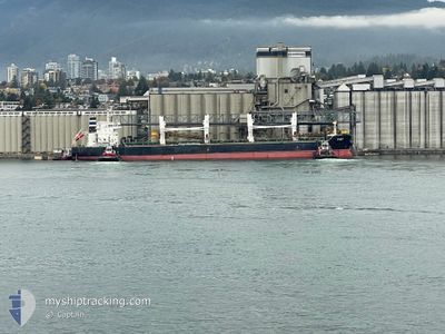
Bulk Carrier
Current Trip
| Time Travelled | 5 days |
|---|---|
| Remaining Time | 13 h, 0 mins |
| Distance Travelled | 1434.89 nm |
| Remaining Distance | 139.34 nm |
| AVG Speed | 10.5 Knots |
| MAX Speed | 11.8 Knots |
| AVG Wind | 15.1 knots |
| MAX Wind | 28 knots |
| MIN Temp | 7.3°C / 45.14°F |
| MAX Temp | 17.8°C / 64.04°F |
| Dybgang | 11.8 m |
| Position Modtaget | Nu |
Current Position
| Longitude | -5.83335° |
|---|---|
| Latitude | 50.72230° |
| Status | Under way using engine |
| Fart | 10.5 Knots |
| Kurs | 41.3° |
| Område | Celtic Sea |
| Station | T-AIS |
| Position Modtaget | Nu |
Info
Information
The current position of FAST is in Celtic Sea with coordinates 50.72230° / -5.83335° as reported on 2025-02-10 02:29 by AIS to our vessel tracker app. The vessel's current speed is 10.5 Knots and is heading at the port of PORTBURY. The estimated time of arrival as calculated by MyShipTracking vessel tracking app is 2025-02-10 15:30 LT
The vessel FAST (IMO: 9513842, MMSI: 538010009) is a Bulk Carrier that was built in 2012 ( 13 år gamle ). It's sailing under the flag of [MH] Marshall Is.
In this page you can find informations about the vessels current position, last detected port calls, and current voyage information. If the vessels is not in coverage by AIS you will find the latest position.
The current position of FAST is detected by our AIS receivers and we are not responsible for the reliability of the data. The last position was recorded while the vessel was in Coverage by the Ais receivers of our vessel tracking app.
The current draught of FAST as reported by AIS is 11.8 meters
Weather
| Temperature | 7.2°C / 44.96°F |
|---|---|
| Wind Speed | 25 knots |
| Direction | 57° ENE |
| Pressure | 1027.6 hPa |
| Humidity | 85.1 % |
| Cloud Coverage | 91 % |
Featured Company
Last Port Calls
| Port | Arrival | Departure | Time In Port |
|---|---|---|---|
| 2025-02-03 20:19 | 2025-02-04 11:09 | 14 h | |
| 2024-12-22 05:54 | 2024-12-27 07:58 | 5 d |
Last Trips
| Origin | Departure | Destination | Arrival | Distance | |
|---|---|---|---|---|---|
| 2024-12-27 13:28 | 2025-02-03 20:19 | 8762.04 nm | |||
| 2024-10-16 17:20 | 2024-12-22 11:24 | 6281.91 nm |
Events
| Tid | Hændelsen | Detaljer | Position / Dest | Info |
|---|---|---|---|---|
| 2025-02-10 01:27 | ETA er ændret | 2025/02/10 15:00 2025/02/10 08:00 |
50.58174 / -6.02550
ESLPA>>GBBRS
|
Fart: 10.7 kn Kurs: 38.9° |
| 2025-02-10 01:13 | Status er ændret | Under way using engine Default |
50.55073 / -6.06450
ESLPA>>GBBRS
|
Fart: 10.7 kn Kurs: 39° |
| 2025-02-10 01:11 | Status er ændret | Default Under way using engine |
50.54767 / -6.06834
ESLPA>>GBBRS
|
Fart: 10.7 kn Kurs: 27.7° |
| 2025-02-10 01:05 | Status er ændret | Under way using engine Default |
50.53247 / -6.08559
ESLPA>>GBBRS
|
Fart: 10.8 kn Kurs: 23° |
| 2025-02-10 00:35 | Status er ændret | Default Under way using engine |
50.44844 / -6.11908
ESLPA>>GBBRS
|
Fart: 10.6 kn Kurs: 45.5° |
| 2025-02-10 00:28 | Status er ændret | Under way using engine Default |
50.43361 / -6.14013
ESLPA>>GBBRS
|
Fart: 10.5 kn Kurs: 46° |
| 2025-02-10 00:23 | Status er ændret | Default Under way using engine |
50.42348 / -6.15664
ESLPA>>GBBRS
|
Fart: 10.5 kn Kurs: 42.4° |
| 2025-02-10 00:15 | Fundet i havområde | United Kingdom part of the Celtic Sea |
50.40573 / -6.18500
Celtic Sea
ESLPA>>GBBRS
|
Fart: 10.5 kn Kurs: 42.4° |
| 2025-02-10 00:15 | Status er ændret | Under way using engine Default |
50.40573 / -6.18500
ESLPA>>GBBRS
|
Fart: 10.4 kn Kurs: 39° |
| 2025-02-10 00:15 | Indenfor Dækning |
50.40573 / -6.18500
Celtic Sea
ESLPA>>GBBRS
|
Fart: 10.5 kn Kurs: 42.4° |