
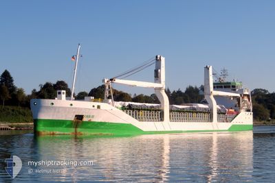
FINN III
General Cargo
Current Trip
| Trip Time | 2 days |
|---|---|
| Trip Distance | 654.47 nm |
| AVG Speed | 10.9 Knots |
| MAX Speed | 13.4 Knots |
| Dybgang | 5.3 m |
| AVG Wind | 9.6 knots |
| MAX Wind | 18 knots |
| MIN Temp | -0.3°C / 31.46°F |
| MAX Temp | 4.7°C / 40.46°F |
| Position Modtaget | 18 h, 24 m siden |
Current Position
| Longitude | 27.13812° |
|---|---|
| Latitude | 60.46999° |
| Status | Under way using engine |
| Fart | 10.4 Knots |
| Kurs | 344.9° |
| Område | Gulf of Finland |
| Station | T-AIS |
| Position Modtaget | 18 h, 24 m siden |
Info
Information
The current position of FINN III is in Gulf of Finland with coordinates 60.46999° / 27.13812° as reported on 2025-03-02 20:57 by AIS to our vessel tracker app. The vessel's current speed is 10.4 Knots and is currently inside the port of HAMINA.
The vessel FINN III (IMO: 9534456, MMSI: 305166000) is a General Cargo that was built in 2011 ( 14 år gamle ). It's sailing under the flag of [AG] Antigua Barbuda.
In this page you can find informations about the vessels current position, last detected port calls, and current voyage information. If the vessels is not in coverage by AIS you will find the latest position.
The current position of FINN III is detected by our AIS receivers and we are not responsible for the reliability of the data. The last position was recorded while the vessel was in Coverage by the Ais receivers of our vessel tracking app.
The current draught of FINN III as reported by AIS is 5.3 meters
Weather
| Temperature | 0.6°C / 33.08°F |
|---|---|
| Wind Speed | 15 knots |
| Direction | 242° WSW |
| Pressure | 997.3 hPa |
| Humidity | 97.9 % |
| Cloud Coverage | 100 % |
Featured Company
Last Port Calls
| Port | Arrival | Departure | Time In Port |
|---|---|---|---|
| 2025-03-02 21:21 | |||
| 2025-02-24 11:10 | 2025-02-27 22:31 | 3 d | |
| 2025-02-23 07:14 | 2025-02-23 07:15 | 1 m | |
| 2025-02-17 03:21 | 2025-02-17 10:27 | 7 h | |
| 2025-02-06 07:38 | 2025-02-10 17:58 | 4 d | |
| 2025-01-12 09:52 | 2025-01-21 16:29 | 9 d | |
| 2025-01-03 21:59 | 2025-01-08 06:31 | 4 d |
Last Trips
| Origin | Departure | Destination | Arrival | Distance | |
|---|---|---|---|---|---|
| 2025-02-27 23:31 | 2025-03-02 23:21 | 654.47 nm | |||
| 2025-02-23 08:15 | 2025-02-24 12:10 | 82.02 nm | |||
| 2025-02-17 11:27 | 2025-02-23 08:14 | 1690.61 nm | |||
| 2025-02-10 20:58 | 2025-02-17 04:21 | 1820.91 nm | |||
| 2025-01-21 19:29 | 2025-02-06 10:38 | 75.09 nm | |||
| 2025-01-08 08:31 | 2025-01-12 12:52 | 763.94 nm | |||
| 2024-12-19 03:38 | 2025-01-03 23:59 | 3598.47 nm |
Events
| Tid | Hændelsen | Detaljer | Position / Dest | Info |
|---|---|---|---|---|
| 2025-03-02 21:21 | Skibe i havn |
|
60.51742 / 27.16959
[FI] HAMINA
|
Fart: 3.9 kn Kurs: 41° |
| 2025-03-02 21:01 | Status er ændret | Default Under way using engine |
60.48139 / 27.13321
FIHMN
|
Fart: 10.4 kn Kurs: 344.9° |
| 2025-03-02 20:57 | Udenfor Dækning |
60.46999 / 27.13812
Gulf of Finland
[FI] HAMINA
|
Fart: 10.4 kn Kurs: 344.9° |
|
| 2025-03-02 19:24 | START Sejllads | 4.17 nm, South of KOTKA |
60.41396 / 26.90837
FIHMN
|
Fart: 4.2 kn Kurs: 226° |
| 2025-03-02 18:16 | Status er ændret | Under way using engine Default |
60.41860 / 26.90227
FIHMN
|
Fart: Kurs: 320° |
| 2025-03-02 18:11 | Status er ændret | Default Moored |
60.41861 / 26.90230
FIHMN
|
Fart: Kurs: 320° |
| 2025-03-02 18:02 | Dybgangen er ændret | 5.3 4.8 |
60.41857 / 26.90231
FIHMN
|
Fart: Kurs: 320° |
| 2025-03-02 18:02 | Destination er ændret | FIHMN FIKTK |
60.41857 / 26.90231
FIHMN
|
Fart: Kurs: 320° |
| 2025-03-02 18:02 | ETA er ændret | 2025/03/02 23:00 2025/03/02 08:00 |
60.41857 / 26.90231
FIHMN
|
Fart: Kurs: 320° |
| 2025-03-02 16:38 | Status er ændret | Moored Default |
60.41859 / 26.90246
FIKTK
|
Fart: Kurs: 319° |