

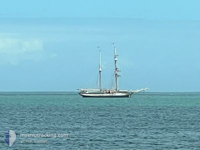
FLORETTE
Sailing

Current Trip
VIBO MARINA
| Time Travelled | 4 days |
|---|---|
| Remaining Time | --- |
| Distance Travelled | 61.64 nm |
| Remaining Distance | --- |
| AVG Speed | 5.3 Knots |
| MAX Speed | 7.6 Knots |
| AVG Wind | 8.8 knots |
| MAX Wind | 15.6 knots |
| MIN Temp | 18.1°C / 64.58°F |
| MAX Temp | 20.5°C / 68.9°F |
| Dybgang | 3.2 m |
| Position Modtaget | 6 h, 2 m siden |
Current Position
| Longitude | 15.24692° |
|---|---|
| Latitude | 38.80498° |
| Status | Under way sailing |
| Fart | 0.2 Knots |
| Kurs | --- |
| Område | Tyrrhenian Sea |
| Station | T-AIS |
| Position Modtaget | 6 h, 2 m siden |
Information
The current position of FLORETTE is in Tyrrhenian Sea with coordinates 38.80498° / 15.24692° as reported on 2025-05-21 09:52 by AIS to our vessel tracker app. The vessel's current speed is 0.2 Knots
The vessel FLORETTE (MMSI: 256519000) is a Sailing It's sailing under the flag of [MT] Malta.
In this page you can find informations about the vessels current position, last detected port calls, and current voyage information. If the vessels is not in coverage by AIS you will find the latest position.
The current position of FLORETTE is detected by our AIS receivers and we are not responsible for the reliability of the data. The last position was recorded while the vessel was in Coverage by the Ais receivers of our vessel tracking app.
The current draught of FLORETTE as reported by AIS is 3.2 meters
Weather
| Temperature | 18.9°C / 66.02°F |
|---|---|
| Wind Speed | 7 knots |
| Direction | 261° W |
| Pressure | 1015.9 hPa |
| Humidity | 81.8 % |
| Cloud Coverage | 74 % |


Featured Company
Last Port Calls
| Port | Arrival | Departure | Time In Port |
|---|---|---|---|
| 2025-05-16 06:54 | 2025-05-17 08:10 | 1 d | |
| 2025-05-06 16:14 | |||
| 2025-04-20 08:43 | |||
| 2025-03-05 16:46 | 2025-03-17 05:12 | 11 d |
Events
| Tid | Hændelsen | Detaljer | Position / Dest | Info |
|---|---|---|---|---|
| 2025-05-21 09:52 | Udenfor Dækning |
38.80498 / 15.24692
Tyrrhenian Sea
|
Fart: 0.2 kn Kurs: 330.4° |
|
| 2025-05-21 09:34 | STOP Sejllads | 12.78 nm, North East of PANAREA |
38.80504 / 15.24694
VIBO MARINA
|
Fart: 0.1 kn Kurs: 511° |
| 2025-05-21 05:57 | START Sejllads | 2.64 nm, North of LIPARI |
38.51377 / 14.96923
VIBO MARINA
|
Fart: 6.2 kn Kurs: 26.5° |
| 2025-05-21 01:19 | STOP Sejllads | 2.4 nm, North of LIPARI |
38.50998 / 14.96644
VIBO MARINA
|
Fart: 0.2 kn Kurs: 511° |
| 2025-05-20 23:36 | START Sejllads | 2.09 nm, North West of SALINA |
38.58752 / 14.85179
VIBO MARINA
|
Fart: 4.5 kn Kurs: 80.5° |
| 2025-05-20 21:29 | Indenfor Dækning |
38.58341 / 14.84550
Tyrrhenian Sea
|
Fart: 0.3 kn Kurs: 70.4° |
|
| 2025-05-20 13:48 | Udenfor Dækning |
38.58262 / 14.84567
Tyrrhenian Sea
|
Fart: 0.1 kn Kurs: 71.7° |
|
| 2025-05-20 12:11 | Indenfor Dækning |
38.58250 / 14.84462
Tyrrhenian Sea
|
Fart: 0.1 kn Kurs: 96.5° |
|
| 2025-05-20 06:21 | Udenfor Dækning |
38.58621 / 14.80849
Tyrrhenian Sea
|
Fart: 6.2 kn Kurs: 72.8° |
|
| 2025-05-20 06:12 | START Sejllads | 2.37 nm, North West of RINELLA |
38.57680 / 14.79716
VIBO MARINA
|
Fart: 5.5 kn Kurs: 359.2° |