
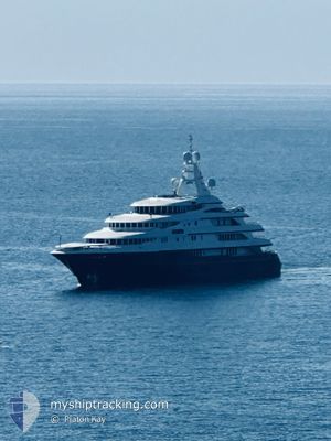
FREEDOM
Yacht
Current Trip
| Time Travelled | 8 days |
|---|---|
| Remaining Time | 2 days |
| Distance Travelled | 52.41 nm |
| Remaining Distance | 3767.81 nm |
| AVG Speed | 13.2 Knots |
| MAX Speed | 17.6 Knots |
| AVG Wind | 6.6 knots |
| MAX Wind | 16 knots |
| MIN Temp | 11.9°C / 53.42°F |
| MAX Temp | 14.4°C / 57.92°F |
| Dybgang | 3.8 m |
| Position Modtaget | 8 d siden |
Current Position
| Longitude | -6.27055° |
|---|---|
| Latitude | 35.91057° |
| Status | Under way using engine |
| Fart | 12.9 Knots |
| Kurs | 233.7° |
| Område | North Atlantic Ocean |
| Station | T-AIS |
| Position Modtaget | 8 d siden |
Info
Information
The current position of FREEDOM is in North Atlantic Ocean with coordinates 35.91057° / -6.27055° as reported on 2025-01-31 14:11 by AIS to our vessel tracker app. The vessel's current speed is 12.9 Knots and is heading at the port of FORT LAUDERDALE. The estimated time of arrival as calculated by MyShipTracking vessel tracking app is 2025-02-11 05:02 LT
The vessel FREEDOM (IMO: 8975067, MMSI: 319107000) is a Yacht that was built in 2000 ( 25 år gamle ). It's sailing under the flag of [KY] Cayman Is.
In this page you can find informations about the vessels current position, last detected port calls, and current voyage information. If the vessels is not in coverage by AIS you will find the latest position.
The current position of FREEDOM is detected by our AIS receivers and we are not responsible for the reliability of the data. The last position was recorded while the vessel was in Coverage by the Ais receivers of our vessel tracking app.
The current draught of FREEDOM as reported by AIS is 3.8 meters
Weather
| Temperature | 14.4°C / 57.92°F |
|---|---|
| Wind Speed | 16 knots |
| Direction | 6° N |
| Pressure | 1026.4 hPa |
| Humidity | 57.4 % |
| Cloud Coverage | --- |
Featured Company
Most Visited Ports (Last year)
| Port | Arrivals | |
|---|---|---|
| 7 | ||
| 2 | ||
| 2 | ||
| 2 | ||
| 2 | ||
| 1 |
Events
| Tid | Hændelsen | Detaljer | Position / Dest | Info |
|---|---|---|---|---|
| 2025-01-31 14:11 | Udenfor Dækning |
35.91057 / -6.27055
North Atlantic Ocean
US FLL
|
Fart: 12.9 kn Kurs: 233.7° |
|
| 2025-01-31 14:10 | Ændre havområde | Moroccan part of the North Atlantic Ocean Spanish part of the North Atlantic Ocean |
35.91282 / -6.26684
North Atlantic Ocean
US FLL
|
Fart: 13.5 kn Kurs: 232.9° |
| 2025-01-31 13:40 | Fundet i havområde | Spanish part of the North Atlantic Ocean |
35.95088 / -6.13127
North Atlantic Ocean
US FLL
|
Fart: 14.1 kn Kurs: 267° |
| 2025-01-31 13:07 | Fundet i havområde | Moroccan part of the North Atlantic Ocean |
35.94999 / -5.96917
North Atlantic Ocean
US FLL
|
Fart: 14.3 kn Kurs: 268.8° |
| 2025-01-31 12:51 | Ændre havområde | Moroccan part of the Strait of Gibraltar Spanish part of the Strait of Gibraltar |
35.95156 / -5.88522
Strait of Gibraltar
US FLL
|
Fart: 14.5 kn Kurs: 268.7° |
| 2025-01-31 10:52 | Ændre havområde | Spanish part of the Strait of Gibraltar Gibraltarian part of the Strait of Gibraltar |
36.04169 / -5.35842
Strait of Gibraltar
US FLL
|
Fart: 11.8 kn Kurs: 229° |
| 2025-01-31 10:21 | Afsejlet fra sidste havn |
|
36.14058 / -5.37014
US FLL
|
Fart: 7.7 kn Kurs: 205° |
| 2025-01-31 10:15 | START Sejllads |
36.14182 / -5.36301
[GI] GIBRALTAR
|
Fart: 3.1 kn Kurs: 304° |
|
| 2025-01-31 10:00 | Status er ændret | Under way using engine Moored |
36.14053 / -5.36123
[GI] GIBRALTAR
|
Fart: Kurs: 340° |
| 2025-01-31 07:52 | Destination er ændret | US FLL GI GIB |
36.14053 / -5.36119
[GI] GIBRALTAR
|
Fart: 0.1 kn Kurs: 339° |