

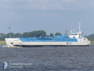
FROYA
Co2 Tanker
Current Trip
| Time Travelled | 1 day |
|---|---|
| Remaining Time | 24 mins |
| Distance Travelled | 290.97 nm |
| Remaining Distance | 3.19 nm |
| AVG Speed | 7.9 Knots |
| MAX Speed | 13.4 Knots |
| AVG Wind | 18.3 knots |
| MAX Wind | 22.6 knots |
| MIN Temp | 12.3°C / 54.14°F |
| MAX Temp | 19°C / 66.2°F |
| Dybgang | 3.8 m |
| Position Modtaget | 1 m siden |
Current Position
| Longitude | 3.81754° |
|---|---|
| Latitude | 51.32797° |
| Status | Under way using engine |
| Fart | 0.3 Knots |
| Kurs | 156° |
| Område | North Sea |
| Station | T-AIS |
| Position Modtaget | 1 m siden |
Information
The current position of FROYA is in North Sea with coordinates 51.32797° / 3.81754° as reported on 2025-05-25 16:22 by AIS to our vessel tracker app. The vessel's current speed is 0.3 Knots and is heading at the port of SLUISKIL. The estimated time of arrival as calculated by MyShipTracking vessel tracking app is 2025-05-25 18:47 LT
The vessel FROYA (IMO: 9345350, MMSI: 257081000) is a Co2 Tanker that was built in 2005 ( 20 år gamle ). It's sailing under the flag of [NO] Norway.
In this page you can find informations about the vessels current position, last detected port calls, and current voyage information. If the vessels is not in coverage by AIS you will find the latest position.
The current position of FROYA is detected by our AIS receivers and we are not responsible for the reliability of the data. The last position was recorded while the vessel was in Coverage by the Ais receivers of our vessel tracking app.
The current draught of FROYA as reported by AIS is 3.8 meters
Weather
| Temperature | 19°C / 66.2°F |
|---|---|
| Wind Speed | 15 knots |
| Direction | 284° WNW |
| Pressure | 1010.5 hPa |
| Humidity | 47.9 % |
| Cloud Coverage | 81 % |
Featured Company
Last Port Calls
| Port | Arrival | Departure | Time In Port |
|---|---|---|---|
| 2025-05-22 21:16 | 2025-05-24 10:24 | 1 d | |
| 2025-05-18 08:15 | 2025-05-20 21:31 | 2 d | |
| 2025-05-16 03:50 | 2025-05-16 13:05 | 9 h | |
| 2025-05-14 21:01 | 2025-05-15 07:04 | 10 h | |
| 2025-05-13 08:54 | 2025-05-13 22:36 | 13 h | |
| 2025-05-09 16:46 | 2025-05-11 00:55 | 1 d | |
| 2025-05-08 08:29 | 2025-05-09 01:55 | 17 h | |
| 2025-05-03 05:17 | 2025-05-06 12:43 | 3 d | |
| 2025-05-01 21:20 | 2025-05-02 14:16 | 16 h | |
| 2025-04-29 16:12 | 2025-04-30 06:16 | 14 h |
Last Trips
| Origin | Departure | Destination | Arrival | Distance | |
|---|---|---|---|---|---|
| 2025-05-20 21:31 | 2025-05-22 21:16 | 471.72 nm | |||
| 2025-05-16 13:05 | 2025-05-18 08:15 | 404.74 nm | |||
| 2025-05-15 07:04 | 2025-05-16 03:50 | 174.13 nm | |||
| 2025-05-13 22:36 | 2025-05-14 21:01 | 250.53 nm | |||
| 2025-05-11 00:55 | 2025-05-13 08:54 | 602.34 nm | |||
| 2025-05-09 01:55 | 2025-05-09 16:46 | 143.24 nm | |||
| 2025-05-06 12:43 | 2025-05-08 08:29 | 149.39 nm | |||
| 2025-05-02 14:16 | 2025-05-03 05:17 | 139.67 nm | |||
| 2025-04-30 06:16 | 2025-05-01 21:20 | 260.38 nm | |||
| 2025-04-27 19:10 | 2025-04-29 16:12 | 465.46 nm |
Events
| Tid | Hændelsen | Detaljer | Position / Dest | Info |
|---|---|---|---|---|
| 2025-05-25 16:22 | STOP Sejllads | 0.57 nm, North West of TERNEUZEN |
51.32797 / 3.81754
NLSLU
|
Fart: 0.3 kn Kurs: 156° |
| 2025-05-25 09:19 | Ændre havområde | Dutch part of the North Sea Belgian part of the North Sea |
51.78529 / 2.69973
North Sea
NLSLU
|
Fart: 12.4 kn Kurs: 79.1° |
| 2025-05-25 08:46 | Ændre havområde | Belgian part of the North Sea United Kingdom part of the North Sea |
51.83003 / 2.56540
North Sea
NLSLU
|
Fart: 11.4 kn Kurs: 153.5° |
| 2025-05-25 08:44 | Status er ændret | Under way using engine Default |
51.83516 / 2.56088
NLSLU
|
Fart: 11.7 kn Kurs: 140° |
| 2025-05-25 08:39 | Indenfor Dækning |
51.83003 / 2.56540
North Sea
NLSLU
|
Fart: 11.4 kn Kurs: 153.5° |
|
| 2025-05-25 01:18 | Status er ændret | Default Under way using engine |
52.81585 / 1.81810
NLSLU
|
Fart: 7.9 kn Kurs: 114.6° |
| 2025-05-25 01:10 | Udenfor Dækning |
52.82383 / 1.79066
North Sea
NLSLU
|
Fart: 7.9 kn Kurs: 114.6° |
|
| 2025-05-24 21:41 | Status er ændret | Under way using engine Default |
53.15806 / 1.33674
NLSLU
|
Fart: 8.2 kn Kurs: 153° |
| 2025-05-24 21:39 | Indenfor Dækning |
53.15806 / 1.33674
North Sea
NLSLU
|
Fart: 8.2 kn Kurs: 152.6° |
|
| 2025-05-24 14:49 | Udenfor Dækning |
53.99358 / .31504
North Sea
NLSLU
|
Fart: 12.2 kn Kurs: 133.7° |