

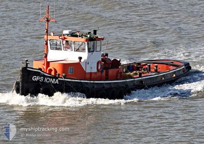
GPS IONIA
Tug

Current Trip
Unknown
Destination Port
ETA*
---
| Time Travelled | 1 h, 28 mins |
|---|---|
| Remaining Time | --- |
| Distance Travelled | 3.99 nm |
| Remaining Distance | --- |
| AVG Speed | 5 Knots |
| MAX Speed | 8.8 Knots |
| AVG Wind | 11 knots |
| MAX Wind | 11 knots |
| MIN Temp | 11.4°C / 52.52°F |
| MAX Temp | 11.9°C / 53.42°F |
| Dybgang | 0 m |
| Position Modtaget | 2 m siden |
Current Position
| Longitude | 0.53028° |
|---|---|
| Latitude | 51.40919° |
| Status | Under way using engine |
| Fart | |
| Kurs | --- |
| Område | North Sea |
| Station | T-AIS |
| Position Modtaget | 2 m siden |
Information
The current position of GPS IONIA is in North Sea with coordinates 51.40919° / 0.53028° as reported on 2025-03-28 13:23 by AIS to our vessel tracker app. The vessel's current speed is 0 Knots
The vessel GPS IONIA (MMSI: 235117078) is a Tug It's sailing under the flag of [GB] United Kingdom.
In this page you can find informations about the vessels current position, last detected port calls, and current voyage information. If the vessels is not in coverage by AIS you will find the latest position.
The current position of GPS IONIA is detected by our AIS receivers and we are not responsible for the reliability of the data. The last position was recorded while the vessel was in Coverage by the Ais receivers of our vessel tracking app.
Weather
| Temperature | 12°C / 53.6°F |
|---|---|
| Wind Speed | 11 knots |
| Direction | 295° WNW |
| Pressure | 1010.9 hPa |
| Humidity | 57.2 % |
| Cloud Coverage | 100 % |


Featured Company
Limited time offer - Install a base station receiver to your area and list your company on MyShipTracking Free forever!
Last Port Calls
| Port | Arrival | Departure | Time In Port |
|---|---|---|---|
| 2025-03-28 11:50 | 2025-03-28 11:57 | 7 m | |
| 2025-03-27 17:56 | 2025-03-27 18:31 | 34 m | |
| 2025-03-27 11:21 | 2025-03-27 13:43 | 2 h | |
| 2025-03-26 14:58 | 2025-03-26 15:00 | 1 m | |
| 2025-03-26 09:22 | 2025-03-26 09:25 | 3 m | |
| 2025-03-25 16:24 | 2025-03-25 16:52 | 27 m | |
| 2025-03-25 11:51 | 2025-03-25 15:13 | 3 h | |
| 2025-03-25 10:25 | 2025-03-25 11:05 | 39 m | |
| 2025-03-25 07:12 | 2025-03-25 09:15 | 2 h | |
| 2025-03-24 12:11 | 2025-03-24 14:36 | 2 h |
Last Trips
| Origin | Departure | Destination | Arrival | Distance | |
|---|---|---|---|---|---|
| 2025-03-27 18:31 | 2025-03-28 11:50 | 29.05 nm | |||
| 2025-03-27 13:43 | 2025-03-27 17:56 | 20.08 nm | |||
| 2025-03-26 15:00 | 2025-03-27 11:21 | 8.97 nm | |||
| 2025-03-26 09:25 | 2025-03-26 14:58 | 3.68 nm | |||
| 2025-03-25 16:52 | 2025-03-26 09:22 | 2.32 nm | |||
| 2025-03-25 15:13 | 2025-03-25 16:24 | 6.11 nm | |||
| 2025-03-25 11:05 | 2025-03-25 11:51 | 5.38 nm | |||
| 2025-03-25 09:15 | 2025-03-25 10:25 | 6.89 nm | |||
| 2025-03-24 14:36 | 2025-03-25 07:12 | 5.25 nm | |||
| 2025-03-21 16:43 | 2025-03-24 12:11 | 3.34 nm |
Events
| Tid | Hændelsen | Detaljer | Position / Dest | Info |
|---|---|---|---|---|
| 2025-03-28 12:55 | STOP Sejllads | 0.64 nm, North West of CHATHAM |
51.40922 / .53034
|
Fart: 0.2 kn Kurs: 511° |
| 2025-03-28 12:25 | START Sejllads | 0.98 nm, East of GILLINGHAM |
51.40182 / .58580
|
Fart: 4.5 kn Kurs: 201.6° |
| 2025-03-28 12:15 | STOP Sejllads | 1.05 nm, East of GILLINGHAM |
51.40352 / .58679
|
Fart: 0.2 kn Kurs: 511° |
| 2025-03-28 11:57 | Afsejlet fra sidste havn |
|
51.39957 / .55703
|
Fart: 4.9 kn Kurs: 92.6° |
| 2025-03-28 11:57 | START Sejllads |
51.39958 / .55589
[GB] CHATHAM
|
Fart: 4.3 kn Kurs: 81.6° |
|
| 2025-03-28 11:50 | Skibe i havn |
|
51.40033 / .55364
[GB] CHATHAM
|
Fart: 1.8 kn Kurs: 511° |
| 2025-03-28 11:23 | STOP Sejllads | 0.19 nm, North of GILLINGHAM |
51.40017 / .55925
|
Fart: 0.1 kn Kurs: 511° |
| 2025-03-28 10:12 | START Sejllads | 0.5 nm, South East of THAMESPORT |
51.42543 / .70030
|
Fart: 5 kn Kurs: 323.7° |
| 2025-03-28 03:17 | STOP Sejllads | 0.61 nm, South East of THAMESPORT |
51.42446 / .70301
|
Fart: 0.1 kn Kurs: 511° |
| 2025-03-27 23:45 | START Sejllads | 1.34 nm, East of GRAVESEND |
51.44729 / .41307
|
Fart: 4.2 kn Kurs: 71.6° |