

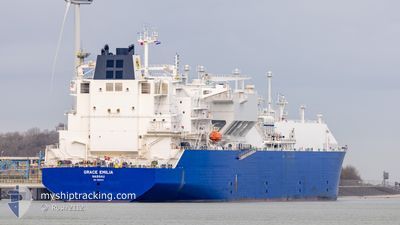
GRACE EMILIA
Tanker

Current Trip
| Time Travelled | 6 days |
|---|---|
| Remaining Time | --- |
| Distance Travelled | 2272.03 nm |
| Remaining Distance | --- |
| AVG Speed | 14.9 Knots |
| MAX Speed | 18.6 Knots |
| AVG Wind | 18.6 knots |
| MAX Wind | 30.5 knots |
| MIN Temp | 8.3°C / 46.94°F |
| MAX Temp | 20.3°C / 68.54°F |
| Dybgang | 11.4 m |
| Position Modtaget | 5 d siden |
Current Position
| Longitude | -75.86512° |
|---|---|
| Latitude | 36.85910° |
| Status | Under way using engine |
| Fart | 9.3 Knots |
| Kurs | 123.2° |
| Område | North Atlantic Ocean |
| Station | T-AIS |
| Position Modtaget | 5 d siden |
Information
The current position of GRACE EMILIA is in North Atlantic Ocean with coordinates 36.85910° / -75.86512° as reported on 2025-04-10 19:51 by AIS to our vessel tracker app. The vessel's current speed is 9.3 Knots and is heading at the port of DUNKERQUE. The estimated time of arrival as calculated by MyShipTracking vessel tracking app is 2025-04-22 02:01 LT
The vessel GRACE EMILIA (IMO: 9884174, MMSI: 311001072) is a Tanker It's sailing under the flag of [BS] Bahamas.
In this page you can find informations about the vessels current position, last detected port calls, and current voyage information. If the vessels is not in coverage by AIS you will find the latest position.
The current position of GRACE EMILIA is detected by our AIS receivers and we are not responsible for the reliability of the data. The last position was recorded while the vessel was in Coverage by the Ais receivers of our vessel tracking app.
The current draught of GRACE EMILIA as reported by AIS is 11.4 meters
Weather
| Temperature | 12.2°C / 53.96°F |
|---|---|
| Wind Speed | 22 knots |
| Direction | 259° W |
| Pressure | 1001.1 hPa |
| Humidity | 83.4 % |
| Cloud Coverage | 88 % |


Featured Company
Last Port Calls
| Port | Arrival | Departure | Time In Port |
|---|---|---|---|
| 2025-04-09 07:16 | 2025-04-10 08:36 | 1 d | |
| 2025-03-21 00:21 | 2025-03-22 01:08 | 1 d | |
| 2025-03-10 06:55 | 2025-03-11 08:43 | 1 d |
Last Trips
| Origin | Departure | Destination | Arrival | Distance | |
|---|---|---|---|---|---|
| 2025-03-22 01:08 | 2025-04-09 07:16 | 4699.28 nm | |||
| 2025-03-11 08:43 | 2025-03-21 00:21 | 3725.23 nm | |||
| 2025-01-11 10:12 | 2025-03-10 06:55 | 14809.97 nm |
Events
| Tid | Hændelsen | Detaljer | Position / Dest | Info |
|---|---|---|---|---|
| 2025-04-10 19:56 | Status er ændret | Default Under way using engine |
36.85227 / -75.85198
FR DKK
|
Fart: 9.3 kn Kurs: 123.2° |
| 2025-04-10 19:51 | Udenfor Dækning |
36.85910 / -75.86512
North Atlantic Ocean
FR DKK
|
Fart: 9.3 kn Kurs: 123.2° |
|
| 2025-04-10 19:09 | Status er ændret | Under way using engine Default |
36.93190 / -75.95980
FR DKK
|
Fart: 8.4 kn Kurs: 129° |
| 2025-04-10 19:08 | Status er ændret | Default Under way using engine |
36.93312 / -75.96168
FR DKK
|
Fart: 8.5 kn Kurs: 128.8° |
| 2025-04-10 16:55 | Status er ændret | Under way using engine Default |
37.40671 / -76.07991
FR DKK
|
Fart: 15.8 kn Kurs: 161° |
| 2025-04-10 16:52 | Status er ændret | Default Under way using engine |
37.41846 / -76.08482
FR DKK
|
Fart: 15.9 kn Kurs: 163.3° |
| 2025-04-10 16:51 | Status er ændret | Under way using engine Default |
37.42358 / -76.08689
FR DKK
|
Fart: 16.3 kn Kurs: 196° |
| 2025-04-10 16:03 | Status er ændret | Default Under way using engine |
37.61351 / -76.09265
FR DKK
|
Fart: 15 kn Kurs: 139° |
| 2025-04-10 15:57 | Status er ændret | Under way using engine Default |
37.63440 / -76.11465
FR DKK
|
Fart: 15.4 kn Kurs: 140° |
| 2025-04-10 15:55 | Status er ændret | Default Under way using engine |
37.63970 / -76.12022
FR DKK
|
Fart: 15 kn Kurs: 140° |