
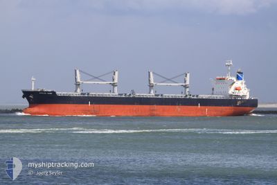
GRAMPUS BRAVE
Bulk Carrier
Current Trip
| Trip Time | 12 days |
|---|---|
| Trip Distance | 1801.80 nm |
| AVG Speed | 9.3 Knots |
| MAX Speed | 14.4 Knots |
| Dybgang | 6.4 m |
| AVG Wind | 12.1 knots |
| MAX Wind | 35.4 knots |
| MIN Temp | -0.5°C / 31.1°F |
| MAX Temp | 28.5°C / 83.3°F |
| Position Modtaget | 27 d siden |
Current Position
| Longitude | 114.16540° |
|---|---|
| Latitude | 22.17056° |
| Status | Under way using engine |
| Fart | 4 Knots |
| Kurs | 95° |
| Område | South China Sea |
| Station | T-AIS |
| Position Modtaget | 27 d siden |
Info
Information
The current position of GRAMPUS BRAVE is in South China Sea with coordinates 22.17056° / 114.16540° as reported on 2025-02-05 03:19 by AIS to our vessel tracker app. The vessel's current speed is 4 Knots and is currently inside the port of NANTONG.
The vessel GRAMPUS BRAVE (IMO: 9478872, MMSI: 354127000) is a Bulk Carrier that was built in 2010 ( 15 år gamle ). It's sailing under the flag of [PA] Panama.
In this page you can find informations about the vessels current position, last detected port calls, and current voyage information. If the vessels is not in coverage by AIS you will find the latest position.
The current position of GRAMPUS BRAVE is detected by our AIS receivers and we are not responsible for the reliability of the data. The last position was recorded while the vessel was in Coverage by the Ais receivers of our vessel tracking app.
The current draught of GRAMPUS BRAVE as reported by AIS is 6.4 meters
Weather
| Temperature | 5.6°C / 42.08°F |
|---|---|
| Wind Speed | 13 knots |
| Direction | 331° NNW |
| Pressure | 1020.2 hPa |
| Humidity | 90.2 % |
| Cloud Coverage | 100 % |
Featured Company
Most Visited Ports (Last year)
| Port | Arrivals | |
|---|---|---|
| 1 | ||
| 1 | ||
| 1 | ||
| 1 | ||
| 1 | ||
| 1 |
Last Trips
Events
| Tid | Hændelsen | Detaljer | Position / Dest | Info |
|---|---|---|---|---|
| 2025-03-02 10:37 | STOP Sejllads |
31.80593 / 120.95292
[CN] NANTONG
|
Fart: Kurs: 318° |
|
| 2025-03-02 10:37 | Skibe i havn |
|
31.80593 / 120.95292
[CN] NANTONG
|
Fart: 1.7 kn Kurs: 325° |
| 2025-03-01 21:29 | START Sejllads |
31.00102 / 122.90460
SANGKULIRANG
|
Fart: 4.4 kn Kurs: 221° |
|
| 2025-02-27 16:15 | STOP Sejllads |
31.00305 / 122.90856
SANGKULIRANG
|
Fart: Kurs: 283° |
|
| 2025-02-27 12:33 | START Sejllads |
30.95122 / 123.46890
SANGKULIRANG
|
Fart: 10 kn Kurs: 289° |
|
| 2025-02-26 21:55 | STOP Sejllads |
30.94772 / 123.48662
SANGKULIRANG
|
Fart: 0.1 kn Kurs: 88° |
|
| 2025-02-26 00:21 | START Sejllads | 4.22 nm, North West of TAIXING |
32.19868 / 119.88302
SANGKULIRANG
|
Fart: 5.1 kn Kurs: 116° |
| 2025-02-24 05:14 | STOP Sejllads | 4.22 nm, North West of TAIXING |
32.19864 / 119.88251
SANGKULIRANG
|
Fart: 0.2 kn Kurs: 320° |