
GUNERLER
General Cargo
Current Trip
| Trip Time | 35 days |
|---|---|
| Trip Distance | 2667.90 nm |
| AVG Speed | 9.7 Knots |
| MAX Speed | 12.9 Knots |
| Dybgang | 6.6 m |
| AVG Wind | 8.1 knots |
| MAX Wind | 23 knots |
| MIN Temp | 13.6°C / 56.48°F |
| MAX Temp | 20.4°C / 68.72°F |
| Position Modtaget | 3 m siden |
Current Position
| Longitude | 35.03642° |
|---|---|
| Latitude | 32.81258° |
| Status | Moored |
| Fart | |
| Kurs | 341° |
| Område | Mediterranean Sea - Eastern Basin |
| Station | T-AIS |
| Position Modtaget | 3 m siden |
Info
Information
The current position of GUNERLER is in Mediterranean Sea - Eastern Basin with coordinates 32.81258° / 35.03642° as reported on 2025-02-05 01:53 by AIS to our vessel tracker app. The vessel's current speed is 0 Knots and is currently inside the port of HAIFA.
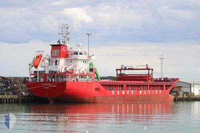
The vessel GUNERLER (IMO: 9598684, MMSI: 314686000) is a General Cargo that was built in 2011 ( 14 år gamle ). It's sailing under the flag of [BB] Barbados.
In this page you can find informations about the vessels current position, last detected port calls, and current voyage information. If the vessels is not in coverage by AIS you will find the latest position.
The current position of GUNERLER is detected by our AIS receivers and we are not responsible for the reliability of the data. The last position was recorded while the vessel was in Coverage by the Ais receivers of our vessel tracking app.
The current draught of GUNERLER as reported by AIS is 6.6 meters
Weather
| Temperature | 14°C / 57.2°F |
|---|---|
| Wind Speed | 5 knots |
| Direction | 266° W |
| Pressure | 1013.7 hPa |
| Humidity | 75.8 % |
| Cloud Coverage | 27 % |
Featured Company
Events
| Tid | Hændelsen | Detaljer | Position / Dest | Info |
|---|---|---|---|---|
| 2025-02-04 14:14 | Status er ændret | Moored Default |
32.81269 / 35.03634
[IL] HAIFA
|
Fart: Kurs: 341° |
| 2025-02-04 13:35 | Status er ændret | Default Moored |
32.81260 / 35.03637
[IL] HAIFA
|
Fart: Kurs: 341° |
| 2025-02-04 08:24 | Status er ændret | Moored Under way using engine |
32.81266 / 35.03631
[IL] HAIFA
|
Fart: Kurs: 340° |
| 2025-02-04 08:13 | STOP Sejllads |
32.81267 / 35.03629
[IL] HAIFA
|
Fart: 0.3 kn Kurs: 341° |
|
| 2025-02-04 07:41 | Skibe i havn |
|
32.83089 / 35.02018
[IL] HAIFA
|
Fart: 7 kn Kurs: 193.8° |
| 2025-02-04 06:50 | START Sejllads | 3.67 nm, North of HAIFA |
32.89057 / 35.00443
ILHFA
|
Fart: 5.1 kn Kurs: 266.8° |
| 2025-02-04 06:31 | Status er ændret | Under way using engine At anchor |
32.89235 / 35.00623
ILHFA
|
Fart: Kurs: 129° |
| 2025-02-03 14:04 | Indenfor Dækning |
32.89093 / 35.00733
Mediterranean Sea - Eastern Basin
|
Fart: 0.3 kn Kurs: 173° |
|
| 2025-02-03 12:58 | Udenfor Dækning |
32.89101 / 35.00758
Mediterranean Sea - Eastern Basin
|
Fart: Kurs: 165.8° |
|
| 2025-02-02 16:05 | STOP Sejllads | 3.65 nm, South West of ACRE |
32.89084 / 35.00686
ILHFA
|
Fart: Kurs: 10° |