
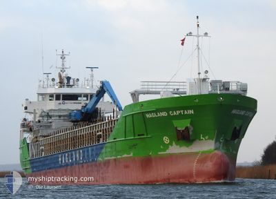
HAGLAND CAPTAIN
General Cargo
Current Trip
VAKSDAL
| Time Travelled | 7 h, 51 mins |
|---|---|
| Remaining Time | --- |
| Distance Travelled | 79.51 nm |
| Remaining Distance | --- |
| AVG Speed | 10 Knots |
| MAX Speed | 12.5 Knots |
| AVG Wind | 6.5 knots |
| MAX Wind | 13 knots |
| MIN Temp | 1.5°C / 34.7°F |
| MAX Temp | 3.9°C / 39.02°F |
| Dybgang | 6.1 m |
| Position Modtaget | Nu |
Current Position
| Longitude | 5.25446° |
|---|---|
| Latitude | 60.44405° |
| Status | Under way using engine |
| Fart | 9.1 Knots |
| Kurs | 355.4° |
| Område | North Sea |
| Station | T-AIS |
| Position Modtaget | Nu |
Info
Information
The current position of HAGLAND CAPTAIN is in North Sea with coordinates 60.44405° / 5.25446° as reported on 2025-03-15 01:22 by AIS to our vessel tracker app. The vessel's current speed is 9.1 Knots
The vessel HAGLAND CAPTAIN (IMO: 9521356, MMSI: 259017000) is a General Cargo that was built in 2012 ( 13 år gamle ). It's sailing under the flag of [NO] Norway.
In this page you can find informations about the vessels current position, last detected port calls, and current voyage information. If the vessels is not in coverage by AIS you will find the latest position.
The current position of HAGLAND CAPTAIN is detected by our AIS receivers and we are not responsible for the reliability of the data. The last position was recorded while the vessel was in Coverage by the Ais receivers of our vessel tracking app.
The current draught of HAGLAND CAPTAIN as reported by AIS is 6.1 meters
Weather
| Temperature | 1.7°C / 35.06°F |
|---|---|
| Wind Speed | 3 knots |
| Direction | 109° ESE |
| Pressure | 1018.2 hPa |
| Humidity | 70.2 % |
| Cloud Coverage | 100 % |
Featured Company
Last Port Calls
| Port | Arrival | Departure | Time In Port |
|---|---|---|---|
| 2025-03-14 11:30 | 2025-03-14 18:32 | 7 h | |
| 2025-03-12 20:29 | 2025-03-13 12:41 | 16 h | |
| 2025-03-10 06:08 | 2025-03-11 22:41 | 1 d | |
| 2025-03-05 00:30 | 2025-03-05 17:59 | 17 h | |
| 2025-03-03 14:28 | 2025-03-04 03:17 | 12 h | |
| 2025-02-28 19:04 | 2025-03-01 10:21 | 15 h | |
| 2025-02-26 08:07 | 2025-02-26 18:42 | 10 h | |
| 2025-02-24 19:32 | 2025-02-25 05:46 | 10 h | |
| 2025-02-23 21:55 | 2025-02-24 09:02 | 11 h | |
| 2025-02-20 10:45 | 2025-02-20 10:47 | 2 m |
Last Trips
| Origin | Departure | Destination | Arrival | Distance | |
|---|---|---|---|---|---|
| 2025-03-13 12:41 | 2025-03-14 11:30 | 273.26 nm | |||
| 2025-03-11 22:41 | 2025-03-12 20:29 | 146.05 nm | |||
| 2025-03-05 17:59 | 2025-03-10 06:08 | 569.61 nm | |||
| 2025-03-04 03:17 | 2025-03-05 00:30 | 246.26 nm | |||
| 2025-03-01 10:21 | 2025-03-03 14:28 | 421.01 nm | |||
| 2025-02-26 18:42 | 2025-02-28 19:04 | 350.62 nm | |||
| 2025-02-25 05:46 | 2025-02-26 08:07 | 252.80 nm | |||
| 2025-02-24 09:02 | 2025-02-24 19:32 | 78.65 nm | |||
| 2025-02-20 10:47 | 2025-02-23 21:55 | 460.33 nm | |||
| 2025-02-19 23:10 | 2025-02-20 10:45 | 111.90 nm |
Events
| Tid | Hændelsen | Detaljer | Position / Dest | Info |
|---|---|---|---|---|
| 2025-03-14 17:32 | Afsejlet fra sidste havn |
|
59.28871 / 5.32178
VAKSDAL
|
Fart: 6.2 kn Kurs: 29° |
| 2025-03-14 17:31 | START Sejllads |
59.28585 / 5.31873
[NO] KOPERVIK
|
Fart: 6.2 kn Kurs: 29° |
|
| 2025-03-14 17:22 | Status er ændret | Under way using engine Moored |
59.28445 / 5.31630
[NO] KOPERVIK
|
Fart: Kurs: 276° |
| 2025-03-14 10:38 | Status er ændret | Moored Under way using engine |
59.28444 / 5.31627
[NO] KOPERVIK
|
Fart: Kurs: 277° |
| 2025-03-14 10:32 | STOP Sejllads |
59.28442 / 5.31637
[NO] KOPERVIK
|
Fart: 0.2 kn Kurs: 276° |
|
| 2025-03-14 10:30 | Skibe i havn |
|
59.28446 / 5.31783
[NO] KOPERVIK
|
Fart: 2.3 kn Kurs: 272° |
| 2025-03-14 02:04 | Ændre havområde | Norwegian part of the North Sea Norwegian part of the Skaggerak |
57.95823 / 7.05974
North Sea
VAKSDAL
|
Fart: 12.2 kn Kurs: 287.4° |
| 2025-03-13 11:41 | START Sejllads | 0.09 nm, West of KAMBO |
59.47485 / 10.67850
VAKSDAL
|
Fart: 5.4 kn Kurs: 3.4° |
| 2025-03-13 11:41 | Afsejlet fra sidste havn |
|
59.47438 / 10.67844
VAKSDAL
|
Fart: 4 kn Kurs: 4° |
| 2025-03-13 11:29 | Status er ændret | Under way using engine Moored |
59.47313 / 10.68076
[NO] KAMBO
|
Fart: Kurs: 193° |