
HELMSAND
Military ops
Current Trip
| Time Travelled | 3 h, 35 mins |
|---|---|
| Remaining Time | 3 h, 21 mins |
| Distance Travelled | 7.14 nm |
| Remaining Distance | 45.00 nm |
| AVG Speed | 12.6 Knots |
| MAX Speed | 12.8 Knots |
| AVG Wind | 8 knots |
| MAX Wind | 8.3 knots |
| MIN Temp | 4.5°C / 40.1°F |
| MAX Temp | 4.6°C / 40.28°F |
| Dybgang | 3.6 m |
| Position Modtaget | Nu |
Current Position
| Longitude | 11.10449° |
|---|---|
| Latitude | 54.58234° |
| Status | Under way using engine |
| Fart | 12.9 Knots |
| Kurs | 91.6° |
| Område | Baltic Sea |
| Station | T-AIS |
| Position Modtaget | Nu |
Info
Information
The current position of HELMSAND is in Baltic Sea with coordinates 54.58234° / 11.10449° as reported on 2025-03-10 09:31 by AIS to our vessel tracker app. The vessel's current speed is 12.9 Knots and is heading at the port of ROSTOCK. The estimated time of arrival as calculated by MyShipTracking vessel tracking app is 2025-03-10 12:53 LT
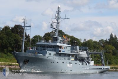
The vessel HELMSAND (MMSI: 211212220) is a Military ops It's sailing under the flag of [DE] Germany.
In this page you can find informations about the vessels current position, last detected port calls, and current voyage information. If the vessels is not in coverage by AIS you will find the latest position.
The current position of HELMSAND is detected by our AIS receivers and we are not responsible for the reliability of the data. The last position was recorded while the vessel was in Coverage by the Ais receivers of our vessel tracking app.
The current draught of HELMSAND as reported by AIS is 3.6 meters
Weather
| Temperature | 4.5°C / 40.1°F |
|---|---|
| Wind Speed | 8 knots |
| Direction | 1° N |
| Pressure | 1001.4 hPa |
| Humidity | 88.8 % |
| Cloud Coverage | 5 % |
Featured Company
Last Port Calls
| Port | Arrival | Departure | Time In Port |
|---|---|---|---|
| 2025-02-27 11:23 | 2025-03-10 05:57 | 10 d | |
| 2025-02-25 15:29 | 2025-02-27 09:09 | 1 d | |
| 2025-02-22 12:51 | 2025-02-23 06:15 | 17 h | |
| 2025-02-21 05:28 | 2025-02-21 11:27 | 5 h | |
| 2025-02-20 21:30 | 2025-02-20 21:41 | 10 m | |
| 2025-02-17 08:21 | 2025-02-18 06:42 | 22 h | |
| 2025-02-06 13:34 | 2025-02-17 06:40 | 10 d | |
| 2025-02-06 08:03 | 2025-02-06 09:55 | 1 h | |
| 2025-01-15 11:41 | 2025-02-06 06:16 | 21 d | |
| 2025-01-15 08:04 |
Most Visited Ports (Last year)
| Port | Arrivals | |
|---|---|---|
| 32 | ||
| 13 | ||
| 3 | ||
| 3 | ||
| 2 | ||
| 2 |
Last Trips
| Origin | Departure | Destination | Arrival | Distance | |
|---|---|---|---|---|---|
| 2025-02-27 10:09 | 2025-02-27 12:23 | 21.16 nm | |||
| 2025-02-23 07:15 | 2025-02-25 16:29 | 228.26 nm | |||
| 2025-02-21 12:27 | 2025-02-22 13:51 | 111.67 nm | |||
| 2025-02-20 22:41 | 2025-02-21 06:28 | 1.47 nm | |||
| 2025-02-18 07:42 | 2025-02-20 22:30 | 303.96 nm | |||
| 2025-02-17 07:40 | 2025-02-17 09:21 | 21.14 nm | |||
| 2025-02-06 10:55 | 2025-02-06 14:34 | 28.89 nm | |||
| 2025-02-06 07:16 | 2025-02-06 09:03 | 18.46 nm | |||
| 2025-01-15 09:04 | 2025-01-15 12:41 | 34.22 nm |
Events
| Tid | Hændelsen | Detaljer | Position / Dest | Info |
|---|---|---|---|---|
| 2025-03-10 08:59 | Destination er ændret | WARNEMUENDE ECKERNFOERDE |
54.57878 / 10.90785
WARNEMUENDE
|
Fart: 12.3 kn Kurs: 83.8° |
| 2025-03-10 08:59 | ETA er ændret | 2025/03/10 14:00 2025/02/27 13:00 |
54.57878 / 10.90785
WARNEMUENDE
|
Fart: 12.3 kn Kurs: 83.8° |
| 2025-03-10 08:55 | Indenfor Dækning |
54.57753 / 10.88640
Baltic Sea
|
Fart: 12.4 kn Kurs: 83.8° |
|
| 2025-03-10 05:57 | Afsejlet fra sidste havn |
|
54.57723 / 10.88111
ECKERNFOERDE
|
Fart: Kurs: 186° |