
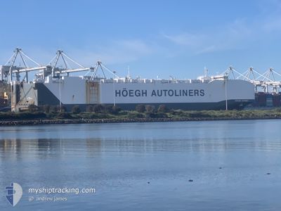
HOEGH TARGET
Not available
Current Trip
| Time Travelled | 5 h, 45 mins |
|---|---|
| Remaining Time | 12 h, 25 mins |
| Distance Travelled | 67.21 nm |
| Remaining Distance | 147.20 nm |
| AVG Speed | 11.3 Knots |
| MAX Speed | 14.8 Knots |
| AVG Wind | 11.5 knots |
| MAX Wind | 15.3 knots |
| MIN Temp | 8°C / 46.4°F |
| MAX Temp | 9.6°C / 49.28°F |
| Dybgang | 10 m |
| Position Modtaget | 1 m siden |
Current Position
| Longitude | 0.08653° |
|---|---|
| Latitude | 50.28797° |
| Status | Under way using engine |
| Fart | 12.6 Knots |
| Kurs | 60° |
| Område | English Channel |
| Station | T-AIS |
| Position Modtaget | 1 m siden |
Info
Information
The current position of HOEGH TARGET is in English Channel with coordinates 50.28797° / 0.08653° as reported on 2025-02-03 22:49 by AIS to our vessel tracker app. The vessel's current speed is 12.6 Knots and is heading at the port of ZEEBRUGGE. The estimated time of arrival as calculated by MyShipTracking vessel tracking app is 2025-02-04 11:16 LT
The vessel HOEGH TARGET (IMO: 9684976, MMSI: 257864000) is a Not available It's sailing under the flag of [NO] Norway.
In this page you can find informations about the vessels current position, last detected port calls, and current voyage information. If the vessels is not in coverage by AIS you will find the latest position.
The current position of HOEGH TARGET is detected by our AIS receivers and we are not responsible for the reliability of the data. The last position was recorded while the vessel was in Coverage by the Ais receivers of our vessel tracking app.
The current draught of HOEGH TARGET as reported by AIS is 10 meters
Weather
| Temperature | 9.5°C / 49.1°F |
|---|---|
| Wind Speed | 14 knots |
| Direction | 219° SW |
| Pressure | 1025.9 hPa |
| Humidity | 83.5 % |
| Cloud Coverage | 100 % |
Featured Company
Last Port Calls
| Port | Arrival | Departure | Time In Port |
|---|---|---|---|
| 2025-02-03 01:39 | 2025-02-03 17:06 | 15 h | |
| 2024-12-22 22:04 | 2024-12-23 10:56 | 12 h | |
| 2024-12-20 21:46 | 2024-12-21 07:32 | 9 h | |
| 2024-12-18 02:06 | 2024-12-18 10:10 | 8 h | |
| 2024-12-15 22:01 | 2024-12-17 07:41 | 1 d | |
| 2024-12-14 21:13 | 2024-12-15 07:13 | 10 h | |
| 2024-12-03 02:14 | 2024-12-04 05:12 | 1 d |
Most Visited Ports (Last year)
| Port | Arrivals | |
|---|---|---|
| 3 | ||
| 3 | ||
| 3 | ||
| 3 | ||
| 3 | ||
| 2 |
Last Trips
| Origin | Departure | Destination | Arrival | Distance | |
|---|---|---|---|---|---|
| 2024-12-23 18:56 | 2025-02-03 02:39 | 11605.68 nm | |||
| 2024-12-21 16:32 | 2024-12-23 06:04 | 500.04 nm | |||
| 2024-12-18 19:10 | 2024-12-21 06:46 | 652.26 nm | |||
| 2024-12-17 16:41 | 2024-12-18 11:06 | 265.81 nm | |||
| 2024-12-15 16:13 | 2024-12-16 07:01 | 212.31 nm | |||
| 2024-12-04 15:12 | 2024-12-15 06:13 | 4037.20 nm | |||
| 2024-11-26 03:27 | 2024-12-03 12:14 | 601.09 nm |
Events
| Tid | Hændelsen | Detaljer | Position / Dest | Info |
|---|---|---|---|---|
| 2025-02-03 22:22 | Ændre havområde | United Kingdom part of the English Channel French part of the English Channel |
50.23690 / -.03448
English Channel
FR LEH>BE ZEE
|
Fart: 12.3 kn Kurs: 57° |
| 2025-02-03 22:21 | Status er ændret | Under way using engine Default |
50.23382 / -.04183
FR LEH>BE ZEE
|
Fart: 12 kn Kurs: 58° |
| 2025-02-03 22:19 | Status er ændret | Default Under way using engine |
50.23073 / -.04913
FR LEH>BE ZEE
|
Fart: 12.1 kn Kurs: 56° |
| 2025-02-03 17:06 | Afsejlet fra sidste havn |
|
49.48633 / .08722
FR LEH>BE ZEE
|
Fart: 12.2 kn Kurs: 289° |
| 2025-02-03 16:37 | START Sejllads |
49.47445 / .16673
[FR] LE HAVRE
|
Fart: 3.1 kn Kurs: 246° |
|
| 2025-02-03 15:51 | STOP Sejllads |
49.47565 / .17140
[FR] LE HAVRE
|
Fart: 0.3 kn Kurs: 245° |
|
| 2025-02-03 15:27 | START Sejllads |
49.47433 / .20057
[FR] LE HAVRE
|
Fart: 3.1 kn Kurs: 277° |
|
| 2025-02-03 15:10 | Status er ændret | Under way using engine Moored |
49.47195 / .21013
[FR] LE HAVRE
|
Fart: 0.1 kn Kurs: 99° |
| 2025-02-03 14:48 | Dybgangen er ændret | 10 10.2 |
49.47193 / .21008
[FR] LE HAVRE
|
Fart: Kurs: 99° |
| 2025-02-03 14:48 | Destination er ændret | FR LEH>BE ZEE LE HAVRE |
49.47193 / .21008
[FR] LE HAVRE
|
Fart: Kurs: 99° |