
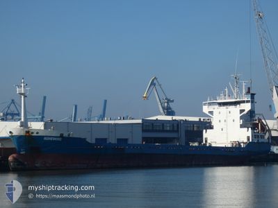
HOHEWIND
Cargo
Current Trip
| Time Travelled | 1 day |
|---|---|
| Remaining Time | 7 h, 39 mins |
| Distance Travelled | 393.23 nm |
| Remaining Distance | 284.77 nm |
| AVG Speed | 11.3 Knots |
| MAX Speed | 13.9 Knots |
| AVG Wind | 17.1 knots |
| MAX Wind | 21 knots |
| MIN Temp | 23.2°C / 73.76°F |
| MAX Temp | 25.9°C / 78.62°F |
| Dybgang | 5.5 m |
| Position Modtaget | 5 d siden |
Current Position
| Longitude | -79.09769° |
|---|---|
| Latitude | 23.57935° |
| Status | Under way using engine |
| Fart | 12.4 Knots |
| Kurs | 163° |
| Område | North Atlantic Ocean |
| Station | T-AIS |
| Position Modtaget | 5 d siden |
Info
Information
The current position of HOHEWIND is in North Atlantic Ocean with coordinates 23.57935° / -79.09769° as reported on 2025-02-03 17:36 by AIS to our vessel tracker app. The vessel's current speed is 12.4 Knots and is heading at the port of PORT AU PRINCE. The estimated time of arrival as calculated by MyShipTracking vessel tracking app is 2025-02-09 12:38 LT
The vessel HOHEWIND (IMO: 9116187, MMSI: 305102000) is a Cargo that was built in 1995 ( 30 år gamle ). It's sailing under the flag of [AG] Antigua Barbuda.
In this page you can find informations about the vessels current position, last detected port calls, and current voyage information. If the vessels is not in coverage by AIS you will find the latest position.
The current position of HOHEWIND is detected by our AIS receivers and we are not responsible for the reliability of the data. The last position was recorded while the vessel was in Coverage by the Ais receivers of our vessel tracking app.
The current draught of HOHEWIND as reported by AIS is 5.5 meters
Weather
| Temperature | 24.5°C / 76.1°F |
|---|---|
| Wind Speed | 16 knots |
| Direction | 74° ENE |
| Pressure | 1020.6 hPa |
| Humidity | 80.7 % |
| Cloud Coverage | 5 % |
Featured Company
Last Port Calls
| Port | Arrival | Departure | Time In Port |
|---|---|---|---|
| 2025-02-06 19:12 | 2025-02-07 13:32 | 18 h | |
| 2025-02-05 15:55 | 2025-02-06 03:56 | 12 h | |
| 2025-02-02 16:21 | 2025-02-03 01:58 | 9 h | |
| 2025-02-02 16:02 | 2025-02-02 16:07 | 5 m | |
| 2025-01-28 08:02 | 2025-01-28 08:08 | 6 m | |
| 2025-01-27 23:58 | |||
| 2025-01-27 23:47 | 2025-01-27 23:55 | 7 m | |
| 2025-01-22 17:15 | 2025-01-24 14:00 | 1 d | |
| 2025-01-19 23:10 | 2025-01-20 08:04 | 8 h | |
| 2025-01-19 12:17 |
Most Visited Ports (Last year)
| Port | Arrivals | |
|---|---|---|
| 34 | ||
| 23 | ||
| 17 | ||
| 7 | ||
| 5 | ||
| 1 |
Last Trips
| Origin | Departure | Destination | Arrival | Distance | |
|---|---|---|---|---|---|
| 2025-02-05 22:56 | 2025-02-06 14:12 | 176.83 nm | |||
| 2025-02-02 20:58 | 2025-02-05 10:55 | 672.60 nm | |||
| 2025-02-02 11:07 | 2025-02-02 11:21 | 1.00 nm | |||
| 2025-01-28 03:08 | 2025-02-02 11:02 | 10.38 nm | |||
| 2025-01-27 18:55 | 2025-01-28 03:02 | 2.14 nm | |||
| 2025-01-27 18:55 | 2025-01-27 18:58 | 0.39 nm | |||
| 2025-01-24 09:00 | 2025-01-27 18:47 | 639.26 nm | |||
| 2025-01-20 03:04 | 2025-01-22 12:15 | 636.55 nm | |||
| 2025-01-19 07:15 | 2025-01-19 18:10 | 1.97 nm | |||
| 2025-01-19 07:15 | 2025-01-19 07:17 | 0.27 nm |
Events
| Tid | Hændelsen | Detaljer | Position / Dest | Info |
|---|---|---|---|---|
| 2025-02-07 13:45 | START Sejllads | 2.87 nm, North of CAP HAITIEN |
19.80193 / -72.18938
HTPAP
|
Fart: 12.2 kn Kurs: 347° |
| 2025-02-07 13:32 | Afsejlet fra sidste havn |
|
19.80193 / -72.18938
HTPAP
|
Fart: Kurs: 224° |
| 2025-02-06 19:30 | STOP Sejllads |
19.75872 / -72.19381
[HT] CAP HAITIEN
|
Fart: 0.1 kn Kurs: 220° |
|
| 2025-02-06 19:12 | Skibe i havn |
|
19.75872 / -72.19381
[HT] CAP HAITIEN
|
Fart: 5.4 kn Kurs: 186° |
| 2025-02-06 03:56 | Afsejlet fra sidste havn |
|
18.57803 / -72.43587
HTPAP
|
Fart: 6.7 kn Kurs: 284° |
| 2025-02-05 16:41 | STOP Sejllads |
18.55632 / -72.34843
[HT] PORT AU PRINCE
|
Fart: Kurs: 282° |
|
| 2025-02-05 15:55 | Skibe i havn |
|
18.55570 / -72.35603
[HT] PORT AU PRINCE
|
Fart: 2.9 kn Kurs: 101° |
| 2025-02-03 17:40 | Status er ændret | Default Under way using engine |
23.56607 / -79.09347
HTPAP
|
Fart: 12.4 kn Kurs: 163° |
| 2025-02-03 17:36 | Udenfor Dækning |
23.57935 / -79.09769
North Atlantic Ocean
HTPAP
|
Fart: 12.4 kn Kurs: 163° |
|
| 2025-02-03 16:06 | Status er ændret | Under way using engine Default |
23.87680 / -79.19344
HTPAP
|
Fart: 12.2 kn Kurs: 164° |