
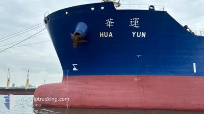
HUA YUN
Tanker
Current Trip
TW KHH
| Time Travelled | 1 day |
|---|---|
| Remaining Time | --- |
| Distance Travelled | 31.06 nm |
| Remaining Distance | --- |
| AVG Speed | 7.5 Knots |
| MAX Speed | 10 Knots |
| AVG Wind | 7.7 knots |
| MAX Wind | 20 knots |
| MIN Temp | 25.5°C / 77.9°F |
| MAX Temp | 27.9°C / 82.22°F |
| Dybgang | 9.3 m |
| Position Modtaget | 1 d siden |
Current Position
| Longitude | 120.13378° |
|---|---|
| Latitude | 22.71506° |
| Status | Under way using engine |
| Fart | 9.7 Knots |
| Kurs | 333.5° |
| Område | South China Sea |
| Station | T-AIS |
| Position Modtaget | 1 d siden |
Information
The current position of HUA YUN is in South China Sea with coordinates 22.71506° / 120.13378° as reported on 2025-05-30 04:36 by AIS to our vessel tracker app. The vessel's current speed is 9.7 Knots
The vessel HUA YUN (IMO: 9566344, MMSI: 416449000) is a Tanker It's sailing under the flag of [TW] Taiwan.
In this page you can find informations about the vessels current position, last detected port calls, and current voyage information. If the vessels is not in coverage by AIS you will find the latest position.
The current position of HUA YUN is detected by our AIS receivers and we are not responsible for the reliability of the data. The last position was recorded while the vessel was in Coverage by the Ais receivers of our vessel tracking app.
The current draught of HUA YUN as reported by AIS is 9.3 meters
Weather
| Temperature | 27.9°C / 82.22°F |
|---|---|
| Wind Speed | 18 knots |
| Direction | 157° SSE |
| Pressure | 1004.4 hPa |
| Humidity | 82.7 % |
| Cloud Coverage | 100 % |
Featured Company
Last Port Calls
| Port | Arrival | Departure | Time In Port |
|---|---|---|---|
| 2025-05-28 06:57 | 2025-05-30 03:06 | 1 d | |
| 2025-04-30 03:32 | 2025-05-25 01:22 | 24 d | |
| 2025-04-24 03:33 | 2025-04-29 08:41 | 5 d | |
| 2025-04-21 07:09 | 2025-04-23 11:33 | 2 d | |
| 2025-04-15 14:22 | 2025-04-20 23:22 | 5 d | |
| 2025-04-12 23:49 | 2025-04-15 00:53 | 2 d | |
| 2025-04-09 00:22 | 2025-04-11 08:29 | 2 d | |
| 2025-04-03 00:14 | 2025-04-05 04:02 | 2 d | |
| 2025-03-24 05:06 | 2025-03-27 02:18 | 2 d | |
| 2025-03-21 07:32 | 2025-03-23 07:06 | 1 d |
Last Trips
| Origin | Departure | Destination | Arrival | Distance | |
|---|---|---|---|---|---|
| 2025-05-25 09:22 | 2025-05-28 14:57 | 217.15 nm | |||
| 2025-04-29 16:41 | 2025-04-30 11:32 | 202.81 nm | |||
| 2025-04-23 19:33 | 2025-04-24 11:33 | 91.80 nm | |||
| 2025-04-21 07:22 | 2025-04-21 15:09 | 67.62 nm | |||
| 2025-04-15 08:53 | 2025-04-15 22:22 | 127.88 nm | |||
| 2025-04-11 16:29 | 2025-04-13 07:49 | 264.36 nm | |||
| 2025-04-05 12:02 | 2025-04-09 08:22 | 249.41 nm | |||
| 2025-03-27 10:18 | 2025-04-03 08:14 | 324.84 nm | |||
| 2025-03-23 15:06 | 2025-03-24 13:06 | 237.36 nm | |||
| 2025-03-21 14:49 | 2025-03-21 15:32 | 4.28 nm |
Events
| Tid | Hændelsen | Detaljer | Position / Dest | Info |
|---|---|---|---|---|
| 2025-05-30 07:10 | STOP Sejllads | 4.6 nm, South West of ANPING |
22.93281 / 120.07578
TW KHH
|
Fart: 0.2 kn Kurs: 327° |
| 2025-05-30 04:42 | Status er ændret | Default Under way using engine |
22.72901 / 120.12631
TW KHH
|
Fart: 9.7 kn Kurs: 333.5° |
| 2025-05-30 04:36 | Udenfor Dækning |
22.71506 / 120.13378
South China Sea
TW KHH
|
Fart: 9.7 kn Kurs: 333.5° |
|
| 2025-05-30 03:38 | ETA er ændret | 2025/05/30 13:00 2025/05/30 11:00 |
22.57469 / 120.20860
TW KHH
|
Fart: 9.8 kn Kurs: 335.9° |
| 2025-05-30 03:06 | Afsejlet fra sidste havn |
|
22.54916 / 120.27936
TW KHH
|
Fart: 8.8 kn Kurs: 267° |
| 2025-05-30 02:40 | START Sejllads |
22.54882 / 120.32918
[TW] KAOHSIUNG
|
Fart: 3.2 kn Kurs: 316° |
|
| 2025-05-30 02:14 | Dybgangen er ændret | 9.3 7.6 |
22.54282 / 120.33956
[TW] KAOHSIUNG
|
Fart: 1.9 kn Kurs: 132° |
| 2025-05-30 02:14 | ETA er ændret | 2025/05/30 11:00 2025/05/26 08:00 |
22.54282 / 120.33956
[TW] KAOHSIUNG
|
Fart: 1.9 kn Kurs: 132° |
| 2025-05-30 02:00 | Status er ændret | Under way using engine Default |
22.54114 / 120.34088
[TW] KAOHSIUNG
|
Fart: Kurs: 131° |
| 2025-05-30 01:58 | Indenfor Dækning |
22.54114 / 120.34088
South China Sea
[TW] KAOHSIUNG
|
Fart: Kurs: 150.9° |