

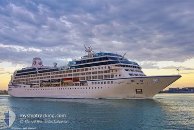
INSIGNIA
Passengers Ship

Current Trip
LK HBA
| Time Travelled | 1 day |
|---|---|
| Remaining Time | --- |
| Distance Travelled | 90.84 nm |
| Remaining Distance | --- |
| AVG Speed | 17.6 Knots |
| MAX Speed | 18.3 Knots |
| AVG Wind | 10.7 knots |
| MAX Wind | 11 knots |
| MIN Temp | 28.1°C / 82.58°F |
| MAX Temp | 28.7°C / 83.66°F |
| Dybgang | 6 m |
| Position Modtaget | 1 d siden |
Current Position
| Longitude | 80.36890° |
|---|---|
| Latitude | 5.80613° |
| Status | Under way using engine |
| Fart | 13 Knots |
| Kurs | 124.8° |
| Område | Laccadive Sea |
| Station | T-AIS |
| Position Modtaget | 1 d siden |
Information
The current position of INSIGNIA is in Laccadive Sea with coordinates 5.80613° / 80.36890° as reported on 2025-03-14 19:24 by AIS to our vessel tracker app. The vessel's current speed is 13 Knots
The vessel INSIGNIA (IMO: 9156462, MMSI: 538001663) is a Passengers Ship that was built in 1998 ( 27 år gamle ). It's sailing under the flag of [MH] Marshall Is.
In this page you can find informations about the vessels current position, last detected port calls, and current voyage information. If the vessels is not in coverage by AIS you will find the latest position.
The current position of INSIGNIA is detected by our AIS receivers and we are not responsible for the reliability of the data. The last position was recorded while the vessel was in Coverage by the Ais receivers of our vessel tracking app.
The current draught of INSIGNIA as reported by AIS is 6 meters
Weather
| Temperature | 28.5°C / 83.3°F |
|---|---|
| Wind Speed | 12 knots |
| Direction | 56° NE |
| Pressure | 1010.3 hPa |
| Humidity | 76 % |
| Cloud Coverage | 100 % |


Featured Company
Last Port Calls
| Port | Arrival | Departure | Time In Port |
|---|---|---|---|
| 2025-03-15 05:57 | 2025-03-15 16:47 | 10 h | |
| 2025-03-13 12:00 | 2025-03-14 17:11 | 1 d | |
| 2025-03-12 06:04 | 2025-03-12 16:19 | 10 h | |
| 2025-03-11 06:13 | 2025-03-11 17:06 | 10 h | |
| 2025-03-01 06:30 | 2025-03-01 15:37 | 9 h | |
| 2025-02-24 07:40 | 2025-02-24 17:52 | 10 h | |
| 2025-02-22 07:08 | 2025-02-23 15:24 | 1 d | |
| 2025-02-21 07:25 | 2025-02-21 22:03 | 14 h | |
| 2025-02-17 05:45 | 2025-02-18 18:36 | 1 d | |
| 2025-02-15 08:42 | 2025-02-15 18:52 | 10 h |
Last Trips
| Origin | Departure | Destination | Arrival | Distance | |
|---|---|---|---|---|---|
| 2025-03-14 17:11 | 2025-03-15 05:57 | 156.58 nm | |||
| 2025-03-12 16:19 | 2025-03-13 12:00 | 317.40 nm | |||
| 2025-03-11 17:06 | 2025-03-12 06:04 | 210.87 nm | |||
| 2025-03-01 15:37 | 2025-03-11 06:13 | 2391.16 nm | |||
| 2025-02-24 17:52 | 2025-03-01 06:30 | 1409.03 nm | |||
| 2025-02-23 15:24 | 2025-02-24 07:40 | 252.30 nm | |||
| 2025-02-21 22:03 | 2025-02-22 07:08 | 121.18 nm | |||
| 2025-02-18 18:36 | 2025-02-21 07:25 | 828.99 nm | |||
| 2025-02-15 18:52 | 2025-02-17 05:45 | 487.24 nm | |||
| 2025-02-14 16:16 | 2025-02-15 08:42 | 254.82 nm |
Events
| Tid | Hændelsen | Detaljer | Position / Dest | Info |
|---|---|---|---|---|
| 2025-03-15 11:17 | Afsejlet fra sidste havn |
|
6.10090 / 81.18304
LK HBA
|
Fart: 13 kn Kurs: 150° |
| 2025-03-15 11:08 | START Sejllads |
6.13043 / 81.09735
[LK] HAMBANTOTA
|
Fart: 6.8 kn Kurs: 128° |
|
| 2025-03-15 00:27 | Skibe i havn |
|
6.12550 / 81.10036
[LK] HAMBANTOTA
|
Fart: 10.8 kn Kurs: 340° |
| 2025-03-14 19:25 | Status er ændret | Default Under way using engine |
5.80333 / 80.37289
LK HBA
|
Fart: 13 kn Kurs: 124.8° |
| 2025-03-14 19:24 | Udenfor Dækning |
5.80613 / 80.36890
Laccadive Sea
LK HBA
|
Fart: 13 kn Kurs: 124.8° |
|
| 2025-03-14 18:14 | Destination er ændret | LK HBA IN COK |
5.94613 / 80.15355
LK HBA
|
Fart: 13.6 kn Kurs: 113.6° |
| 2025-03-14 18:14 | ETA er ændret | 2025/03/15 00:00 2025/03/13 06:30 |
5.94613 / 80.15355
LK HBA
|
Fart: 13.6 kn Kurs: 113.6° |
| 2025-03-14 17:42 | Ændre havområde | Sri Lankan part of the Laccadive Sea Indian part of the Laccadive Sea |
6.00322 / 80.04697
Laccadive Sea
|
Fart: 14 kn Kurs: 123.8° |
| 2025-03-14 17:41 | Status er ændret | Under way using engine Default |
6.00503 / 80.04403
IN COK
|
Fart: 13.8 kn Kurs: 120° |
| 2025-03-14 17:31 | Indenfor Dækning |
6.00322 / 80.04697
Laccadive Sea
|
Fart: 14 kn Kurs: 123.8° |