
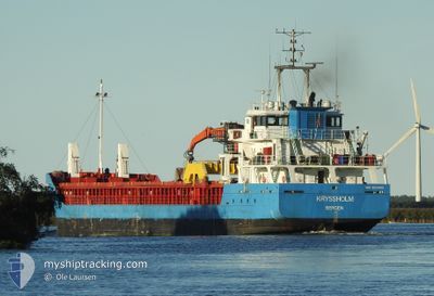
KRYSSHOLM
General Cargo
Current Trip
| Trip Time | 7 days |
|---|---|
| Trip Distance | 669.84 nm |
| AVG Speed | 7.3 Knots |
| MAX Speed | 7.3 Knots |
| Dybgang | 4.6 m |
| AVG Wind | 15 knots |
| MAX Wind | 32 knots |
| MIN Temp | 2.6°C / 36.68°F |
| MAX Temp | 9.9°C / 49.82°F |
| Position Modtaget | 15 h, 24 m siden |
Current Position
| Longitude | -6.84085° |
|---|---|
| Latitude | 55.25739° |
| Status | Under way using engine |
| Fart | 8.6 Knots |
| Kurs | 242° |
| Område | Inner Seas off the West Coast of Scotland |
| Station | T-AIS |
| Position Modtaget | 15 h, 24 m siden |
Info
Information
The current position of KRYSSHOLM is in Inner Seas off the West Coast of Scotland with coordinates 55.25739° / -6.84085° as reported on 2025-02-04 17:07 by AIS to our vessel tracker app. The vessel's current speed is 8.6 Knots and is currently inside the port of LONDONDERRY.
The vessel KRYSSHOLM (IMO: 9579468, MMSI: 257041670) is a General Cargo that was built in 2011 ( 14 år gamle ). It's sailing under the flag of [NO] Norway.
In this page you can find informations about the vessels current position, last detected port calls, and current voyage information. If the vessels is not in coverage by AIS you will find the latest position.
The current position of KRYSSHOLM is detected by our AIS receivers and we are not responsible for the reliability of the data. The last position was recorded while the vessel was in Coverage by the Ais receivers of our vessel tracking app.
The current draught of KRYSSHOLM as reported by AIS is 4.6 meters
Weather
| Temperature | 1.3°C / 34.34°F |
|---|---|
| Wind Speed | 5 knots |
| Direction | 205° SSW |
| Pressure | 1031.2 hPa |
| Humidity | 90.9 % |
| Cloud Coverage | 100 % |
Featured Company
Last Port Calls
| Port | Arrival | Departure | Time In Port |
|---|---|---|---|
| 2025-02-04 19:31 | |||
| 2025-01-27 21:14 | 2025-01-28 11:26 | 14 h | |
| 2025-01-26 17:29 | 2025-01-26 21:54 | 4 h | |
| 2025-01-25 07:14 | 2025-01-26 06:05 | 22 h | |
| 2025-01-23 07:41 | 2025-01-23 23:47 | 16 h | |
| 2025-01-15 15:11 | 2025-01-16 20:55 | 1 d | |
| 2025-01-06 05:39 | 2025-01-07 17:09 | 1 d | |
| 2025-01-05 07:16 | 2025-01-05 11:43 | 4 h | |
| 2024-12-27 06:33 | 2024-12-28 13:51 | 1 d | |
| 2024-12-11 11:39 | 2024-12-12 16:31 | 1 d |
Most Visited Ports (Last year)
| Port | Arrivals | |
|---|---|---|
| 17 | ||
| 14 | ||
| 10 | ||
| 6 | ||
| 5 | ||
| 5 |
Last Trips
| Origin | Departure | Destination | Arrival | Distance | |
|---|---|---|---|---|---|
| 2025-01-28 12:26 | 2025-02-04 19:31 | 669.84 nm | |||
| 2025-01-26 22:54 | 2025-01-27 22:14 | 194.18 nm | |||
| 2025-01-26 07:05 | 2025-01-26 18:29 | 77.32 nm | |||
| 2025-01-24 00:47 | 2025-01-25 08:14 | 302.13 nm | |||
| 2025-01-16 20:55 | 2025-01-23 08:41 | 637.14 nm | |||
| 2025-01-07 18:09 | 2025-01-15 15:11 | 674.00 nm | |||
| 2025-01-05 12:43 | 2025-01-06 06:39 | 180.67 nm | |||
| 2024-12-28 14:51 | 2025-01-05 08:16 | 156.13 nm | |||
| 2024-12-12 16:31 | 2024-12-27 07:33 | 658.34 nm | |||
| 2024-12-09 06:25 | 2024-12-11 11:39 | 381.93 nm |
Events
| Tid | Hændelsen | Detaljer | Position / Dest | Info |
|---|---|---|---|---|
| 2025-02-04 19:51 | STOP Sejllads |
55.04143 / -7.26458
[GB] LONDONDERRY
|
Fart: Kurs: 72° |
|
| 2025-02-04 19:31 | Skibe i havn |
|
55.04720 / -7.24965
[GB] LONDONDERRY
|
Fart: 8.3 kn Kurs: 208° |
| 2025-02-04 17:15 | Status er ændret | Default Under way using engine |
55.24900 / -6.87056
GBLDY
|
Fart: 8.6 kn Kurs: 242° |
| 2025-02-04 17:07 | Udenfor Dækning |
55.25739 / -6.84085
Inner Seas off the West Coast of Scotland
GBLDY
|
Fart: 8.6 kn Kurs: 242° |
|
| 2025-02-04 16:52 | Ændre havområde | Irish part of the Inner Seas off the West Coast of Scotland United Kingdom part of the Inner Seas off the West Coast of Scotland |
55.27199 / -6.78259
Inner Seas off the West Coast of Scotland
GBLDY
|
Fart: 8.5 kn Kurs: 240.4° |
| 2025-02-04 11:57 | ETA er ændret | 2025/02/04 21:00 2025/02/04 12:00 |
55.71951 / -5.98775
GBLDY
|
Fart: 10.1 kn Kurs: 168.5° |
| 2025-02-04 11:56 | Status er ændret | Under way using engine Default |
55.72227 / -5.98877
GBLDY
|
Fart: 10 kn Kurs: 168° |
| 2025-02-04 11:51 | Status er ændret | Default Under way using engine |
55.73554 / -5.99606
GBLDY
|
Fart: 12.7 kn Kurs: 149.1° |
| 2025-02-04 11:45 | Status er ændret | Under way using engine Default |
55.75555 / -6.01365
GBLDY
|
Fart: 12.4 kn Kurs: 149° |
| 2025-02-04 11:39 | Indenfor Dækning |
55.75555 / -6.01365
Inner Seas off the West Coast of Scotland
GBLDY
|
Fart: 12.7 kn Kurs: 149.1° |