
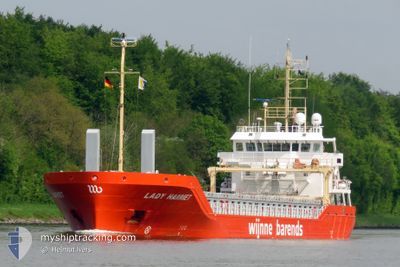
LADY HARRIET
Cargo
Current Trip
| Time Travelled | 15 h, 6 mins |
|---|---|
| Remaining Time | 2 days |
| Distance Travelled | 162.62 nm |
| Remaining Distance | 540.37 nm |
| AVG Speed | 10.7 Knots |
| MAX Speed | 12.2 Knots |
| AVG Wind | 16.4 knots |
| MAX Wind | 26 knots |
| MIN Temp | 3.5°C / 38.3°F |
| MAX Temp | 6.4°C / 43.52°F |
| Dybgang | 5.5 m |
| Position Modtaget | Nu |
Current Position
| Longitude | 14.25354° |
|---|---|
| Latitude | 55.09072° |
| Status | Under way using engine |
| Fart | 10.5 Knots |
| Kurs | 41° |
| Område | Kattegat |
| Station | T-AIS |
| Position Modtaget | Nu |
Info
Information
The current position of LADY HARRIET is in Kattegat with coordinates 55.09072° / 14.25354° as reported on 2025-03-03 07:40 by AIS to our vessel tracker app. The vessel's current speed is 10.5 Knots and is heading at the port of HAMINA. The estimated time of arrival as calculated by MyShipTracking vessel tracking app is 2025-03-05 14:27 LT
The vessel LADY HARRIET (IMO: 9834997, MMSI: 244020808) is a Cargo It's sailing under the flag of [NL] Netherlands.
In this page you can find informations about the vessels current position, last detected port calls, and current voyage information. If the vessels is not in coverage by AIS you will find the latest position.
The current position of LADY HARRIET is detected by our AIS receivers and we are not responsible for the reliability of the data. The last position was recorded while the vessel was in Coverage by the Ais receivers of our vessel tracking app.
The current draught of LADY HARRIET as reported by AIS is 5.5 meters
Weather
| Temperature | 3.6°C / 38.48°F |
|---|---|
| Wind Speed | 26 knots |
| Direction | 268° W |
| Pressure | 1022.6 hPa |
| Humidity | 90.4 % |
| Cloud Coverage | 100 % |
Featured Company
Last Port Calls
| Port | Arrival | Departure | Time In Port |
|---|---|---|---|
| 2025-03-02 17:30 | 2025-03-02 17:34 | 3 m | |
| 2025-02-21 04:52 | 2025-02-25 21:51 | 4 d | |
| 2025-02-17 17:53 | 2025-02-19 18:08 | 2 d | |
| 2025-02-11 19:19 | 2025-02-12 18:27 | 23 h | |
| 2025-02-10 19:25 | 2025-02-10 21:16 | 1 h | |
| 2025-02-09 19:03 | 2025-02-10 18:14 | 23 h | |
| 2025-02-09 17:16 | 2025-02-09 18:31 | 1 h | |
| 2025-02-01 23:26 | 2025-02-03 17:31 | 1 d | |
| 2025-01-24 14:10 | 2025-01-31 16:25 | 7 d | |
| 2025-01-19 19:49 | 2025-01-21 22:19 | 2 d |
Last Trips
| Origin | Departure | Destination | Arrival | Distance | |
|---|---|---|---|---|---|
| 2025-02-25 21:51 | 2025-03-02 17:30 | 1043.12 nm | |||
| 2025-02-19 18:08 | 2025-02-21 04:52 | 386.92 nm | |||
| 2025-02-12 18:27 | 2025-02-17 17:53 | 1030.98 nm | |||
| 2025-02-10 21:16 | 2025-02-11 19:19 | 99.47 nm | |||
| 2025-02-10 18:14 | 2025-02-10 19:25 | 6.13 nm | |||
| 2025-02-09 18:31 | 2025-02-09 19:03 | 2.34 nm | |||
| 2025-02-03 17:31 | 2025-02-09 17:16 | 1073.57 nm | |||
| 2025-01-31 16:25 | 2025-02-01 23:26 | 180.05 nm | |||
| 2025-01-21 22:19 | 2025-01-24 14:10 | 665.29 nm | |||
| 2025-01-18 17:19 | 2025-01-19 19:49 | 207.59 nm |
Events
| Tid | Hændelsen | Detaljer | Position / Dest | Info |
|---|---|---|---|---|
| 2025-03-03 06:47 | Ændre havområde | Danish part of the Kattegat Swedish part of the Baltic Sea |
55.00142 / 14.04845
Kattegat
HAMINA
|
Fart: 10.5 kn Kurs: 75.1° |
| 2025-03-03 06:23 | Fundet i havområde | Swedish part of the Baltic Sea |
54.98177 / 13.92957
Baltic Sea
HAMINA
|
Fart: 10.8 kn Kurs: 73.6° |
| 2025-03-02 23:17 | Ændre havområde | German part of the Baltic Sea Danish part of the Baltic Sea |
54.39993 / 12.08290
Baltic Sea
HAMINA
|
Fart: 11.2 kn Kurs: 89.9° |
| 2025-03-02 21:02 | Fundet i havområde | Danish part of the Baltic Sea |
54.51906 / 11.40910
Baltic Sea
HAMINA
|
Fart: 11.3 kn Kurs: 113.5° |
| 2025-03-02 19:07 | Fundet i havområde | German part of the Baltic Sea |
54.57386 / 10.79433
Baltic Sea
HAMINA
|
Fart: 11 kn Kurs: 87° |
| 2025-03-02 19:01 | ETA er ændret | 2025/03/05 10:00 2025/03/05 06:00 |
54.57278 / 10.76200
HAMINA
|
Fart: 10.9 kn Kurs: 86.1° |
| 2025-03-02 18:28 | Ændre havområde | Danish part of the Baltic Sea German part of the Baltic Sea |
54.56292 / 10.59569
Baltic Sea
HAMINA
|
Fart: 10.5 kn Kurs: 79.3° |
| 2025-03-02 17:13 | Ændre havområde | German part of the Baltic Sea German part of the North Sea |
54.46625 / 10.26591
Baltic Sea
HAMINA
|
Fart: 11.1 kn Kurs: 32.8° |
| 2025-03-02 16:34 | Afsejlet fra sidste havn |
|
54.36419 / 10.16839
HAMINA
|
Fart: 9.6 kn Kurs: 63° |
| 2025-03-02 16:30 | Skibe i havn |
|
54.36385 / 10.15418
[DE] KIEL
|
Fart: 7.7 kn Kurs: 103° |