
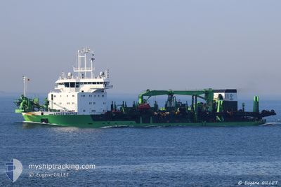
LANGE WAPPER
Trailing Suction Hopper Dredger
Current Trip
| Time Travelled | 9 h, 28 mins |
|---|---|
| Remaining Time | --- |
| Distance Travelled | 127.42 nm |
| Remaining Distance | --- |
| AVG Speed | 13 Knots |
| MAX Speed | 15.2 Knots |
| AVG Wind | 13.4 knots |
| MAX Wind | 30.7 knots |
| MIN Temp | 16.6°C / 61.88°F |
| MAX Temp | 20.1°C / 68.18°F |
| Dybgang | 5.8 m |
| Position Modtaget | 14 m siden |
Current Position
| Longitude | 19.95491° |
|---|---|
| Latitude | 37.78399° |
| Status | Under way using engine |
| Fart | 14 Knots |
| Kurs | 246.5° |
| Område | Ionian Sea |
| Station | T-AIS |
| Position Modtaget | 14 m siden |
Info
Information
The current position of LANGE WAPPER is in Ionian Sea with coordinates 37.78399° / 19.95491° as reported on 2025-03-12 19:15 by AIS to our vessel tracker app. The vessel's current speed is 14 Knots and is heading at the port of COLON. The estimated time of arrival as calculated by MyShipTracking vessel tracking app is 2025-04-03 19:34 LT
The vessel LANGE WAPPER (IMO: 9174139, MMSI: 205309000) is a Trailing Suction Hopper Dredger that was built in 1999 ( 26 år gamle ). It's sailing under the flag of [BE] Belgium.
In this page you can find informations about the vessels current position, last detected port calls, and current voyage information. If the vessels is not in coverage by AIS you will find the latest position.
The current position of LANGE WAPPER is detected by our AIS receivers and we are not responsible for the reliability of the data. The last position was recorded while the vessel was in Coverage by the Ais receivers of our vessel tracking app.
The current draught of LANGE WAPPER as reported by AIS is 5.8 meters
Weather
| Temperature | 17°C / 62.6°F |
|---|---|
| Wind Speed | 29 knots |
| Direction | 152° SSE |
| Pressure | 1006 hPa |
| Humidity | 82.2 % |
| Cloud Coverage | 100 % |
Featured Company
Events
| Tid | Hændelsen | Detaljer | Position / Dest | Info |
|---|---|---|---|---|
| 2025-03-12 17:47 | Status er ændret | Under way using engine Default |
37.91484 / 20.35732
PA ONX
|
Fart: 13.9 kn Kurs: 246° |
| 2025-03-12 17:40 | Status er ændret | Default Under way using engine |
37.92581 / 20.39066
PA ONX
|
Fart: 13.9 kn Kurs: 244.5° |
| 2025-03-12 13:15 | ETA er ændret | 2025/04/03 19:34 2025/03/12 13:00 |
38.24050 / 21.65882
PA ONX
|
Fart: 13 kn Kurs: 256.3° |
| 2025-03-12 12:51 | ETA er ændret | 2025/03/12 13:00 2026/02/02 08:00 |
38.24896 / 21.63411
PA ONX
|
Fart: 14.1 kn Kurs: 89.9° |
| 2025-03-12 12:42 | Destination er ændret | PA ONX PAONX |
38.24900 / 21.58580
PA ONX
|
Fart: 13.8 kn Kurs: 90.1° |
| 2025-03-12 12:41 | Destination er ændret | PAONX ASTAKOS |
38.24898 / 21.57703
PAONX
|
Fart: 13.9 kn Kurs: 90.2° |
| 2025-03-12 10:02 | Afsejlet fra sidste havn |
|
38.46802 / 21.08558
ASTAKOS
|
Fart: 7.6 kn Kurs: 213° |
| 2025-03-12 09:59 | Status er ændret | Under way using engine Moored |
38.47196 / 21.09051
[GR] ASTAKOS
|
Fart: 7.8 kn Kurs: 242° |
| 2025-03-12 09:55 | START Sejllads |
38.47441 / 21.09922
[GR] ASTAKOS
|
Fart: 4 kn Kurs: 255° |
|
| 2025-03-05 20:06 | Status er ændret | Moored Default |
38.47445 / 21.10182
[GR] ASTAKOS
|
Fart: Kurs: 180° |