
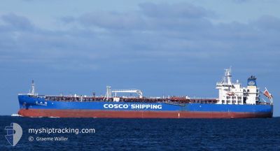
LIAN HUAN HU
Tanker
Current Trip
| Time Travelled | 2 days |
|---|---|
| Remaining Time | 5 days |
| Distance Travelled | 807.80 nm |
| Remaining Distance | 1598.17 nm |
| AVG Speed | 11.9 Knots |
| MAX Speed | 13.9 Knots |
| AVG Wind | 14.4 knots |
| MAX Wind | 19.9 knots |
| MIN Temp | 26.1°C / 78.98°F |
| MAX Temp | 27.8°C / 82.04°F |
| Dybgang | 11.2 m |
| Position Modtaget | 2 d siden |
Current Position
| Longitude | 104.13035° |
|---|---|
| Latitude | 1.25750° |
| Status | Under way using engine |
| Fart | 13.7 Knots |
| Kurs | 83.1° |
| Område | Singapore Strait |
| Station | T-AIS |
| Position Modtaget | 2 d siden |
Info
Information
The current position of LIAN HUAN HU is in Singapore Strait with coordinates 1.25750° / 104.13035° as reported on 2025-02-08 04:07 by AIS to our vessel tracker app. The vessel's current speed is 13.7 Knots and is heading at the port of KWINANA. The estimated time of arrival as calculated by MyShipTracking vessel tracking app is 2025-02-16 01:54 LT
The vessel LIAN HUAN HU (IMO: 9747089, MMSI: 413349650) is a Tanker It's sailing under the flag of [CN] China.
In this page you can find informations about the vessels current position, last detected port calls, and current voyage information. If the vessels is not in coverage by AIS you will find the latest position.
The current position of LIAN HUAN HU is detected by our AIS receivers and we are not responsible for the reliability of the data. The last position was recorded while the vessel was in Coverage by the Ais receivers of our vessel tracking app.
The current draught of LIAN HUAN HU as reported by AIS is 11.2 meters
Weather
| Temperature | 27.8°C / 82.04°F |
|---|---|
| Wind Speed | 15 knots |
| Direction | 263° W |
| Pressure | 1010.1 hPa |
| Humidity | 79.3 % |
| Cloud Coverage | 100 % |
Featured Company
Last Port Calls
| Port | Arrival | Departure | Time In Port |
|---|---|---|---|
| 2025-02-05 17:46 | 2025-02-08 02:00 | 2 d | |
| 2025-01-18 12:17 | 2025-01-21 22:24 | 3 d | |
| 2025-01-07 16:21 | 2025-01-10 04:36 | 2 d |
Most Visited Ports (Last year)
| Port | Arrivals | |
|---|---|---|
| 6 | ||
| 3 | ||
| 3 | ||
| 2 | ||
| 2 | ||
| 2 |
Last Trips
| Origin | Departure | Destination | Arrival | Distance | |
|---|---|---|---|---|---|
| 2025-01-22 06:24 | 2025-02-06 01:46 | 2509.69 nm | |||
| 2025-01-10 12:36 | 2025-01-18 20:17 | 2510.79 nm | |||
| 2024-10-29 12:27 | 2025-01-08 00:21 | 7007.02 nm |
Events
| Tid | Hændelsen | Detaljer | Position / Dest | Info |
|---|---|---|---|---|
| 2025-02-08 04:13 | Status er ændret | Default Under way using engine |
1.26051 / 104.15234
AUKWI
|
Fart: 13.7 kn Kurs: 83.1° |
| 2025-02-08 04:07 | Udenfor Dækning |
1.25750 / 104.13035
Singapore Strait
AUKWI
|
Fart: 13.7 kn Kurs: 83.1° |
|
| 2025-02-08 04:06 | Status er ændret | Under way using engine Default |
1.25707 / 104.12672
AUKWI
|
Fart: 13.6 kn Kurs: 82° |
| 2025-02-08 04:05 | Status er ændret | Default Under way using engine |
1.25658 / 104.12294
AUKWI
|
Fart: 13.7 kn Kurs: 80.6° |
| 2025-02-08 03:02 | Ændre havområde | Indonesian part of the Singapore Strait Singaporean part of the Singapore Strait |
1.20806 / 103.89015
Singapore Strait
AUKWI
|
Fart: 12 kn Kurs: 96.5° |
| 2025-02-08 02:15 | ETA er ændret | 2025/02/16 14:00 2025/02/16 15:00 |
1.22905 / 103.78326
AUKWI
|
Fart: 12.2 kn Kurs: 139.4° |
| 2025-02-08 02:04 | ETA er ændret | 2025/02/16 15:00 2025/02/16 23:00 |
1.24393 / 103.75738
AUKWI
|
Fart: 8.7 kn Kurs: 74.4° |
| 2025-02-08 02:01 | ETA er ændret | 2025/02/16 23:00 2025/02/16 22:00 |
1.24246 / 103.75139
AUKWI
|
Fart: 6.9 kn Kurs: 77.3° |
| 2025-02-08 02:00 | Afsejlet fra sidste havn |
|
1.24194 / 103.74914
AUKWI
|
Fart: 5.8 kn Kurs: 75° |
| 2025-02-08 01:57 | ETA er ændret | 2025/02/16 22:00 2025/02/07 10:56 |
1.24060 / 103.74497
[SG] BUKOM ISLAND
|
Fart: 3.5 kn Kurs: 66° |