

LILY RISING
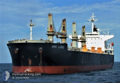
Bulk Carrier

Current Trip
| Trip Time | 35 days |
|---|---|
| Trip Distance | 6420.81 nm |
| AVG Speed | 11 Knots |
| MAX Speed | 14.3 Knots |
| Dybgang | 11.2 m |
| AVG Wind | 9.4 knots |
| MAX Wind | 19 knots |
| MIN Temp | -2.4°C / 27.68°F |
| MAX Temp | 29.7°C / 85.46°F |
| Position Modtaget | 1 m siden |
Current Position
| Longitude | 55.06778° |
|---|---|
| Latitude | 24.98299° |
| Status | Under way using engine |
| Fart | |
| Kurs | 227° |
| Område | Persian Gulf |
| Station | T-AIS |
| Position Modtaget | 1 m siden |
Information
The current position of LILY RISING is in Persian Gulf with coordinates 24.98299° / 55.06778° as reported on 2025-03-31 01:11 by AIS to our vessel tracker app. The vessel's current speed is 0 Knots and is currently inside the port of JEBEL ALI.
The vessel LILY RISING (IMO: 9331892, MMSI: 357008000) is a Bulk Carrier that was built in 2007 ( 18 år gamle ). It's sailing under the flag of [PA] Panama.
In this page you can find informations about the vessels current position, last detected port calls, and current voyage information. If the vessels is not in coverage by AIS you will find the latest position.
The current position of LILY RISING is detected by our AIS receivers and we are not responsible for the reliability of the data. The last position was recorded while the vessel was in Coverage by the Ais receivers of our vessel tracking app.
The current draught of LILY RISING as reported by AIS is 11.2 meters
Weather
| Temperature | 23.7°C / 74.66°F |
|---|---|
| Wind Speed | 4 knots |
| Direction | 50° NE |
| Pressure | 1012.4 hPa |
| Humidity | 53.5 % |
| Cloud Coverage | --- |


Featured Company
Most Visited Ports (Last year)
| Port | Arrivals | |
|---|---|---|
| 1 | ||
| 1 | ||
| 1 | ||
| 1 | ||
| 1 | ||
| 1 |
Last Trips
| Origin | Departure | Destination | Arrival | Distance | |
|---|---|---|---|---|---|
| 2025-02-21 23:05 | 2025-03-29 12:43 | 6420.81 nm | |||
| 2025-01-24 08:35 | 2025-02-20 19:41 | 5033.85 nm | |||
| 2025-01-08 09:57 | 2025-01-23 05:18 | 3952.83 nm | |||
| 2025-01-01 17:00 | 2025-01-06 10:27 | 1146.76 nm |
Events
| Tid | Hændelsen | Detaljer | Position / Dest | Info |
|---|---|---|---|---|
| 2025-03-29 09:34 | STOP Sejllads |
24.98307 / 55.06775
[AE] JEBEL ALI
|
Fart: 0.3 kn Kurs: 227° |
|
| 2025-03-29 08:43 | Skibe i havn |
|
25.02792 / 55.03675
[AE] JEBEL ALI
|
Fart: 6.6 kn Kurs: 153.7° |
| 2025-03-28 22:22 | Ændre havområde | United Arab Emirates part of the Persian Gulf Omani part of the Persian Gulf |
26.20144 / 55.85790
Persian Gulf
JEBEL ALI
|
Fart: 11.3 kn Kurs: 223° |
| 2025-03-28 22:08 | Dybgangen er ændret | 11.2 11.4 |
26.23419 / 55.89214
JEBEL ALI
|
Fart: 11.4 kn Kurs: 224° |
| 2025-03-28 22:08 | ETA er ændret | 2025/03/29 07:00 2025/03/29 13:00 |
26.23419 / 55.89214
JEBEL ALI
|
Fart: 11.4 kn Kurs: 224° |
| 2025-03-28 22:04 | Ændre havområde | Omani part of the Persian Gulf Indian part of the Laccadive Sea |
26.24292 / 55.90169
Persian Gulf
JEBEL ALI
|
Fart: 11.5 kn Kurs: 223.9° |
| 2025-03-28 22:03 | Status er ændret | Under way using engine Default |
26.24639 / 55.90540
JEBEL ALI
|
Fart: 11.5 kn Kurs: 224° |
| 2025-03-28 21:46 | Indenfor Dækning |
26.24292 / 55.90169
Persian Gulf
JEBEL ALI
|
Fart: 11.5 kn Kurs: 223.9° |
|
| 2025-03-22 21:44 | Status er ændret | Default Under way using engine |
8.65105 / 76.11344
JEBEL ALI
|
Fart: 10.5 kn Kurs: 311.7° |
| 2025-03-22 21:19 | Udenfor Dækning |
8.60294 / 76.16692
Laccadive Sea
JEBEL ALI
|
Fart: 10.5 kn Kurs: 311.7° |