
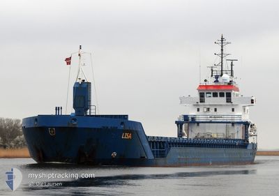
LISA
General Cargo
Current Trip
| Time Travelled | 14 h, 16 mins |
|---|---|
| Remaining Time | 2 days |
| Distance Travelled | 128.89 nm |
| Remaining Distance | 549.64 nm |
| AVG Speed | 8.9 Knots |
| MAX Speed | 10.2 Knots |
| AVG Wind | 12.3 knots |
| MAX Wind | 16 knots |
| MIN Temp | 8°C / 46.4°F |
| MAX Temp | 9.4°C / 48.92°F |
| Dybgang | 6.1 m |
| Position Modtaget | 2 m siden |
Current Position
| Longitude | -5.67038° |
|---|---|
| Latitude | 52.80212° |
| Status | Under way using engine |
| Fart | 10.2 Knots |
| Kurs | 197.1° |
| Område | Irish Sea and St. George's Channel |
| Station | T-AIS |
| Position Modtaget | 2 m siden |
Info
Information
The current position of LISA is in Irish Sea and St. George's Channel with coordinates 52.80212° / -5.67038° as reported on 2025-03-10 09:17 by AIS to our vessel tracker app. The vessel's current speed is 10.2 Knots and is heading at the port of IPSWICH. The estimated time of arrival as calculated by MyShipTracking vessel tracking app is 2025-03-12 21:46 LT
The vessel LISA (IMO: 9235505, MMSI: 209989000) is a General Cargo that was built in 2001 ( 24 år gamle ). It's sailing under the flag of [CY] Cyprus.
In this page you can find informations about the vessels current position, last detected port calls, and current voyage information. If the vessels is not in coverage by AIS you will find the latest position.
The current position of LISA is detected by our AIS receivers and we are not responsible for the reliability of the data. The last position was recorded while the vessel was in Coverage by the Ais receivers of our vessel tracking app.
The current draught of LISA as reported by AIS is 6.1 meters
Weather
| Temperature | 8.7°C / 47.66°F |
|---|---|
| Wind Speed | 14 knots |
| Direction | 10° N |
| Pressure | 1004.2 hPa |
| Humidity | 87.8 % |
| Cloud Coverage | 48 % |
Featured Company
Last Port Calls
| Port | Arrival | Departure | Time In Port |
|---|---|---|---|
| 2025-03-08 19:59 | 2025-03-09 19:03 | 23 h | |
| 2025-03-06 07:36 | 2025-03-08 06:07 | 1 d | |
| 2025-02-26 07:06 | 2025-02-27 20:21 | 1 d | |
| 2025-02-20 14:34 | 2025-02-25 17:18 | 5 d | |
| 2025-02-12 02:26 | 2025-02-14 17:21 | 2 d | |
| 2025-02-09 20:18 | 2025-02-11 07:35 | 1 d | |
| 2025-02-05 12:08 | 2025-02-06 11:28 | 23 h | |
| 2025-02-03 14:23 | 2025-02-05 08:27 | 1 d | |
| 2025-01-16 01:37 | 2025-01-22 05:35 | 6 d | |
| 2025-01-09 11:42 | 2025-01-10 17:57 | 1 d |
Last Trips
| Origin | Departure | Destination | Arrival | Distance | |
|---|---|---|---|---|---|
| 2025-03-08 06:07 | 2025-03-08 19:59 | 106.57 nm | |||
| 2025-02-27 20:21 | 2025-03-06 07:36 | 1125.19 nm | |||
| 2025-02-25 17:18 | 2025-02-26 07:06 | 76.29 nm | |||
| 2025-02-14 18:21 | 2025-02-20 14:34 | 1165.98 nm | |||
| 2025-02-11 07:35 | 2025-02-12 03:26 | 168.92 nm | |||
| 2025-02-06 11:28 | 2025-02-09 20:18 | 698.63 nm | |||
| 2025-02-05 08:27 | 2025-02-05 12:08 | 25.96 nm | |||
| 2025-01-22 06:35 | 2025-02-03 14:23 | 1359.01 nm | |||
| 2025-01-10 18:57 | 2025-01-16 02:37 | 1086.37 nm | |||
| 2025-01-08 19:31 | 2025-01-09 12:42 | 115.09 nm |
Events
| Tid | Hændelsen | Detaljer | Position / Dest | Info |
|---|---|---|---|---|
| 2025-03-10 03:20 | Fundet i havområde | Irish part of the Irish Sea and St. George's Channel |
53.66933 / -5.51885
Irish Sea and St. George's Channel
IPSWICH
|
Fart: 9.4 kn Kurs: 187.7° |
| 2025-03-10 03:18 | Status er ændret | Under way using engine Default |
53.67404 / -5.51775
IPSWICH
|
Fart: 9.4 kn Kurs: 188° |
| 2025-03-10 02:40 | Status er ændret | Default Under way using engine |
53.77514 / -5.49399
IPSWICH
|
Fart: 9.6 kn Kurs: 186.2° |
| 2025-03-10 02:32 | Status er ændret | Under way using engine Default |
53.79557 / -5.49004
IPSWICH
|
Fart: 9.5 kn Kurs: 186° |
| 2025-03-10 02:20 | Indenfor Dækning |
53.79557 / -5.49004
Irish Sea and St. George's Channel
IPSWICH
|
Fart: 9.6 kn Kurs: 186.2° |
|
| 2025-03-10 01:28 | Status er ændret | Default Under way using engine |
53.96877 / -5.45165
IPSWICH
|
Fart: 9.9 kn Kurs: 194° |
| 2025-03-10 01:21 | Udenfor Dækning |
53.98571 / -5.44442
Irish Sea and St. George's Channel
IPSWICH
|
Fart: 9.9 kn Kurs: 194° |
|
| 2025-03-09 22:32 | Ændre havområde | United Kingdom part of the Irish Sea and St. George's Channel United Kingdom part of the Inner Seas off the West Coast of Scotland |
54.42982 / -5.34932
Irish Sea and St. George's Channel
IPSWICH
|
Fart: 8.8 kn Kurs: 176.6° |
| 2025-03-09 19:03 | Afsejlet fra sidste havn |
|
54.64729 / -5.86174
IPSWICH
|
Fart: 8.8 kn Kurs: 38° |
| 2025-03-09 18:42 | START Sejllads |
54.61617 / -5.91314
[GB] BELFAST
|
Fart: 3.6 kn Kurs: 40° |