
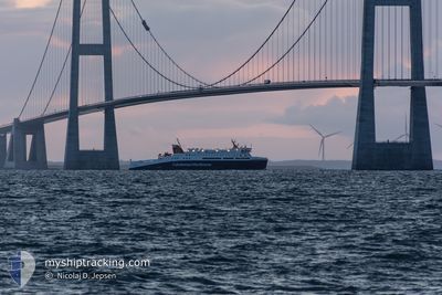
LOCH SEAFORTH
Passenger
Current Trip
| Time Travelled | 2 h, 36 mins |
|---|---|
| Remaining Time | -15 mins |
| Distance Travelled | 40.84 nm |
| Remaining Distance | --- |
| AVG Speed | 18.5 Knots |
| MAX Speed | 18.8 Knots |
| AVG Wind | 15.4 knots |
| MAX Wind | 17 knots |
| MIN Temp | 1.8°C / 35.24°F |
| MAX Temp | 5.1°C / 41.18°F |
| Dybgang | 4.5 m |
| Position Modtaget | 1 h, 16 m siden |
Current Position
| Longitude | -5.71440° |
|---|---|
| Latitude | 57.96325° |
| Status | Under way using engine |
| Fart | 18.8 Knots |
| Kurs | 117.9° |
| Område | Inner Seas off the West Coast of Scotland |
| Station | T-AIS |
| Position Modtaget | 1 h, 16 m siden |
Info
Information
The current position of LOCH SEAFORTH is in Inner Seas off the West Coast of Scotland with coordinates 57.96325° / -5.71440° as reported on 2025-02-10 23:35 by AIS to our vessel tracker app. The vessel's current speed is 18.8 Knots and is heading at the port of ULLAPOOL. The estimated time of arrival as calculated by MyShipTracking vessel tracking app is 2025-02-11 00:36 LT
The vessel LOCH SEAFORTH (IMO: 9665437, MMSI: 235101635) is a Passenger It's sailing under the flag of [GB] United Kingdom.
In this page you can find informations about the vessels current position, last detected port calls, and current voyage information. If the vessels is not in coverage by AIS you will find the latest position.
The current position of LOCH SEAFORTH is detected by our AIS receivers and we are not responsible for the reliability of the data. The last position was recorded while the vessel was in Coverage by the Ais receivers of our vessel tracking app.
The current draught of LOCH SEAFORTH as reported by AIS is 4.5 meters
Weather
| Temperature | 1.9°C / 35.42°F |
|---|---|
| Wind Speed | 10 knots |
| Direction | 90° E |
| Pressure | 1034.1 hPa |
| Humidity | 84.2 % |
| Cloud Coverage | 16 % |
Featured Company
Last Port Calls
| Port | Arrival | Departure | Time In Port |
|---|---|---|---|
| 2025-02-10 19:46 | 2025-02-10 22:15 | 2 h | |
| 2025-02-10 12:44 | 2025-02-10 14:08 | 1 h | |
| 2025-02-10 05:10 | 2025-02-10 07:05 | 1 h | |
| 2025-02-09 20:43 | 2025-02-09 22:12 | 1 h | |
| 2025-02-09 17:18 | 2025-02-09 18:30 | 1 h | |
| 2025-02-08 20:45 | 2025-02-09 14:36 | 17 h | |
| 2025-02-08 12:46 | 2025-02-08 14:38 | 1 h | |
| 2025-02-08 05:08 | 2025-02-08 07:04 | 1 h | |
| 2025-02-07 20:45 | 2025-02-07 22:25 | 1 h | |
| 2025-02-07 12:46 | 2025-02-07 14:07 | 1 h |
Most Visited Ports (Last year)
| Port | Arrivals | |
|---|---|---|
| 863 | ||
| 399 | ||
| 1 | ||
| 1 |
Last Trips
| Origin | Departure | Destination | Arrival | Distance | |
|---|---|---|---|---|---|
| 2025-02-10 14:08 | 2025-02-10 19:46 | 85.20 nm | |||
| 2025-02-10 07:05 | 2025-02-10 12:44 | 85.73 nm | |||
| 2025-02-09 22:12 | 2025-02-10 05:10 | 85.55 nm | |||
| 2025-02-09 18:30 | 2025-02-09 20:43 | 42.90 nm | |||
| 2025-02-09 14:36 | 2025-02-09 17:18 | 43.01 nm | |||
| 2025-02-08 14:38 | 2025-02-08 20:45 | 81.35 nm | |||
| 2025-02-08 07:04 | 2025-02-08 12:46 | 82.32 nm | |||
| 2025-02-07 22:25 | 2025-02-08 05:08 | 82.62 nm | |||
| 2025-02-07 14:07 | 2025-02-07 20:45 | 85.45 nm | |||
| 2025-02-07 07:04 | 2025-02-07 12:46 | 86.58 nm |
Events
| Tid | Hændelsen | Detaljer | Position / Dest | Info |
|---|---|---|---|---|
| 2025-02-10 23:35 | Status er ændret | Default Under way using engine |
57.96286 / -5.71294
GBSTO/GBULL
|
Fart: 18.8 kn Kurs: 117.9° |
| 2025-02-10 23:35 | Status er ændret | Under way using engine Default |
57.96325 / -5.71440
GBSTO/GBULL
|
Fart: 18.7 kn Kurs: 117° |
| 2025-02-10 23:35 | Udenfor Dækning |
57.96325 / -5.71440
Inner Seas off the West Coast of Scotland
|
Fart: 18.8 kn Kurs: 117.9° |
|
| 2025-02-10 23:23 | Status er ændret | Default Under way using engine |
57.99381 / -5.81536
GBSTO/GBULL
|
Fart: 18.2 kn Kurs: 121.2° |
| 2025-02-10 23:17 | Status er ændret | Under way using engine Default |
58.01084 / -5.86794
GBSTO/GBULL
|
Fart: 18.3 kn Kurs: 121° |
| 2025-02-10 22:47 | Status er ændret | Default Under way using engine |
58.09148 / -6.10876
GBSTO/GBULL
|
Fart: 18.7 kn Kurs: 124° |
| 2025-02-10 22:15 | Afsejlet fra sidste havn |
|
58.18761 / -6.36250
GBSTO/GBULL
|
Fart: 15.1 kn Kurs: 165° |
| 2025-02-10 22:08 | START Sejllads |
58.20267 / -6.38933
[GB] STORNOWAY
|
Fart: 3.3 kn Kurs: 159° |
|
| 2025-02-10 20:01 | STOP Sejllads |
58.20607 / -6.38763
[GB] STORNOWAY
|
Fart: 0.2 kn Kurs: 20° |
|
| 2025-02-10 19:46 | Skibe i havn |
|
58.19000 / -6.36129
[GB] STORNOWAY
|
Fart: 15.8 kn Kurs: 338.2° |