
LUCY BORCHARD
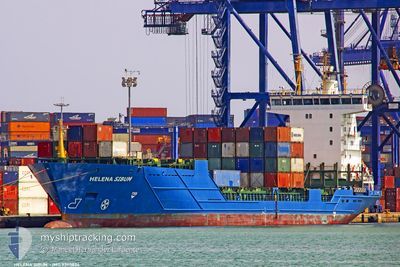
Container Ship
Current Trip
| Time Travelled | 3 days |
|---|---|
| Remaining Time | 14 h, 19 mins |
| Distance Travelled | 1020.55 nm |
| Remaining Distance | 223.22 nm |
| AVG Speed | 14.3 Knots |
| MAX Speed | 16.3 Knots |
| AVG Wind | 16 knots |
| MAX Wind | 38.7 knots |
| MIN Temp | 3.9°C / 39.02°F |
| MAX Temp | 15.3°C / 59.54°F |
| Dybgang | 6.7 m |
| Position Modtaget | 1 m siden |
Current Position
| Longitude | 16.17683° |
|---|---|
| Latitude | 42.30808° |
| Status | Under way using engine |
| Fart | 15.5 Knots |
| Kurs | 315.2° |
| Område | Adriatic Sea |
| Station | T-AIS |
| Position Modtaget | 1 m siden |
Info
Information
The current position of LUCY BORCHARD is in Adriatic Sea with coordinates 42.30808° / 16.17683° as reported on 2025-02-09 05:13 by AIS to our vessel tracker app. The vessel's current speed is 15.5 Knots and is heading at the port of RAVENNA. The estimated time of arrival as calculated by MyShipTracking vessel tracking app is 2025-02-09 19:34 LT
The vessel LUCY BORCHARD (IMO: 9390824, MMSI: 305032000) is a Container Ship that was built in 2006 ( 19 år gamle ). It's sailing under the flag of [AG] Antigua Barbuda.
In this page you can find informations about the vessels current position, last detected port calls, and current voyage information. If the vessels is not in coverage by AIS you will find the latest position.
The current position of LUCY BORCHARD is detected by our AIS receivers and we are not responsible for the reliability of the data. The last position was recorded while the vessel was in Coverage by the Ais receivers of our vessel tracking app.
The current draught of LUCY BORCHARD as reported by AIS is 6.7 meters
Weather
| Temperature | 12.6°C / 54.68°F |
|---|---|
| Wind Speed | 17 knots |
| Direction | 144° SE |
| Pressure | 1026.3 hPa |
| Humidity | 72.4 % |
| Cloud Coverage | 91 % |
Featured Company
Last Port Calls
| Port | Arrival | Departure | Time In Port |
|---|---|---|---|
| 2025-02-05 03:58 | 2025-02-05 12:24 | 8 h | |
| 2025-02-03 01:31 | 2025-02-03 16:33 | 15 h | |
| 2025-02-01 09:52 | 2025-02-01 21:15 | 11 h | |
| 2025-01-31 04:48 | 2025-01-31 14:45 | 9 h | |
| 2025-01-27 06:07 | 2025-01-27 16:28 | 10 h | |
| 2025-01-26 10:59 | 2025-01-26 22:24 | 11 h | |
| 2025-01-21 20:01 | 2025-01-22 12:04 | 16 h | |
| 2025-01-19 20:35 | 2025-01-20 19:14 | 22 h | |
| 2025-01-18 09:15 | 2025-01-18 21:53 | 12 h | |
| 2025-01-17 06:32 | 2025-01-17 15:31 | 8 h |
Most Visited Ports (Last year)
| Port | Arrivals | |
|---|---|---|
| 50 | ||
| 26 | ||
| 26 | ||
| 25 | ||
| 24 |
Last Trips
| Origin | Departure | Destination | Arrival | Distance | |
|---|---|---|---|---|---|
| 2025-02-03 18:33 | 2025-02-05 05:58 | 195.50 nm | |||
| 2025-02-01 23:15 | 2025-02-03 03:31 | 276.73 nm | |||
| 2025-01-31 16:45 | 2025-02-01 11:52 | 271.87 nm | |||
| 2025-01-27 17:28 | 2025-01-31 06:48 | 1270.56 nm | |||
| 2025-01-26 23:24 | 2025-01-27 07:07 | 90.92 nm | |||
| 2025-01-22 14:04 | 2025-01-26 11:59 | 1232.26 nm | |||
| 2025-01-20 21:14 | 2025-01-21 22:01 | 193.17 nm | |||
| 2025-01-18 23:53 | 2025-01-19 22:35 | 276.23 nm | |||
| 2025-01-17 17:31 | 2025-01-18 11:15 | 270.43 nm | |||
| 2025-01-13 19:02 | 2025-01-17 08:32 | 1268.28 nm |
Events
| Tid | Hændelsen | Detaljer | Position / Dest | Info |
|---|---|---|---|---|
| 2025-02-09 04:30 | Fundet i havområde | Croatian part of the Adriatic Sea |
42.17358 / 16.34603
Adriatic Sea
IT RAN
|
Fart: 15.3 kn Kurs: 317.3° |
| 2025-02-09 02:38 | Indenfor Dækning |
41.81515 / 16.78736
Adriatic Sea
IT RAN
|
Fart: 15.7 kn Kurs: 318.1° |
|
| 2025-02-08 23:54 | Udenfor Dækning |
41.29386 / 17.42796
Adriatic Sea
IT RAN
|
Fart: 14.8 kn Kurs: 317.1° |
|
| 2025-02-08 22:58 | Status er ændret | Under way using engine Default |
41.12740 / 17.64457
IT RAN
|
Fart: 15.4 kn Kurs: 317° |
| 2025-02-08 22:58 | Indenfor Dækning |
41.13090 / 17.64054
Adriatic Sea
IT RAN
|
Fart: 15.3 kn Kurs: 319.3° |
|
| 2025-02-08 21:00 | Status er ændret | Default Under way using engine |
40.75848 / 18.10444
IT RAN
|
Fart: 15.1 kn Kurs: 318.8° |
| 2025-02-08 20:41 | Udenfor Dækning |
40.69375 / 18.17276
Adriatic Sea
IT RAN
|
Fart: 15.1 kn Kurs: 318.8° |
|
| 2025-02-08 17:15 | Ændre havområde | Italian part of the Adriatic Sea Greek part of the Ionian Sea |
39.95886 / 18.81586
Adriatic Sea
IT RAN
|
Fart: 15.7 kn Kurs: 327.4° |
| 2025-02-08 17:15 | Status er ændret | Under way using engine Default |
39.95886 / 18.81586
IT RAN
|
Fart: 15.6 kn Kurs: 325° |
| 2025-02-08 17:12 | Indenfor Dækning |
39.95886 / 18.81586
Adriatic Sea
IT RAN
|
Fart: 15.7 kn Kurs: 327.4° |