
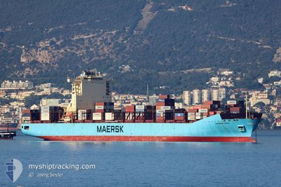
MAERSK LEON
Container Ship
Current Trip
| Time Travelled | 3 h, 26 mins |
|---|---|
| Remaining Time | 9 days |
| Distance Travelled | 35.80 nm |
| Remaining Distance | 3499.71 nm |
| AVG Speed | 9.4 Knots |
| MAX Speed | 16.5 Knots |
| AVG Wind | 8.8 knots |
| MAX Wind | 9.5 knots |
| MIN Temp | 12.2°C / 53.96°F |
| MAX Temp | 15.2°C / 59.36°F |
| Dybgang | 12.6 m |
| Position Modtaget | 28 m siden |
Current Position
| Longitude | -6.00441° |
|---|---|
| Latitude | 35.86090° |
| Status | Under way using engine |
| Fart | 16.9 Knots |
| Kurs | 223.4° |
| Område | North Atlantic Ocean |
| Station | T-AIS |
| Position Modtaget | 28 m siden |
Info
Information
The current position of MAERSK LEON is in North Atlantic Ocean with coordinates 35.86090° / -6.00441° as reported on 2025-02-02 21:37 by AIS to our vessel tracker app. The vessel's current speed is 16.9 Knots and is heading at the port of SALVADOR. The estimated time of arrival as calculated by MyShipTracking vessel tracking app is 2025-02-12 13:08 LT
The vessel MAERSK LEON (IMO: 9526966, MMSI: 219516000) is a Container Ship that was built in 2012 ( 13 år gamle ). It's sailing under the flag of [DK] Denmark.
In this page you can find informations about the vessels current position, last detected port calls, and current voyage information. If the vessels is not in coverage by AIS you will find the latest position.
The current position of MAERSK LEON is detected by our AIS receivers and we are not responsible for the reliability of the data. The last position was recorded while the vessel was in Coverage by the Ais receivers of our vessel tracking app.
The current draught of MAERSK LEON as reported by AIS is 12.6 meters
Weather
| Temperature | 14.2°C / 57.56°F |
|---|---|
| Wind Speed | 7 knots |
| Direction | 211° SSW |
| Pressure | 1021.4 hPa |
| Humidity | 82.1 % |
| Cloud Coverage | 33 % |
Featured Company
Last Port Calls
| Port | Arrival | Departure | Time In Port |
|---|---|---|---|
| 2025-02-02 00:28 | 2025-02-02 19:39 | 19 h | |
| 2025-01-29 01:17 | 2025-01-29 22:09 | 20 h | |
| 2025-01-28 01:24 | 2025-01-29 00:52 | 23 h | |
| 2025-01-26 13:52 | 2025-01-27 03:34 | 13 h | |
| 2025-01-14 06:55 | 2025-01-15 07:26 | 1 d | |
| 2025-01-11 12:12 | 2025-01-11 12:58 | 45 m | |
| 2025-01-08 11:21 | 2025-01-09 07:22 | 20 h | |
| 2025-01-05 17:43 | 2025-01-06 22:28 | 1 d | |
| 2025-01-02 23:29 | 2025-01-03 00:22 | 53 m | |
| 2024-12-23 19:14 | 2024-12-24 06:47 | 11 h |
Last Trips
| Origin | Departure | Destination | Arrival | Distance | |
|---|---|---|---|---|---|
| 2025-01-29 22:09 | 2025-02-02 00:28 | 186.27 nm | |||
| 2025-01-29 00:52 | 2025-01-29 01:17 | 3.49 nm | |||
| 2025-01-27 03:34 | 2025-01-28 01:24 | 119.92 nm | |||
| 2025-01-15 07:26 | 2025-01-26 13:52 | 4269.54 nm | |||
| 2025-01-11 12:58 | 2025-01-14 06:55 | 254.22 nm | |||
| 2025-01-09 07:22 | 2025-01-11 12:12 | 187.76 nm | |||
| 2025-01-06 22:28 | 2025-01-08 11:21 | 91.05 nm | |||
| 2025-01-03 00:22 | 2025-01-05 17:43 | 238.83 nm | |||
| 2024-12-24 06:47 | 2025-01-02 23:29 | 4436.20 nm | |||
| 2024-12-20 19:58 | 2024-12-23 19:14 | 224.43 nm |
Events
| Tid | Hændelsen | Detaljer | Position / Dest | Info |
|---|---|---|---|---|
| 2025-02-02 21:38 | Status er ændret | Default Under way using engine |
35.85784 / -6.00801
MAPTM01>BRSSA
|
Fart: 16.9 kn Kurs: 223.4° |
| 2025-02-02 21:28 | Ændre havområde | Moroccan part of the North Atlantic Ocean Moroccan part of the Strait of Gibraltar |
35.89067 / -5.97027
North Atlantic Ocean
MAPTM01>BRSSA
|
Fart: 16 kn Kurs: 222.6° |
| 2025-02-02 21:28 | Status er ændret | Under way using engine Default |
35.89067 / -5.97027
MAPTM01>BRSSA
|
Fart: 16.1 kn Kurs: 231° |
| 2025-02-02 21:14 | Status er ændret | Default Under way using engine |
35.92880 / -5.90938
MAPTM01>BRSSA
|
Fart: 15 kn Kurs: 245.9° |
| 2025-02-02 21:11 | Status er ændret | Under way using engine Default |
35.93393 / -5.89492
MAPTM01>BRSSA
|
Fart: 14.8 kn Kurs: 264° |
| 2025-02-02 20:56 | Status er ændret | Default Under way using engine |
35.94163 / -5.82287
MAPTM01>BRSSA
|
Fart: 14.3 kn Kurs: 261.1° |
| 2025-02-02 20:53 | Ændre havområde | Moroccan part of the Strait of Gibraltar Spanish part of the Strait of Gibraltar |
35.94327 / -5.80356
Strait of Gibraltar
MAPTM01>BRSSA
|
Fart: 14.3 kn Kurs: 260.3° |
| 2025-02-02 19:26 | Ændre havområde | Spanish part of the Strait of Gibraltar Moroccan part of the Strait of Gibraltar |
35.98829 / -5.42745
Strait of Gibraltar
MAPTM01>BRSSA
|
Fart: 7.9 kn Kurs: 269.5° |
| 2025-02-02 18:39 | Afsejlet fra sidste havn |
|
35.90214 / -5.49081
MAPTM01>BRSSA
|
Fart: 6.5 kn Kurs: 352° |
| 2025-02-02 18:34 | START Sejllads |
35.89580 / -5.49609
[MA] TANGER MED
|
Fart: 3.1 kn Kurs: 40° |