
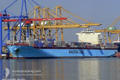
MAERSK STRALSUND
Container Ship
Current Trip
| Time Travelled | 3 days |
|---|---|
| Remaining Time | --- |
| Distance Travelled | 1249.15 nm |
| Remaining Distance | --- |
| AVG Speed | 12.3 Knots |
| MAX Speed | 20.4 Knots |
| AVG Wind | 16.5 knots |
| MAX Wind | 29.5 knots |
| MIN Temp | 6.2°C / 43.16°F |
| MAX Temp | 15.6°C / 60.08°F |
| Dybgang | 12.4 m |
| Position Modtaget | 7 m siden |
Current Position
| Longitude | -5.53714° |
|---|---|
| Latitude | 35.86527° |
| Status | Moored |
| Fart | |
| Kurs | 41° |
| Område | Strait of Gibraltar |
| Station | T-AIS |
| Position Modtaget | 7 m siden |
Information
The current position of MAERSK STRALSUND is in Strait of Gibraltar with coordinates 35.86527° / -5.53714° as reported on 2025-03-16 06:17 by AIS to our vessel tracker app. The vessel's current speed is 0 Knots
The vessel MAERSK STRALSUND (IMO: 9303522, MMSI: 563032800) is a Container Ship that was built in 2005 ( 20 år gamle ). It's sailing under the flag of [SG] Singapore.
In this page you can find informations about the vessels current position, last detected port calls, and current voyage information. If the vessels is not in coverage by AIS you will find the latest position.
The current position of MAERSK STRALSUND is detected by our AIS receivers and we are not responsible for the reliability of the data. The last position was recorded while the vessel was in Coverage by the Ais receivers of our vessel tracking app.
The current draught of MAERSK STRALSUND as reported by AIS is 12.4 meters
Weather
| Temperature | 9.3°C / 48.74°F |
|---|---|
| Wind Speed | 9 knots |
| Direction | 226° SW |
| Pressure | 1019.5 hPa |
| Humidity | 83.2 % |
| Cloud Coverage | 63 % |
Featured Company
Last Port Calls
| Port | Arrival | Departure | Time In Port |
|---|---|---|---|
| 2025-03-09 17:43 | 2025-03-12 12:21 | 2 d | |
| 2025-03-07 04:12 | 2025-03-08 13:50 | 1 d | |
| 2025-03-05 02:38 | 2025-03-05 21:45 | 19 h | |
| 2025-03-01 20:37 | 2025-03-03 11:33 | 1 d | |
| 2025-02-27 21:04 | 2025-03-01 05:34 | 1 d | |
| 2025-02-20 12:44 | 2025-02-20 23:54 | 11 h | |
| 2025-01-23 00:05 | 2025-01-24 03:25 | 1 d | |
| 2025-01-20 22:00 | 2025-01-21 22:06 | 1 d | |
| 2025-01-16 02:18 | 2025-01-17 03:05 | 1 d | |
| 2025-01-12 07:54 | 2025-01-13 05:26 | 21 h |
Most Visited Ports (Last year)
| Port | Arrivals | |
|---|---|---|
| 6 | ||
| 5 | ||
| 5 | ||
| 4 | ||
| 4 | ||
| 4 |
Last Trips
| Origin | Departure | Destination | Arrival | Distance | |
|---|---|---|---|---|---|
| 2025-03-08 13:50 | 2025-03-09 18:43 | 245.51 nm | |||
| 2025-03-05 22:45 | 2025-03-07 04:12 | 343.89 nm | |||
| 2025-03-03 12:33 | 2025-03-05 03:38 | 288.45 nm | |||
| 2025-03-01 06:34 | 2025-03-01 21:37 | 269.20 nm | |||
| 2025-02-21 00:54 | 2025-02-27 22:04 | 1354.18 nm | |||
| 2025-01-24 08:55 | 2025-02-20 13:44 | 9909.36 nm | |||
| 2025-01-22 03:36 | 2025-01-23 05:35 | 422.77 nm | |||
| 2025-01-17 07:05 | 2025-01-21 03:30 | 976.33 nm | |||
| 2025-01-13 09:26 | 2025-01-16 06:18 | 986.88 nm | |||
| 2024-12-18 18:23 | 2025-01-12 11:54 | 9484.85 nm |
Events
| Tid | Hændelsen | Detaljer | Position / Dest | Info |
|---|---|---|---|---|
| 2025-03-16 02:36 | Status er ændret | Moored Default |
35.86534 / -5.53712
MAPTM
|
Fart: Kurs: 40° |
| 2025-03-16 02:33 | Status er ændret | Default Moored |
35.86535 / -5.53711
MAPTM
|
Fart: Kurs: 41° |
| 2025-03-16 01:57 | Status er ændret | Moored Under way using engine |
35.86525 / -5.53720
MAPTM
|
Fart: Kurs: 43° |
| 2025-03-16 01:52 | STOP Sejllads | 1.27 nm, South West of TANGER MED |
35.86541 / -5.53727
MAPTM
|
Fart: 0.3 kn Kurs: 42° |
| 2025-03-16 00:46 | START Sejllads | 2.24 nm, North West of TANGER MED |
35.89725 / -5.56069
MAPTM
|
Fart: 3.1 kn Kurs: 4° |
| 2025-03-16 00:05 | Status er ændret | Under way using engine Default |
35.89734 / -5.56529
MAPTM
|
Fart: 0.4 kn Kurs: 295° |
| 2025-03-16 00:04 | Status er ændret | Default Under way using engine |
35.89739 / -5.56548
MAPTM
|
Fart: 0.3 kn Kurs: 285° |
| 2025-03-15 23:56 | Status er ændret | Under way using engine Default |
35.89720 / -5.56600
MAPTM
|
Fart: 0.3 kn Kurs: 283° |
| 2025-03-15 23:48 | Status er ændret | Default Under way using engine |
35.89650 / -5.56529
MAPTM
|
Fart: 0.2 kn Kurs: 248° |
| 2025-03-15 23:38 | STOP Sejllads | 2.43 nm, West of TANGER MED |
35.89588 / -5.56584
MAPTM
|
Fart: Kurs: 245° |