
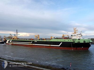
MARGIRIS
Trawler
Current Trip
| Time Travelled | 1 day |
|---|---|
| Remaining Time | 1 day |
| Distance Travelled | 389.58 nm |
| Remaining Distance | 424.23 nm |
| AVG Speed | 13.8 Knots |
| MAX Speed | 15.3 Knots |
| AVG Wind | 12.9 knots |
| MAX Wind | 25 knots |
| MIN Temp | 5°C / 41°F |
| MAX Temp | 7°C / 44.6°F |
| Dybgang | 5.5 m |
| Position Modtaget | 25 m siden |
Current Position
| Longitude | -4.35352° |
|---|---|
| Latitude | 49.78234° |
| Status | Under way using engine |
| Fart | 13.2 Knots |
| Kurs | 256.9° |
| Område | English Channel |
| Station | T-AIS |
| Position Modtaget | 25 m siden |
Info
Information
The current position of MARGIRIS is in English Channel with coordinates 49.78234° / -4.35352° as reported on 2025-02-10 02:33 by AIS to our vessel tracker app. The vessel's current speed is 13.2 Knots and is heading at the port of DEN HELDER. The estimated time of arrival as calculated by MyShipTracking vessel tracking app is 2025-02-11 09:32 LT
The vessel MARGIRIS (IMO: 8301187, MMSI: 277330000) is a Trawler that was built in 1985 ( 40 år gamle ). It's sailing under the flag of [LT] Lithuania.
In this page you can find informations about the vessels current position, last detected port calls, and current voyage information. If the vessels is not in coverage by AIS you will find the latest position.
The current position of MARGIRIS is detected by our AIS receivers and we are not responsible for the reliability of the data. The last position was recorded while the vessel was in Coverage by the Ais receivers of our vessel tracking app.
The current draught of MARGIRIS as reported by AIS is 5.5 meters
Weather
| Temperature | 7°C / 44.6°F |
|---|---|
| Wind Speed | 24 knots |
| Direction | 47° NE |
| Pressure | 1024.7 hPa |
| Humidity | 85.4 % |
| Cloud Coverage | 91 % |
Featured Company
Last Port Calls
| Port | Arrival | Departure | Time In Port |
|---|---|---|---|
| 2025-02-08 15:03 | 2025-02-08 22:53 | 7 h | |
| 2025-02-03 03:00 | 2025-02-07 20:31 | 4 d | |
| 2025-01-06 09:55 | 2025-01-15 14:33 | 9 d |
Most Visited Ports (Last year)
| Port | Arrivals | |
|---|---|---|
| 4 | ||
| 2 | ||
| 1 |
Last Trips
| Origin | Departure | Destination | Arrival | Distance | |
|---|---|---|---|---|---|
| 2025-02-07 20:31 | 2025-02-08 15:03 | 220.64 nm | |||
| 2025-01-15 14:33 | 2025-02-03 03:00 | 1033.55 nm |
Events
| Tid | Hændelsen | Detaljer | Position / Dest | Info |
|---|---|---|---|---|
| 2025-02-10 00:22 | Indenfor Dækning |
49.89433 / -3.59064
English Channel
|
Fart: 14.6 kn Kurs: 257.9° |
|
| 2025-02-09 15:01 | Udenfor Dækning |
50.42900 / -.42848
English Channel
|
Fart: 14.3 kn Kurs: 253.5° |
|
| 2025-02-09 13:06 | Indenfor Dækning |
50.55523 / .28197
English Channel
|
Fart: 15.3 kn Kurs: 254° |
|
| 2025-02-09 10:30 | Udenfor Dækning |
50.84740 / 1.14542
English Channel
|
Fart: 13.1 kn Kurs: 241.7° |
|
| 2025-02-09 10:29 | Indenfor Dækning |
50.84740 / 1.14542
English Channel
|
Fart: 13.1 kn Kurs: 241.7° |
|
| 2025-02-09 09:29 | Udenfor Dækning |
50.98669 / 1.40318
English Channel
|
Fart: 12.2 kn Kurs: 222.5° |
|
| 2025-02-09 09:01 | Ændre havområde | United Kingdom part of the English Channel United Kingdom part of the North Sea |
51.05712 / 1.50078
English Channel
|
Fart: 12.2 kn Kurs: 220.7° |
| 2025-02-09 06:34 | Destination er ændret | FISHING GROUNDS IJMUIDEN |
51.49608 / 2.05446
FISHING GROUNDS
|
Fart: 15 kn Kurs: 223.5° |
| 2025-02-09 06:19 | Ændre havområde | United Kingdom part of the North Sea Belgian part of the North Sea |
51.54154 / 2.12310
North Sea
|
Fart: 15.1 kn Kurs: 223.1° |
| 2025-02-09 06:19 | Indenfor Dækning |
51.54154 / 2.12310
North Sea
|
Fart: 15.1 kn Kurs: 223.1° |