

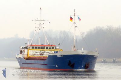
MARIA G
General Cargo

Current Trip
| Time Travelled | 1 day |
|---|---|
| Remaining Time | 21 h, 20 mins |
| Distance Travelled | 221.07 nm |
| Remaining Distance | 255.13 nm |
| AVG Speed | 8.7 Knots |
| MAX Speed | 9.6 Knots |
| AVG Wind | 11.2 knots |
| MAX Wind | 17.8 knots |
| MIN Temp | 8.6°C / 47.48°F |
| MAX Temp | 15.2°C / 59.36°F |
| Dybgang | 2.4 m |
| Position Modtaget | 10 h, 28 m siden |
Current Position
| Longitude | 22.83811° |
|---|---|
| Latitude | 59.54431° |
| Status | Under way using engine |
| Fart | 8.7 Knots |
| Kurs | 251.1° |
| Område | Baltic Sea |
| Station | T-AIS |
| Position Modtaget | 10 h, 28 m siden |
Information
The current position of MARIA G is in Baltic Sea with coordinates 59.54431° / 22.83811° as reported on 2025-05-31 05:30 by AIS to our vessel tracker app. The vessel's current speed is 8.7 Knots and is heading at the port of KLAIPEDA. The estimated time of arrival as calculated by MyShipTracking vessel tracking app is 2025-06-01 16:19 LT
The vessel MARIA G (IMO: 8205187, MMSI: 304559000) is a General Cargo that was built in 1984 ( 41 år gamle ). It's sailing under the flag of [AG] Antigua Barbuda.
In this page you can find informations about the vessels current position, last detected port calls, and current voyage information. If the vessels is not in coverage by AIS you will find the latest position.
The current position of MARIA G is detected by our AIS receivers and we are not responsible for the reliability of the data. The last position was recorded while the vessel was in Coverage by the Ais receivers of our vessel tracking app.
The current draught of MARIA G as reported by AIS is 2.4 meters
Weather
| Temperature | 9.5°C / 49.1°F |
|---|---|
| Wind Speed | 3 knots |
| Direction | 322° NW |
| Pressure | 1013.7 hPa |
| Humidity | 73.7 % |
| Cloud Coverage | 10 % |


Featured Company
Last Port Calls
| Port | Arrival | Departure | Time In Port |
|---|---|---|---|
| 2025-05-29 11:30 | 2025-05-30 15:02 | 1 d | |
| 2025-05-24 10:52 | 2025-05-26 06:59 | 1 d | |
| 2025-05-21 07:21 | 2025-05-23 10:34 | 2 d | |
| 2025-05-18 08:45 | 2025-05-19 13:31 | 1 d | |
| 2025-05-13 21:47 | 2025-05-14 14:35 | 16 h | |
| 2025-05-11 14:03 | 2025-05-13 10:18 | 1 d | |
| 2025-05-09 13:16 | 2025-05-09 20:06 | 6 h | |
| 2025-05-08 07:21 | 2025-05-08 17:10 | 9 h | |
| 2025-04-30 12:30 | 2025-05-06 19:36 | 6 d | |
| 2025-04-28 08:15 | 2025-04-28 22:03 | 13 h |
Last Trips
| Origin | Departure | Destination | Arrival | Distance | |
|---|---|---|---|---|---|
| 2025-05-26 06:59 | 2025-05-29 11:30 | 625.23 nm | |||
| 2025-05-23 10:34 | 2025-05-24 10:52 | 198.42 nm | |||
| 2025-05-19 13:31 | 2025-05-21 07:21 | 329.16 nm | |||
| 2025-05-14 14:35 | 2025-05-18 08:45 | 420.35 nm | |||
| 2025-05-13 10:18 | 2025-05-13 21:47 | 95.80 nm | |||
| 2025-05-09 20:06 | 2025-05-11 14:03 | 374.17 nm | |||
| 2025-05-08 17:10 | 2025-05-09 13:16 | 87.31 nm | |||
| 2025-05-06 19:36 | 2025-05-08 07:21 | 266.70 nm | |||
| 2025-04-28 22:03 | 2025-04-30 12:30 | 324.44 nm | |||
| 2025-04-25 21:04 | 2025-04-28 08:15 | 503.64 nm |
Events
| Tid | Hændelsen | Detaljer | Position / Dest | Info |
|---|---|---|---|---|
| 2025-05-31 05:46 | Status er ændret | Default Under way using engine |
59.53025 / 22.76758
LTKLJ
|
Fart: 8.7 kn Kurs: 251.1° |
| 2025-05-31 05:30 | Udenfor Dækning |
59.54431 / 22.83811
Baltic Sea
LTKLJ
|
Fart: 8.7 kn Kurs: 251.1° |
|
| 2025-05-31 04:31 | Fundet i havområde | Finnish part of the Baltic Sea |
59.58056 / 23.10081
Baltic Sea
LTKLJ
|
Fart: 8.3 kn Kurs: 256.1° |
| 2025-05-31 02:50 | Status er ændret | Under way using engine Default |
59.65021 / 23.52403
LTKLJ
|
Fart: 7.3 kn Kurs: 255° |
| 2025-05-31 02:30 | Status er ændret | Default Under way using engine |
59.66191 / 23.60794
LTKLJ
|
Fart: 6.6 kn Kurs: 252.7° |
| 2025-05-31 01:39 | Status er ændret | Under way using engine Default |
59.69179 / 23.80241
LTKLJ
|
Fart: 7.9 kn Kurs: 252° |
| 2025-05-31 01:26 | Indenfor Dækning |
59.69148 / 23.80044
Gulf of Finland
LTKLJ
|
Fart: 7.7 kn Kurs: 252.6° |
|
| 2025-05-31 00:13 | Status er ændret | Default Under way using engine |
59.74725 / 24.14431
LTKLJ
|
Fart: 7.6 kn Kurs: 253.4° |
| 2025-05-31 00:06 | Udenfor Dækning |
59.75185 / 24.17412
Gulf of Finland
LTKLJ
|
Fart: 7.6 kn Kurs: 253.4° |
|
| 2025-05-31 00:04 | Status er ændret | Under way using engine Default |
59.75295 / 24.18150
LTKLJ
|
Fart: 7.7 kn Kurs: 254° |