
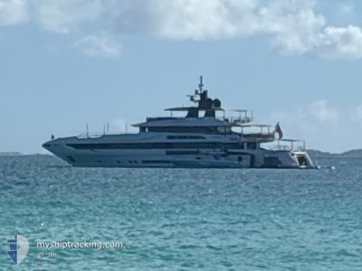
MAVERICK
Pleasure Craft
Current Trip
CAT CAY
| Time Travelled | 1 day |
|---|---|
| Remaining Time | --- |
| Distance Travelled | 50.52 nm |
| Remaining Distance | --- |
| AVG Speed | 11.6 Knots |
| MAX Speed | 12.5 Knots |
| AVG Wind | 18.1 knots |
| MAX Wind | 19 knots |
| MIN Temp | 26°C / 78.8°F |
| MAX Temp | 26.2°C / 79.16°F |
| Dybgang | 3 m |
| Position Modtaget | 1 d siden |
Current Position
| Longitude | -65.81381° |
|---|---|
| Latitude | 18.51033° |
| Status | Under way using engine |
| Fart | 11.5 Knots |
| Kurs | 289.3° |
| Område | North Atlantic Ocean |
| Station | T-AIS |
| Position Modtaget | 1 d siden |
Info
Information
The current position of MAVERICK is in North Atlantic Ocean with coordinates 18.51033° / -65.81381° as reported on 2025-02-06 21:17 by AIS to our vessel tracker app. The vessel's current speed is 11.5 Knots
The vessel MAVERICK (IMO: 9979307, MMSI: 311001480) is a Pleasure Craft It's sailing under the flag of [BS] Bahamas.
In this page you can find informations about the vessels current position, last detected port calls, and current voyage information. If the vessels is not in coverage by AIS you will find the latest position.
The current position of MAVERICK is detected by our AIS receivers and we are not responsible for the reliability of the data. The last position was recorded while the vessel was in Coverage by the Ais receivers of our vessel tracking app.
The current draught of MAVERICK as reported by AIS is 3 meters
Weather
| Temperature | 26°C / 78.8°F |
|---|---|
| Wind Speed | 17 knots |
| Direction | 78° ENE |
| Pressure | 1016.2 hPa |
| Humidity | 68 % |
| Cloud Coverage | 2 % |
Featured Company
Last Port Calls
| Port | Arrival | Departure | Time In Port |
|---|---|---|---|
| 2025-02-05 16:30 | 2025-02-06 16:47 | 1 d | |
| 2025-01-31 12:11 | 2025-01-31 14:33 | 2 h | |
| 2025-01-24 15:05 | 2025-01-26 17:17 | 2 d | |
| 2025-01-04 18:02 | 2025-01-12 12:40 | 7 d | |
| 2024-12-27 13:36 | 2024-12-28 14:37 | 1 d | |
| 2024-12-19 12:23 | 2024-12-20 20:14 | 1 d | |
| 2024-12-10 13:33 | 2024-12-18 20:04 | 8 d | |
| 2024-12-04 11:59 | 2024-12-09 21:52 | 5 d | |
| 2024-12-03 20:14 |
Most Visited Ports (Last year)
| Port | Arrivals | |
|---|---|---|
| 7 | ||
| 6 | ||
| 5 | ||
| 3 | ||
| 2 | ||
| 1 |
Last Trips
| Origin | Departure | Destination | Arrival | Distance | |
|---|---|---|---|---|---|
| 2025-01-31 10:33 | 2025-02-05 12:30 | 73.04 nm | |||
| 2025-01-26 13:17 | 2025-01-31 08:11 | 298.76 nm | |||
| 2025-01-12 08:40 | 2025-01-24 11:05 | 727.95 nm | |||
| 2024-12-28 10:37 | 2025-01-04 14:02 | 89.44 nm | |||
| 2024-12-20 16:14 | 2024-12-27 09:36 | 171.41 nm | |||
| 2024-12-18 16:04 | 2024-12-19 08:23 | 119.89 nm | |||
| 2024-12-09 17:52 | 2024-12-10 09:33 | 103.08 nm | |||
| 2024-12-03 16:14 | 2024-12-04 07:59 | 102.66 nm |
Events
| Tid | Hændelsen | Detaljer | Position / Dest | Info |
|---|---|---|---|---|
| 2025-02-06 21:17 | Udenfor Dækning |
18.51033 / -65.81381
North Atlantic Ocean
CAT CAY
|
Fart: 11.5 kn Kurs: 289.3° |
|
| 2025-02-06 20:23 | Ændre havområde | Puerto Rican part of the North Atlantic Ocean Puerto Rican part of the Caribbean Sea |
18.46091 / -65.63237
North Atlantic Ocean
CAT CAY
|
Fart: 11.8 kn Kurs: 284.1° |
| 2025-02-06 16:47 | Afsejlet fra sidste havn |
|
18.31973 / -64.92930
CAT CAY
|
Fart: 11.3 kn Kurs: 229° |
| 2025-02-06 16:38 | START Sejllads |
18.33386 / -64.92324
[VI] ST THOMAS
|
Fart: 3.5 kn Kurs: 223° |
|
| 2025-02-06 16:23 | Destination er ændret | CAT CAY ST THOMAS |
18.33569 / -64.92109
[VI] ST THOMAS
|
Fart: 0.5 kn Kurs: 224° |
| 2025-02-06 16:23 | ETA er ændret | 2025/02/10 13:00 2025/02/05 13:00 |
18.33569 / -64.92109
[VI] ST THOMAS
|
Fart: 0.5 kn Kurs: 224° |
| 2025-02-06 16:20 | Status er ændret | Under way using engine Moored |
18.33591 / -64.92088
[VI] ST THOMAS
|
Fart: Kurs: 230° |
| 2025-02-06 15:37 | Indenfor Dækning |
18.33590 / -64.92086
Caribbean Sea
[VI] ST THOMAS
|
Fart: Kurs: 54.1° |
|
| 2025-02-06 14:31 | Udenfor Dækning |
18.33588 / -64.92085
Caribbean Sea
[VI] ST THOMAS
|
Fart: Kurs: 54.1° |
|
| 2025-02-06 13:19 | Indenfor Dækning |
18.33588 / -64.92085
Caribbean Sea
[VI] ST THOMAS
|
Fart: Kurs: 54.1° |