
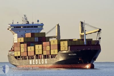
MED IZMIR
Container Ship
Current Trip
EGAKI
| Time Travelled | 16 h, 10 mins |
|---|---|
| Remaining Time | --- |
| Distance Travelled | --- |
| Remaining Distance | --- |
| AVG Speed | --- |
| MAX Speed | --- |
| AVG Wind | --- |
| MAX Wind | --- |
| MIN Temp | --- |
| MAX Temp | --- |
| Dybgang | 8.7 m |
| Position Modtaget | 6 d siden |
Current Position
| Longitude | 34.75127° |
|---|---|
| Latitude | 36.32446° |
| Status | Under way using engine |
| Fart | 12.5 Knots |
| Kurs | 176° |
| Område | Mediterranean Sea - Eastern Basin |
| Station | T-AIS |
| Position Modtaget | 6 d siden |
Info
Information
The current position of MED IZMIR is in Mediterranean Sea - Eastern Basin with coordinates 36.32446° / 34.75127° as reported on 2025-02-02 04:32 by AIS to our vessel tracker app. The vessel's current speed is 12.5 Knots
The vessel MED IZMIR (IMO: 9143879, MMSI: 271051138) is a Container Ship that was built in 1998 ( 27 år gamle ). It's sailing under the flag of [TR] Turkey.
In this page you can find informations about the vessels current position, last detected port calls, and current voyage information. If the vessels is not in coverage by AIS you will find the latest position.
The current position of MED IZMIR is detected by our AIS receivers and we are not responsible for the reliability of the data. The last position was recorded while the vessel was in Coverage by the Ais receivers of our vessel tracking app.
The current draught of MED IZMIR as reported by AIS is 8.7 meters
Weather
| Temperature | 12.8°C / 55.04°F |
|---|---|
| Wind Speed | 14 knots |
| Direction | 342° NNW |
| Pressure | 1023 hPa |
| Humidity | 53.7 % |
| Cloud Coverage | 91 % |
Featured Company
Last Port Calls
| Port | Arrival | Departure | Time In Port |
|---|---|---|---|
| 2025-02-04 12:41 | 2025-02-07 19:23 | 3 d | |
| 2025-01-31 22:34 | 2025-02-02 04:59 | 1 d | |
| 2025-01-25 13:12 | 2025-01-26 08:45 | 19 h | |
| 2025-01-23 20:43 | 2025-01-24 08:04 | 11 h | |
| 2025-01-22 00:24 | 2025-01-22 10:36 | 10 h | |
| 2025-01-20 17:09 | 2025-01-21 12:01 | 18 h | |
| 2025-01-17 20:12 | 2025-01-18 11:34 | 15 h | |
| 2025-01-16 11:33 | 2025-01-16 22:29 | 10 h | |
| 2025-01-14 23:51 | 2025-01-15 11:12 | 11 h | |
| 2025-01-13 18:37 | 2025-01-14 01:07 | 6 h |
Last Trips
| Origin | Departure | Destination | Arrival | Distance | |
|---|---|---|---|---|---|
| 2025-02-02 04:59 | 2025-02-04 12:41 | 445.76 nm | |||
| 2025-01-26 08:45 | 2025-01-31 22:34 | 439.96 nm | |||
| 2025-01-24 08:04 | 2025-01-25 13:12 | 354.73 nm | |||
| 2025-01-22 10:36 | 2025-01-23 20:43 | 277.33 nm | |||
| 2025-01-21 12:01 | 2025-01-22 00:24 | 146.17 nm | |||
| 2025-01-18 11:34 | 2025-01-20 17:09 | 536.90 nm | |||
| 2025-01-16 22:29 | 2025-01-17 20:12 | 259.91 nm | |||
| 2025-01-15 11:12 | 2025-01-16 11:33 | 284.29 nm | |||
| 2025-01-14 01:07 | 2025-01-14 23:51 | 105.29 nm | |||
| 2025-01-13 12:40 | 2025-01-13 18:37 | 62.35 nm |
Events
| Tid | Hændelsen | Detaljer | Position / Dest | Info |
|---|---|---|---|---|
| 2025-02-07 17:23 | Afsejlet fra sidste havn |
|
31.33398 / 30.08931
EGAKI
|
Fart: 3.2 kn Kurs: 13° |
| 2025-02-07 17:12 | START Sejllads |
31.31630 / 30.08406
[EG] ABU QIR
|
Fart: 3.2 kn Kurs: 13° |
|
| 2025-02-04 11:00 | STOP Sejllads |
31.31451 / 30.08381
[EG] ABU QIR
|
Fart: 0.2 kn Kurs: -1° |
|
| 2025-02-04 10:41 | Skibe i havn |
|
31.32379 / 30.08491
[EG] ABU QIR
|
Fart: 7.1 kn Kurs: 196° |
| 2025-02-04 09:59 | START Sejllads | 4.15 nm, North of ABU QIR |
31.38322 / 30.06821
EGAKI
|
Fart: 7.9 kn Kurs: 114° |
| 2025-02-03 15:26 | STOP Sejllads | 4.37 nm, North of ABU QIR |
31.38374 / 30.05363
EGAKI
|
Fart: Kurs: 55° |
| 2025-02-02 04:45 | Status er ændret | Default Under way using engine |
36.27863 / 34.75472
EGAKI
|
Fart: 12.5 kn Kurs: 176° |
| 2025-02-02 04:32 | Udenfor Dækning |
36.32446 / 34.75127
Mediterranean Sea - Eastern Basin
EGAKI
|
Fart: 12.5 kn Kurs: 176° |
|
| 2025-02-02 02:44 | ETA er ændret | 2025/02/03 14:00 2025/02/03 12:00 |
36.69205 / 34.69586
EGAKI
|
Fart: 11.5 kn Kurs: 166° |
| 2025-02-02 01:59 | Afsejlet fra sidste havn |
|
36.78113 / 34.64912
EGAKI
|
Fart: 7.2 kn Kurs: 139° |