
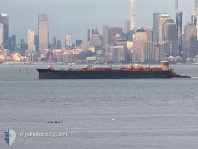
MEREDITH C REINAUER
Spare - Local Vessel
Current Trip
| Time Travelled | 21 h, 57 mins |
|---|---|
| Remaining Time | 14 h, 24 mins |
| Distance Travelled | 47.50 nm |
| Remaining Distance | 136.44 nm |
| AVG Speed | 9.1 Knots |
| MAX Speed | 12 Knots |
| AVG Wind | 4.1 knots |
| MAX Wind | 8.6 knots |
| MIN Temp | -1.4°C / 29.48°F |
| MAX Temp | 1.5°C / 34.7°F |
| Dybgang | 7.6 m |
| Position Modtaget | 43 m siden |
Current Position
| Longitude | -73.43601° |
|---|---|
| Latitude | 40.53842° |
| Status | Pushing Ahead - Towing |
| Fart | 9.5 Knots |
| Kurs | 85° |
| Område | North Atlantic Ocean |
| Station | T-AIS |
| Position Modtaget | 43 m siden |
Info
Information
The current position of MEREDITH C REINAUER is in North Atlantic Ocean with coordinates 40.53842° / -73.43601° as reported on 2025-02-11 19:36 by AIS to our vessel tracker app. The vessel's current speed is 9.5 Knots and is heading at the port of PROVIDENCE. The estimated time of arrival as calculated by MyShipTracking vessel tracking app is 2025-02-12 10:43 LT
The vessel MEREDITH C REINAUER (MMSI: 366891140) is a Spare - Local Vessel It's sailing under the flag of [US] USA.
In this page you can find informations about the vessels current position, last detected port calls, and current voyage information. If the vessels is not in coverage by AIS you will find the latest position.
The current position of MEREDITH C REINAUER is detected by our AIS receivers and we are not responsible for the reliability of the data. The last position was recorded while the vessel was in Coverage by the Ais receivers of our vessel tracking app.
The current draught of MEREDITH C REINAUER as reported by AIS is 7.6 meters
Weather
| Temperature | 1°C / 33.8°F |
|---|---|
| Wind Speed | 6 knots |
| Direction | 209° SSW |
| Pressure | 1027 hPa |
| Humidity | 57.5 % |
| Cloud Coverage | 100 % |
Featured Company
Last Port Calls
| Port | Arrival | Departure | Time In Port |
|---|---|---|---|
| 2025-02-10 13:43 | 2025-02-10 22:22 | 8 h | |
| 2025-02-08 12:08 | 2025-02-09 22:49 | 1 d | |
| 2025-02-06 12:00 | 2025-02-07 12:28 | 1 d | |
| 2025-02-04 02:39 | 2025-02-04 06:26 | 3 h | |
| 2025-02-02 18:59 | 2025-02-04 00:02 | 1 d | |
| 2025-01-31 16:06 | 2025-02-01 16:43 | 1 d | |
| 2025-01-29 00:19 | 2025-01-29 01:59 | 1 h | |
| 2025-01-27 19:07 | |||
| 2025-01-25 12:27 | 2025-01-26 17:29 | 1 d | |
| 2025-01-20 17:35 | 2025-01-20 19:43 | 2 h |
Most Visited Ports (Last year)
| Port | Arrivals | |
|---|---|---|
| 53 | ||
| 35 | ||
| 26 | ||
| 3 | ||
| 1 | ||
| 1 |
Last Trips
| Origin | Departure | Destination | Arrival | Distance | |
|---|---|---|---|---|---|
| 2025-02-09 17:49 | 2025-02-10 08:43 | 8.44 nm | |||
| 2025-02-07 07:28 | 2025-02-08 07:08 | 185.94 nm | |||
| 2025-02-04 01:26 | 2025-02-06 07:00 | 188.57 nm | |||
| 2025-02-03 19:02 | 2025-02-03 21:39 | 14.09 nm | |||
| 2025-02-01 11:43 | 2025-02-02 13:59 | 217.55 nm | |||
| 2025-01-28 20:59 | 2025-01-31 11:06 | 191.07 nm | |||
| 2025-01-26 12:29 | 2025-01-28 19:19 | 220.22 nm | |||
| 2025-01-26 12:29 | 2025-01-27 14:07 | 210.88 nm | |||
| 2025-01-20 14:43 | 2025-01-25 07:27 | 226.88 nm | |||
| 2025-01-20 11:29 | 2025-01-20 12:35 | 8.20 nm |
Events
| Tid | Hændelsen | Detaljer | Position / Dest | Info |
|---|---|---|---|---|
| 2025-02-11 15:37 | Dybgangen er ændret | 7.6 7.9 |
40.64164 / -74.14437
USNYC>USPVD
|
Fart: 8 kn Kurs: 83.9° |
| 2025-02-11 15:37 | Status er ændret | Pushing Ahead - Towing Under way using engine |
40.64151 / -74.14664
USNYC>USPVD
|
Fart: 8.4 kn Kurs: 98.7° |
| 2025-02-11 14:45 | START Sejllads | 4.08 nm, North East of PERTH AMBOY |
40.59257 / -74.20429
USNYC>USPVD
|
Fart: 4.7 kn Kurs: 43° |
| 2025-02-11 14:07 | Status er ændret | Under way using engine Moored |
40.59104 / -74.20694
USNYC>USPVD
|
Fart: Kurs: 29° |
| 2025-02-11 13:28 | Dybgangen er ændret | 7.9 6.8 |
40.59107 / -74.20693
USNYC>USPVD
|
Fart: Kurs: 29° |
| 2025-02-11 13:28 | Destination er ændret | USNYC>USPVD US^0XTU>0XL8 |
40.59107 / -74.20693
USNYC>USPVD
|
Fart: Kurs: 29° |
| 2025-02-11 13:28 | ETA er ændret | 2025/02/12 09:00 |
40.59107 / -74.20693
USNYC>USPVD
|
Fart: Kurs: 29° |
| 2025-02-11 12:12 | Indenfor Dækning |
40.59106 / -74.20693
North Atlantic Ocean
|
Fart: Kurs: 43.7° |
|
| 2025-02-11 10:54 | Udenfor Dækning |
40.59104 / -74.20693
North Atlantic Ocean
|
Fart: Kurs: 43.7° |
|
| 2025-02-11 10:48 | Indenfor Dækning |
40.59106 / -74.20694
North Atlantic Ocean
|
Fart: Kurs: 43.7° |