
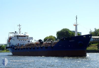
MERSEY
Oil Products Tanker
Current Trip
| Time Travelled | 1 day |
|---|---|
| Remaining Time | 15 h, 0 mins |
| Distance Travelled | 105.29 nm |
| Remaining Distance | 103.54 nm |
| AVG Speed | 7.7 Knots |
| MAX Speed | 16 Knots |
| AVG Wind | 9.7 knots |
| MAX Wind | 24.9 knots |
| MIN Temp | 0.1°C / 32.18°F |
| MAX Temp | 4.1°C / 39.38°F |
| Dybgang | 4.1 m |
| Position Modtaget | 1 m siden |
Current Position
| Longitude | 9.60434° |
|---|---|
| Latitude | 54.23007° |
| Status | Under way using engine |
| Fart | 6.9 Knots |
| Kurs | 21.7° |
| Område | North Sea |
| Station | T-AIS |
| Position Modtaget | 1 m siden |
Info
Information
The current position of MERSEY is in North Sea with coordinates 54.23007° / 9.60434° as reported on 2025-02-09 06:38 by AIS to our vessel tracker app. The vessel's current speed is 6.9 Knots and is heading at the port of ROSTOCK. The estimated time of arrival as calculated by MyShipTracking vessel tracking app is 2025-02-09 22:39 LT
The vessel MERSEY (IMO: 9170420, MMSI: 275541000) is a Oil Products Tanker that was built in 1998 ( 27 år gamle ). It's sailing under the flag of [LV] Latvia.
In this page you can find informations about the vessels current position, last detected port calls, and current voyage information. If the vessels is not in coverage by AIS you will find the latest position.
The current position of MERSEY is detected by our AIS receivers and we are not responsible for the reliability of the data. The last position was recorded while the vessel was in Coverage by the Ais receivers of our vessel tracking app.
The current draught of MERSEY as reported by AIS is 4.1 meters
Weather
| Temperature | 0.3°C / 32.54°F |
|---|---|
| Wind Speed | 6 knots |
| Direction | 63° ENE |
| Pressure | 1031.5 hPa |
| Humidity | 88 % |
| Cloud Coverage | 100 % |
Featured Company
Last Port Calls
| Port | Arrival | Departure | Time In Port |
|---|---|---|---|
| 2025-02-06 14:32 | 2025-02-07 08:24 | 17 h | |
| 2025-02-04 20:27 | 2025-02-05 14:30 | 18 h | |
| 2025-02-04 09:22 | 2025-02-04 13:21 | 3 h | |
| 2025-02-03 16:23 | 2025-02-03 23:59 | 7 h | |
| 2025-02-03 07:48 | 2025-02-03 10:54 | 3 h | |
| 2025-02-02 12:46 | 2025-02-03 07:18 | 18 h | |
| 2025-02-02 06:58 | 2025-02-02 12:20 | 5 h | |
| 2025-01-29 20:35 | 2025-02-01 23:54 | 3 d | |
| 2025-01-29 09:22 | 2025-01-29 13:32 | 4 h | |
| 2025-01-28 16:57 | 2025-01-28 20:43 | 3 h |
Most Visited Ports (Last year)
| Port | Arrivals | |
|---|---|---|
| 93 | ||
| 87 | ||
| 33 | ||
| 26 | ||
| 18 | ||
| 10 |
Last Trips
| Origin | Departure | Destination | Arrival | Distance | |
|---|---|---|---|---|---|
| 2025-02-05 14:30 | 2025-02-06 14:32 | 208.40 nm | |||
| 2025-02-04 13:21 | 2025-02-04 20:27 | 79.91 nm | |||
| 2025-02-03 23:59 | 2025-02-04 09:22 | 82.33 nm | |||
| 2025-02-03 10:54 | 2025-02-03 16:23 | 52.35 nm | |||
| 2025-02-03 07:18 | 2025-02-03 07:48 | 3.54 nm | |||
| 2025-02-02 12:20 | 2025-02-02 12:46 | 3.37 nm | |||
| 2025-02-01 23:54 | 2025-02-02 06:58 | 52.15 nm | |||
| 2025-01-29 13:32 | 2025-01-29 20:35 | 80.06 nm | |||
| 2025-01-28 20:43 | 2025-01-29 09:22 | 2.10 nm | |||
| 2025-01-28 07:05 | 2025-01-28 16:57 | 82.91 nm |
Events
| Tid | Hændelsen | Detaljer | Position / Dest | Info |
|---|---|---|---|---|
| 2025-02-09 02:36 | START Sejllads | 0.65 nm, South West of BRUNSBUETTEL |
53.89484 / 9.14785
DE RSK
|
Fart: 4.4 kn Kurs: 48° |
| 2025-02-09 02:11 | STOP Sejllads | 0.76 nm, South West of BRUNSBUETTEL |
53.89355 / 9.14556
DE RSK
|
Fart: 0.3 kn Kurs: 51° |
| 2025-02-08 23:09 | Dybgangen er ændret | 4.1 4.3 |
53.94162 / 8.64266
DE RSK
|
Fart: 9.1 kn Kurs: 130.9° |
| 2025-02-08 23:09 | Destination er ændret | DE RSK DE HLG |
53.94162 / 8.64266
DE RSK
|
Fart: 9.1 kn Kurs: 130.9° |
| 2025-02-08 23:09 | ETA er ændret | 2025/02/09 19:00 2025/02/07 13:00 |
53.94162 / 8.64266
DE RSK
|
Fart: 9.1 kn Kurs: 130.9° |
| 2025-02-08 20:46 | Indenfor Dækning |
53.99484 / 7.98603
North Sea
|
Fart: 10 kn Kurs: 103° |
|
| 2025-02-08 12:58 | Udenfor Dækning |
53.95446 / 7.86378
North Sea
|
Fart: 10 kn Kurs: 0° |
|
| 2025-02-08 12:42 | Status er ændret | Under way using engine At anchor |
53.91215 / 7.86416
DE HLG
|
Fart: 0.8 kn Kurs: 89° |
| 2025-02-08 12:34 | Indenfor Dækning |
53.91252 / 7.86359
North Sea
|
Fart: 0.8 kn Kurs: 163.8° |
|
| 2025-02-08 08:15 | Udenfor Dækning |
53.91308 / 7.86181
North Sea
|
Fart: 0.3 kn Kurs: 2.3° |