
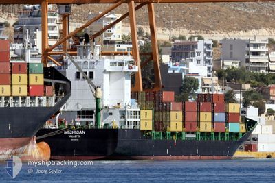
MICHIGAN
Container Ship
Current Trip
| Time Travelled | 1 day |
|---|---|
| Remaining Time | --- |
| Distance Travelled | 315.65 nm |
| Remaining Distance | --- |
| AVG Speed | 12.9 Knots |
| MAX Speed | 13.8 Knots |
| AVG Wind | 8.8 knots |
| MAX Wind | 26.5 knots |
| MIN Temp | 12.5°C / 54.5°F |
| MAX Temp | 16.1°C / 60.98°F |
| Dybgang | 7.2 m |
| Position Modtaget | Nu |
Current Position
| Longitude | 28.75774° |
|---|---|
| Latitude | 36.31146° |
| Status | Under way using engine |
| Fart | 12 Knots |
| Kurs | 297.9° |
| Område | Mediterranean Sea - Eastern Basin |
| Station | T-AIS |
| Position Modtaget | Nu |
Info
Information
The current position of MICHIGAN is in Mediterranean Sea - Eastern Basin with coordinates 36.31146° / 28.75774° as reported on 2025-02-05 10:41 by AIS to our vessel tracker app. The vessel's current speed is 12 Knots and is heading at the port of GIOIA TAURO. The estimated time of arrival as calculated by MyShipTracking vessel tracking app is 2025-02-07 17:00 LT
The vessel MICHIGAN (IMO: 9437139, MMSI: 215020000) is a Container Ship that was built in 2008 ( 17 år gamle ). It's sailing under the flag of [MT] Malta.
In this page you can find informations about the vessels current position, last detected port calls, and current voyage information. If the vessels is not in coverage by AIS you will find the latest position.
The current position of MICHIGAN is detected by our AIS receivers and we are not responsible for the reliability of the data. The last position was recorded while the vessel was in Coverage by the Ais receivers of our vessel tracking app.
The current draught of MICHIGAN as reported by AIS is 7.2 meters
Weather
| Temperature | 12.5°C / 54.5°F |
|---|---|
| Wind Speed | 25 knots |
| Direction | 325° NW |
| Pressure | 1011.2 hPa |
| Humidity | 59.8 % |
| Cloud Coverage | 1 % |
Featured Company
Last Port Calls
| Port | Arrival | Departure | Time In Port |
|---|---|---|---|
| 2025-02-03 07:05 | 2025-02-04 10:19 | 1 d | |
| 2025-02-01 03:13 | 2025-02-01 18:09 | 14 h | |
| 2025-01-28 18:19 | 2025-01-29 11:51 | 17 h | |
| 2025-01-24 21:45 | 2025-01-25 09:09 | 11 h | |
| 2025-01-23 05:15 | 2025-01-23 18:34 | 13 h | |
| 2025-01-18 11:41 | 2025-01-20 14:30 | 2 d | |
| 2025-01-15 11:25 | 2025-01-16 07:33 | 20 h | |
| 2025-01-13 12:33 | 2025-01-14 07:27 | 18 h | |
| 2025-01-11 16:29 | 2025-01-12 07:41 | 15 h | |
| 2025-01-07 11:00 | 2025-01-08 06:13 | 19 h |
Most Visited Ports (Last year)
| Port | Arrivals | |
|---|---|---|
| 33 | ||
| 16 | ||
| 12 | ||
| 12 | ||
| 8 | ||
| 8 |
Last Trips
| Origin | Departure | Destination | Arrival | Distance | |
|---|---|---|---|---|---|
| 2025-02-01 21:09 | 2025-02-03 10:05 | 89.81 nm | |||
| 2025-01-29 13:51 | 2025-02-01 06:13 | 675.33 nm | |||
| 2025-01-25 10:09 | 2025-01-28 20:19 | 562.53 nm | |||
| 2025-01-23 19:34 | 2025-01-24 22:45 | 210.73 nm | |||
| 2025-01-20 15:30 | 2025-01-23 06:15 | 679.35 nm | |||
| 2025-01-16 08:33 | 2025-01-18 12:41 | 679.59 nm | |||
| 2025-01-14 08:27 | 2025-01-15 12:25 | 322.81 nm | |||
| 2025-01-12 08:41 | 2025-01-13 13:33 | 325.95 nm | |||
| 2025-01-08 09:13 | 2025-01-11 17:29 | 1064.94 nm | |||
| 2025-01-07 05:51 | 2025-01-07 14:00 | 86.92 nm |
Events
| Tid | Hændelsen | Detaljer | Position / Dest | Info |
|---|---|---|---|---|
| 2025-02-05 08:29 | Ændre havområde | Turkish part of the Mediterranean Sea - Eastern Basin Greek part of the Mediterranean Sea - Eastern Basin |
36.10509 / 29.25623
Mediterranean Sea - Eastern Basin
ITGIT
|
Fart: 12.8 kn Kurs: 297.4° |
| 2025-02-05 08:15 | Status er ændret | Under way using engine Default |
36.08078 / 29.30776
ITGIT
|
Fart: 12.9 kn Kurs: 300° |
| 2025-02-05 08:06 | Indenfor Dækning |
36.08078 / 29.30776
Mediterranean Sea - Eastern Basin
ITGIT
|
Fart: 13.1 kn Kurs: 299.6° |
|
| 2025-02-05 07:20 | Status er ændret | Default Under way using engine |
35.99403 / 29.52608
ITGIT
|
Fart: 12.8 kn Kurs: 273.9° |
| 2025-02-05 07:08 | Udenfor Dækning |
35.99092 / 29.57846
Mediterranean Sea - Eastern Basin
ITGIT
|
Fart: 12.8 kn Kurs: 273.9° |
|
| 2025-02-05 06:43 | Ændre havområde | Greek part of the Mediterranean Sea - Eastern Basin Turkish part of the Mediterranean Sea - Eastern Basin |
35.99018 / 29.68629
Mediterranean Sea - Eastern Basin
ITGIT
|
Fart: 12.8 kn Kurs: 269.7° |
| 2025-02-05 06:20 | Status er ændret | Under way using engine Default |
35.98833 / 29.78777
ITGIT
|
Fart: 12.7 kn Kurs: 273° |
| 2025-02-05 06:04 | Status er ændret | Default Under way using engine |
35.98501 / 29.85752
ITGIT
|
Fart: 12.8 kn Kurs: 272.1° |
| 2025-02-05 06:03 | Status er ændret | Under way using engine Default |
35.98481 / 29.86190
ITGIT
|
Fart: 12.8 kn Kurs: 273° |
| 2025-02-05 06:03 | Indenfor Dækning |
35.98481 / 29.86190
Mediterranean Sea - Eastern Basin
ITGIT
|
Fart: 12.8 kn Kurs: 272.1° |