
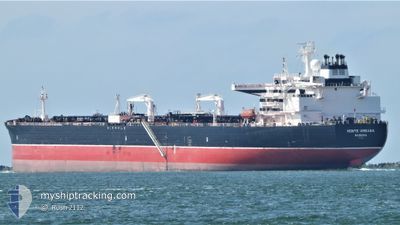
MONTE URBASA
Tanker
Current Trip
GOLA
| Time Travelled | 7 days |
|---|---|
| Remaining Time | --- |
| Distance Travelled | 1666.70 nm |
| Remaining Distance | --- |
| AVG Speed | 12.6 Knots |
| MAX Speed | 14.8 Knots |
| AVG Wind | 11.4 knots |
| MAX Wind | 22 knots |
| MIN Temp | 13.7°C / 56.66°F |
| MAX Temp | 26.8°C / 80.24°F |
| Dybgang | 12.5 m |
| Position Modtaget | 5 d siden |
Current Position
| Longitude | -94.83866° |
|---|---|
| Latitude | 28.64942° |
| Status | Restricted manoeuverability |
| Fart | 0.9 Knots |
| Kurs | 335° |
| Område | Gulf of Mexico |
| Station | T-AIS |
| Position Modtaget | 5 d siden |
Info
Information
The current position of MONTE URBASA is in Gulf of Mexico with coordinates 28.64942° / -94.83866° as reported on 2026-01-03 17:37 by AIS to our vessel tracker app. The vessel's current speed is 0.9 Knots
The vessel MONTE URBASA (IMO: 9785835, MMSI: 255806023) is a Tanker It's sailing under the flag of [PT] Portugal.
In this page you can find informations about the vessels current position, last detected port calls, and current voyage information. If the vessels is not in coverage by AIS you will find the latest position.
The current position of MONTE URBASA is detected by our AIS receivers and we are not responsible for the reliability of the data. The last position was recorded while the vessel was in Coverage by the Ais receivers of our vessel tracking app.
The current draught of MONTE URBASA as reported by AIS is 12.5 meters
Weather
| Temperature | 26.6°C / 79.88°F |
|---|---|
| Wind Speed | 22 knots |
| Direction | 76° ENE |
| Pressure | 1013.9 hPa |
| Humidity | 72.3 % |
| Cloud Coverage | --- |
Featured Company
Last Port Calls
| Port | Arrival | Departure | Time In Port |
|---|---|---|---|
| 2025-12-30 08:45 | 2026-01-01 09:19 | 2 d | |
| 2025-12-07 14:28 | 2025-12-08 19:59 | 1 d | |
| 2025-11-16 10:25 | 2025-11-17 20:18 | 1 d |
Most Visited Ports (Last year)
| Port | Arrivals | |
|---|---|---|
| 2 | ||
| 2 | ||
| 1 | ||
| 1 | ||
| 1 | ||
| 1 |
Last Trips
| Origin | Departure | Destination | Arrival | Distance | |
|---|---|---|---|---|---|
| 2025-12-08 19:59 | 2025-12-30 08:45 | 5823.82 nm | |||
| 2025-11-17 20:18 | 2025-12-07 14:28 | 5790.45 nm | |||
| 2025-10-27 13:59 | 2025-11-16 10:25 | 5645.48 nm |
Events
| Tid | Hændelsen | Detaljer | Position / Dest | Info |
|---|---|---|---|---|
| 2026-01-04 14:29 | START Sejllads |
28.55598 / -94.84285
GOLA
|
Fart: 3.3 kn Kurs: 163° |
|
| 2026-01-04 14:02 | STOP Sejllads |
28.55667 / -94.84666
GOLA
|
Fart: Kurs: -1° |
|
| 2026-01-04 13:08 | START Sejllads |
28.53198 / -94.84068
GOLA
|
Fart: 3.3 kn Kurs: 59° |
|
| 2026-01-03 19:46 | STOP Sejllads |
28.66831 / -94.81349
GOLA
|
Fart: 0.3 kn Kurs: 296° |
|
| 2026-01-03 17:43 | Status er ændret | Default Restricted manoeuverability |
28.65026 / -94.83737
GOLA
|
Fart: 0.9 kn Kurs: 335° |
| 2026-01-03 17:37 | Udenfor Dækning |
28.64942 / -94.83866
Gulf of Mexico
|
Fart: 0.9 kn Kurs: 54.5° |
|
| 2026-01-03 14:26 | START Sejllads |
28.68921 / -94.77511
GOLA
|
Fart: 3.1 kn Kurs: 230° |
|
| 2026-01-03 13:54 | Status er ændret | Restricted manoeuverability Under way using engine |
28.69181 / -94.76583
GOLA
|
Fart: 0.1 kn Kurs: 229° |
| 2026-01-03 13:46 | Status er ændret | Under way using engine At anchor |
28.69195 / -94.76615
GOLA
|
Fart: 0.1 kn Kurs: 227° |
| 2026-01-03 13:40 | Status er ændret | At anchor Default |
28.69197 / -94.76599
GOLA
|
Fart: 0.2 kn Kurs: 226° |