
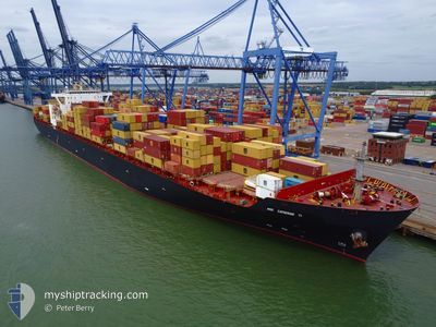
MSC CATHERINE VI
Container Ship
Current Trip
| Time Travelled | 4 days |
|---|---|
| Remaining Time | 1 day |
| Distance Travelled | 1653.21 nm |
| Remaining Distance | 610.69 nm |
| AVG Speed | 14.3 Knots |
| MAX Speed | 17.9 Knots |
| AVG Wind | 16.5 knots |
| MAX Wind | 21 knots |
| MIN Temp | 25.8°C / 78.44°F |
| MAX Temp | 28.2°C / 82.76°F |
| Dybgang | 12.3 m |
| Position Modtaget | 2 d siden |
Current Position
| Longitude | -60.82986° |
|---|---|
| Latitude | 11.88144° |
| Status | Under way using engine |
| Fart | 14.7 Knots |
| Kurs | 123.4° |
| Område | Caribbean Sea |
| Station | T-AIS |
| Position Modtaget | 2 d siden |
Info
Information
The current position of MSC CATHERINE VI is in Caribbean Sea with coordinates 11.88144° / -60.82986° as reported on 2025-01-30 13:15 by AIS to our vessel tracker app. The vessel's current speed is 14.7 Knots and is heading at the port of PECEM. The estimated time of arrival as calculated by MyShipTracking vessel tracking app is 2025-02-04 04:49 LT
The vessel MSC CATHERINE VI (IMO: 9229300, MMSI: 636017173) is a Container Ship that was built in 2001 ( 24 år gamle ). It's sailing under the flag of [LR] Liberia.
In this page you can find informations about the vessels current position, last detected port calls, and current voyage information. If the vessels is not in coverage by AIS you will find the latest position.
The current position of MSC CATHERINE VI is detected by our AIS receivers and we are not responsible for the reliability of the data. The last position was recorded while the vessel was in Coverage by the Ais receivers of our vessel tracking app.
The current draught of MSC CATHERINE VI as reported by AIS is 12.3 meters
Weather
| Temperature | 26.4°C / 79.52°F |
|---|---|
| Wind Speed | 14 knots |
| Direction | 66° ENE |
| Pressure | 1010.7 hPa |
| Humidity | 82 % |
| Cloud Coverage | 83 % |
Featured Company
Last Port Calls
| Port | Arrival | Departure | Time In Port |
|---|---|---|---|
| 2025-01-27 00:13 | 2025-01-28 16:06 | 1 d | |
| 2025-01-21 15:18 | 2025-01-23 06:03 | 1 d | |
| 2024-12-20 21:41 | 2024-12-21 12:53 | 15 h | |
| 2024-12-16 07:52 | 2024-12-16 16:52 | 8 h | |
| 2024-12-06 03:12 | 2024-12-06 23:16 | 20 h |
Most Visited Ports (Last year)
| Port | Arrivals | |
|---|---|---|
| 6 | ||
| 5 | ||
| 5 | ||
| 4 | ||
| 4 | ||
| 3 |
Last Trips
| Origin | Departure | Destination | Arrival | Distance | |
|---|---|---|---|---|---|
| 2025-01-23 01:03 | 2025-01-26 20:13 | 818.63 nm | |||
| 2024-12-21 21:53 | 2025-01-21 10:18 | 9442.12 nm | |||
| 2024-12-17 00:52 | 2024-12-21 06:41 | 549.90 nm | |||
| 2024-12-07 07:16 | 2024-12-16 15:52 | 1525.33 nm | |||
| 2024-11-30 09:32 | 2024-12-06 11:12 | 1617.66 nm |
Events
| Tid | Hændelsen | Detaljer | Position / Dest | Info |
|---|---|---|---|---|
| 2025-01-30 13:22 | Status er ændret | Default Under way using engine |
11.86476 / -60.80525
BRPEC
|
Fart: 14.7 kn Kurs: 123.4° |
| 2025-01-30 13:15 | Ændre havområde | Trinidad and Tobago part of the Caribbean Sea Grenadian part of the Caribbean Sea |
11.88144 / -60.82986
Caribbean Sea
BRPEC
|
Fart: 14.7 kn Kurs: 123.4° |
| 2025-01-30 13:15 | Status er ændret | Under way using engine Default |
11.88144 / -60.82986
BRPEC
|
Fart: 14.7 kn Kurs: 124° |
| 2025-01-30 13:15 | Udenfor Dækning |
11.88144 / -60.82986
Caribbean Sea
BRPEC
|
Fart: 14.7 kn Kurs: 123.4° |
|
| 2025-01-30 12:20 | Status er ændret | Default Under way using engine |
12.00457 / -61.03054
BRPEC
|
Fart: 14.6 kn Kurs: 120.2° |
| 2025-01-30 12:16 | Status er ændret | Under way using engine Default |
12.01355 / -61.04662
BRPEC
|
Fart: 13.8 kn Kurs: 121° |
| 2025-01-30 12:11 | Status er ændret | Default Under way using engine |
12.02386 / -61.06480
BRPEC
|
Fart: 12.6 kn Kurs: 120° |
| 2025-01-30 11:53 | Status er ændret | Under way using engine Default |
12.05689 / -61.11655
BRPEC
|
Fart: 12.5 kn Kurs: 126° |
| 2025-01-30 11:42 | Status er ændret | Default Under way using engine |
12.07911 / -61.14803
BRPEC
|
Fart: 12.6 kn Kurs: 125.1° |
| 2025-01-30 08:04 | Fundet i havområde | Grenadian part of the Caribbean Sea |
12.54253 / -61.75071
Caribbean Sea
BRPEC
|
Fart: 12.6 kn Kurs: 128.9° |