
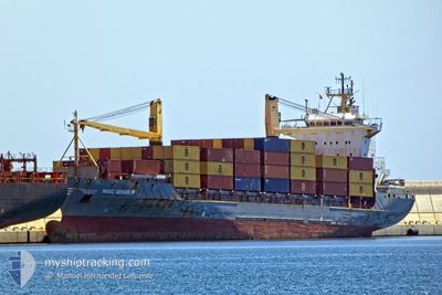
MSC IZMIR F
Container Ship
Current Trip
| Time Travelled | 7 h, 49 mins |
|---|---|
| Remaining Time | 35 mins |
| Distance Travelled | 112.26 nm |
| Remaining Distance | 11.36 nm |
| AVG Speed | 14.5 Knots |
| MAX Speed | 16.4 Knots |
| AVG Wind | 7.9 knots |
| MAX Wind | 11.8 knots |
| MIN Temp | 23.7°C / 74.66°F |
| MAX Temp | 24°C / 75.2°F |
| Dybgang | 6.1 m |
| Position Modtaget | 5 h, 10 m siden |
Current Position
| Longitude | -77.64915° |
|---|---|
| Latitude | 25.64465° |
| Status | Under way using engine |
| Fart | 13.8 Knots |
| Kurs | 333.9° |
| Område | North Atlantic Ocean |
| Station | T-AIS |
| Position Modtaget | 5 h, 10 m siden |
Info
Information
The current position of MSC IZMIR F is in North Atlantic Ocean with coordinates 25.64465° / -77.64915° as reported on 2025-03-14 19:51 by AIS to our vessel tracker app. The vessel's current speed is 13.8 Knots and is heading at the port of FREEPORT (BS). The estimated time of arrival as calculated by MyShipTracking vessel tracking app is 2025-03-14 21:37 LT
The vessel MSC IZMIR F (IMO: 9127021, MMSI: 636017878) is a Container Ship that was built in 1996 ( 29 år gamle ). It's sailing under the flag of [LR] Liberia.
In this page you can find informations about the vessels current position, last detected port calls, and current voyage information. If the vessels is not in coverage by AIS you will find the latest position.
The current position of MSC IZMIR F is detected by our AIS receivers and we are not responsible for the reliability of the data. The last position was recorded while the vessel was in Coverage by the Ais receivers of our vessel tracking app.
The current draught of MSC IZMIR F as reported by AIS is 6.1 meters
Weather
| Temperature | 23.8°C / 74.84°F |
|---|---|
| Wind Speed | 11 knots |
| Direction | 107° ESE |
| Pressure | 1015.1 hPa |
| Humidity | 69.2 % |
| Cloud Coverage | 24 % |
Featured Company
Last Port Calls
| Port | Arrival | Departure | Time In Port |
|---|---|---|---|
| 2025-03-13 04:35 | 2025-03-14 13:13 | 1 d | |
| 2025-03-11 14:23 | 2025-03-11 21:23 | 6 h | |
| 2025-03-10 02:54 | 2025-03-10 13:42 | 10 h | |
| 2025-03-10 02:33 | 2025-03-10 02:40 | 7 m | |
| 2025-03-07 05:19 | 2025-03-07 20:44 | 15 h | |
| 2025-03-04 10:09 | 2025-03-04 23:04 | 12 h | |
| 2025-03-03 15:35 | 2025-03-04 01:06 | 9 h | |
| 2025-03-02 13:27 | 2025-03-03 01:26 | 11 h | |
| 2025-02-28 22:49 | 2025-03-01 13:27 | 14 h | |
| 2025-02-27 04:41 | 2025-02-28 13:23 | 1 d |
Most Visited Ports (Last year)
| Port | Arrivals | |
|---|---|---|
| 74 | ||
| 61 | ||
| 60 | ||
| 45 | ||
| 2 | ||
| 1 |
Last Trips
| Origin | Departure | Destination | Arrival | Distance | |
|---|---|---|---|---|---|
| 2025-03-11 21:23 | 2025-03-13 04:35 | 156.15 nm | |||
| 2025-03-10 13:42 | 2025-03-11 14:23 | 180.43 nm | |||
| 2025-03-10 02:40 | 2025-03-10 02:54 | 0.85 nm | |||
| 2025-03-07 20:44 | 2025-03-10 02:33 | 128.47 nm | |||
| 2025-03-04 23:04 | 2025-03-07 05:19 | 242.34 nm | |||
| 2025-03-04 01:06 | 2025-03-04 10:09 | 121.28 nm | |||
| 2025-03-03 01:26 | 2025-03-03 15:35 | 102.05 nm | |||
| 2025-03-01 13:27 | 2025-03-02 13:27 | 89.78 nm | |||
| 2025-02-28 13:23 | 2025-02-28 22:49 | 120.28 nm | |||
| 2025-02-25 21:37 | 2025-02-27 04:41 | 155.01 nm |
Events
| Tid | Hændelsen | Detaljer | Position / Dest | Info |
|---|---|---|---|---|
| 2025-03-14 19:51 | Status er ændret | Default Under way using engine |
25.64517 / -77.64945
BSFPO
|
Fart: 13.8 kn Kurs: 333.9° |
| 2025-03-14 19:51 | Udenfor Dækning |
25.64465 / -77.64915
North Atlantic Ocean
|
Fart: 13.8 kn Kurs: 333.9° |
|
| 2025-03-14 19:47 | Status er ændret | Under way using engine Default |
25.63324 / -77.64296
BSFPO
|
Fart: 13.8 kn Kurs: 334° |
| 2025-03-14 19:47 | Indenfor Dækning |
25.63324 / -77.64296
North Atlantic Ocean
|
Fart: 13.7 kn Kurs: 333.6° |
|
| 2025-03-14 17:49 | Status er ændret | Default Under way using engine |
25.21223 / -77.41396
BSFPO
|
Fart: 13 kn Kurs: 334° |
| 2025-03-14 17:44 | Status er ændret | Under way using engine Default |
25.19396 / -77.40434
BSFPO
|
Fart: 13.6 kn Kurs: 334° |
| 2025-03-14 17:44 | Udenfor Dækning |
25.19396 / -77.40434
North Atlantic Ocean
|
Fart: 13 kn Kurs: 334° |
|
| 2025-03-14 17:40 | Status er ændret | Default Under way using engine |
25.17959 / -77.39680
BSFPO
|
Fart: 13 kn Kurs: 339° |
| 2025-03-14 17:13 | Afsejlet fra sidste havn |
|
25.08850 / -77.35540
BSFPO
|
Fart: 8 kn Kurs: 328° |
| 2025-03-14 17:10 | START Sejllads |
25.08423 / -77.35078
[BS] NASSAU
|
Fart: 5 kn Kurs: 312° |