
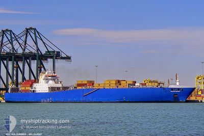
MSC MIA SUMMER II
Container Ship
Current Trip
MAAGA
| Time Travelled | 17 h, 20 mins |
|---|---|
| Remaining Time | --- |
| Distance Travelled | 172.58 nm |
| Remaining Distance | --- |
| AVG Speed | 10.2 Knots |
| MAX Speed | 11 Knots |
| AVG Wind | 5.9 knots |
| MAX Wind | 9 knots |
| MIN Temp | 13.6°C / 56.48°F |
| MAX Temp | 16.4°C / 61.52°F |
| Dybgang | 9.4 m |
| Position Modtaget | 6 d siden |
Current Position
| Longitude | -9.41441° |
|---|---|
| Latitude | 37.41018° |
| Status | Under way using engine |
| Fart | 10.6 Knots |
| Kurs | 227.7° |
| Område | North Atlantic Ocean |
| Station | T-AIS |
| Position Modtaget | 6 d siden |
Info
Information
The current position of MSC MIA SUMMER II is in North Atlantic Ocean with coordinates 37.41018° / -9.41441° as reported on 2025-02-01 12:40 by AIS to our vessel tracker app. The vessel's current speed is 10.6 Knots
The vessel MSC MIA SUMMER II (IMO: 9169067, MMSI: 636018326) is a Container Ship that was built in 1999 ( 26 år gamle ). It's sailing under the flag of [LR] Liberia.
In this page you can find informations about the vessels current position, last detected port calls, and current voyage information. If the vessels is not in coverage by AIS you will find the latest position.
The current position of MSC MIA SUMMER II is detected by our AIS receivers and we are not responsible for the reliability of the data. The last position was recorded while the vessel was in Coverage by the Ais receivers of our vessel tracking app.
The current draught of MSC MIA SUMMER II as reported by AIS is 9.4 meters
Weather
| Temperature | 16.1°C / 60.98°F |
|---|---|
| Wind Speed | 8 knots |
| Direction | 16° NNE |
| Pressure | 1025.1 hPa |
| Humidity | 63 % |
| Cloud Coverage | --- |
Featured Company
Last Port Calls
| Port | Arrival | Departure | Time In Port |
|---|---|---|---|
| 2025-02-05 21:29 | 2025-02-07 06:09 | 1 d | |
| 2025-01-31 18:03 | 2025-02-01 08:44 | 14 h | |
| 2025-01-25 05:21 | 2025-01-27 05:49 | 2 d | |
| 2025-01-23 05:37 | 2025-01-23 16:19 | 10 h | |
| 2025-01-21 17:42 | 2025-01-22 17:53 | 1 d | |
| 2025-01-20 04:31 | 2025-01-20 21:45 | 17 h | |
| 2025-01-18 04:15 | 2025-01-18 13:07 | 8 h | |
| 2025-01-14 15:10 | 2025-01-15 20:45 | 1 d | |
| 2025-01-07 23:14 | 2025-01-09 19:07 | 1 d | |
| 2025-01-04 08:21 | 2025-01-05 02:20 | 17 h |
Last Trips
| Origin | Departure | Destination | Arrival | Distance | |
|---|---|---|---|---|---|
| 2025-02-01 08:44 | 2025-02-05 22:29 | 498.36 nm | |||
| 2025-01-27 06:49 | 2025-01-31 18:03 | 343.40 nm | |||
| 2025-01-23 17:19 | 2025-01-25 06:21 | 376.39 nm | |||
| 2025-01-22 18:53 | 2025-01-23 06:37 | 120.39 nm | |||
| 2025-01-20 22:45 | 2025-01-21 18:42 | 248.97 nm | |||
| 2025-01-18 14:07 | 2025-01-20 05:31 | 477.56 nm | |||
| 2025-01-15 21:45 | 2025-01-18 05:15 | 278.44 nm | |||
| 2025-01-09 20:07 | 2025-01-14 16:10 | 1598.73 nm | |||
| 2025-01-05 02:20 | 2025-01-08 00:14 | 521.73 nm | |||
| 2025-01-02 18:52 | 2025-01-04 08:21 | 328.76 nm |
Events
| Tid | Hændelsen | Detaljer | Position / Dest | Info |
|---|---|---|---|---|
| 2025-02-07 06:09 | Afsejlet fra sidste havn |
|
30.41118 / -9.63392
MAAGA
|
Fart: 4.4 kn Kurs: 142° |
| 2025-02-07 05:59 | START Sejllads |
30.42187 / -9.64184
[MA] AGADIR
|
Fart: 4.1 kn Kurs: 143° |
|
| 2025-02-05 21:59 | STOP Sejllads |
30.42726 / -9.64285
[MA] AGADIR
|
Fart: Kurs: 323° |
|
| 2025-02-05 21:29 | Skibe i havn |
|
30.42250 / -9.64097
[MA] AGADIR
|
Fart: 4.3 kn Kurs: 45° |
| 2025-02-05 20:41 | START Sejllads | 2.96 nm, West of AGADIR |
30.40864 / -9.69014
MAAGA
|
Fart: 3.5 kn Kurs: 135° |
| 2025-02-03 07:22 | STOP Sejllads | 3.29 nm, West of AGADIR |
30.41920 / -9.69742
MAAGA
|
Fart: 0.3 kn Kurs: 44° |
| 2025-02-01 12:47 | Status er ændret | Default Under way using engine |
37.39622 / -9.43357
MAAGA
|
Fart: 10.6 kn Kurs: 227.7° |
| 2025-02-01 12:40 | Status er ændret | Under way using engine Default |
37.41018 / -9.41441
MAAGA
|
Fart: 10.6 kn Kurs: 227° |
| 2025-02-01 12:40 | Udenfor Dækning |
37.41018 / -9.41441
North Atlantic Ocean
MAAGA
|
Fart: 10.6 kn Kurs: 227.7° |
|
| 2025-02-01 12:11 | Status er ændret | Default Under way using engine |
37.47063 / -9.33785
MAAGA
|
Fart: 10.7 kn Kurs: 224.1° |