
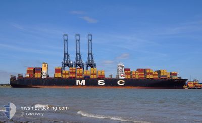
MSC RUBY
Container Ship
Current Trip
| Time Travelled | 9 days |
|---|---|
| Remaining Time | --- |
| Distance Travelled | 1551.15 nm |
| Remaining Distance | --- |
| AVG Speed | 13.3 Knots |
| MAX Speed | 19.9 Knots |
| AVG Wind | 4.6 knots |
| MAX Wind | 8.8 knots |
| MIN Temp | 25.7°C / 78.26°F |
| MAX Temp | 28.5°C / 83.3°F |
| Dybgang | 15.9 m |
| Position Modtaget | 5 d siden |
Current Position
| Longitude | 78.64202° |
|---|---|
| Latitude | 6.37755° |
| Status | Under way using engine |
| Fart | 18.2 Knots |
| Kurs | 302.9° |
| Område | Laccadive Sea |
| Station | T-AIS |
| Position Modtaget | 5 d siden |
Info
Information
The current position of MSC RUBY is in Laccadive Sea with coordinates 6.37755° / 78.64202° as reported on 2026-02-28 21:23 by AIS to our vessel tracker app. The vessel's current speed is 18.2 Knots
The vessel MSC RUBY (IMO: 9502960, MMSI: 636024999) is a Container Ship that was built in 2013 ( 13 år gamle ). It's sailing under the flag of [LR] Liberia.
In this page you can find informations about the vessels current position, last detected port calls, and current voyage information. If the vessels is not in coverage by AIS you will find the latest position.
The current position of MSC RUBY is detected by our AIS receivers and we are not responsible for the reliability of the data. The last position was recorded while the vessel was in Coverage by the Ais receivers of our vessel tracking app.
The current draught of MSC RUBY as reported by AIS is 15.9 meters
Weather
| Temperature | 26.6°C / 79.88°F |
|---|---|
| Wind Speed | 1 knots |
| Direction | 326° NW |
| Pressure | 1007.4 hPa |
| Humidity | 71.7 % |
| Cloud Coverage | --- |
Featured Company
Last Port Calls
| Port | Arrival | Departure | Time In Port |
|---|---|---|---|
| 2026-02-24 06:34 | 2026-02-25 00:37 | 18 h | |
| 2026-02-15 10:25 | 2026-02-16 03:20 | 16 h | |
| 2026-01-06 07:01 | 2026-01-08 01:30 | 1 d | |
| 2026-01-06 06:08 | 2026-01-06 06:31 | 22 m |
Most Visited Ports (Last year)
| Port | Arrivals | |
|---|---|---|
| 4 | ||
| 3 | ||
| 2 | ||
| 2 | ||
| 1 | ||
| 1 |
Last Trips
| Origin | Departure | Destination | Arrival | Distance | |
|---|---|---|---|---|---|
| 2026-02-16 11:20 | 2026-02-24 14:34 | 1498.53 nm | |||
| 2026-01-07 17:30 | 2026-02-15 18:25 | 5345.47 nm | |||
| 2026-01-05 22:31 | 2026-01-05 23:01 | 0.88 nm | |||
| 2025-12-31 09:38 | 2026-01-05 22:08 | 697.68 nm |
Events
| Tid | Hændelsen | Detaljer | Position / Dest | Info |
|---|---|---|---|---|
| 2026-02-28 21:23 | Udenfor Dækning |
6.37755 / 78.64202
Laccadive Sea
JEBEL ALI
|
Fart: 18.2 kn Kurs: 302.9° |
|
| 2026-02-28 16:56 | Fundet i havområde | Sri Lankan part of the Laccadive Sea |
5.68438 / 79.80263
Laccadive Sea
JEBEL ALI
|
Fart: 18.4 kn Kurs: 297.8° |
| 2026-02-28 16:56 | Indenfor Dækning |
5.68438 / 79.80263
Laccadive Sea
JEBEL ALI
|
Fart: 18.4 kn Kurs: 297.8° |
|
| 2026-02-28 15:24 | Udenfor Dækning |
5.53292 / 80.24726
Indian Ocean
JEBEL ALI
|
Fart: 19.3 kn Kurs: 264.5° |
|
| 2026-02-28 14:27 | Indenfor Dækning |
5.54943 / 80.56453
Indian Ocean
JEBEL ALI
|
Fart: 19.5 kn Kurs: 266.5° |
|
| 2026-02-28 13:26 | Udenfor Dækning |
5.59107 / 80.89318
Indian Ocean
JEBEL ALI
|
Fart: 20 kn Kurs: 260.4° |
|
| 2026-02-28 11:17 | Fundet i havområde | Sri Lankan part of the Indian Ocean |
5.57899 / 81.59377
Indian Ocean
JEBEL ALI
|
Fart: 18.9 kn Kurs: 268.2° |
| 2026-02-28 11:17 | Indenfor Dækning |
5.57899 / 81.59377
Indian Ocean
JEBEL ALI
|
Fart: 18.9 kn Kurs: 268.2° |
|
| 2026-02-25 10:35 | Udenfor Dækning |
2.43228 / 101.66652
Malacca Strait
JEBEL ALI
|
Fart: 15.6 kn Kurs: 299.4° |
|
| 2026-02-25 04:13 | Fundet i havområde | Malaysian part of the Malacca Strait |
1.49420 / 103.06158
Malacca Strait
JEBEL ALI
|
Fart: 15.9 kn Kurs: 306.7° |