
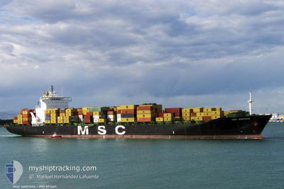
MSC SANTHYA
Container Ship
Current Trip
| Time Travelled | 2 days |
|---|---|
| Remaining Time | --- |
| Distance Travelled | 1121.17 nm |
| Remaining Distance | --- |
| AVG Speed | 15.8 Knots |
| MAX Speed | 20.6 Knots |
| AVG Wind | 13.4 knots |
| MAX Wind | 23.4 knots |
| MIN Temp | 12.4°C / 54.32°F |
| MAX Temp | 21.5°C / 70.7°F |
| Dybgang | 9.7 m |
| Position Modtaget | 17 h, 27 m siden |
Current Position
| Longitude | 17.86411° |
|---|---|
| Latitude | -33.94788° |
| Status | Under way using engine |
| Fart | 18.2 Knots |
| Kurs | 323.2° |
| Område | South Atlantic Ocean |
| Station | T-AIS |
| Position Modtaget | 17 h, 27 m siden |
Information
The current position of MSC SANTHYA is in South Atlantic Ocean with coordinates -33.94788° / 17.86411° as reported on 2025-06-03 20:53 by AIS to our vessel tracker app. The vessel's current speed is 18.2 Knots and is heading at the port of LONDON. The estimated time of arrival as calculated by MyShipTracking vessel tracking app is 2025-06-18 23:59 LT
The vessel MSC SANTHYA (IMO: 8913411, MMSI: 355363000) is a Container Ship that was built in 1991 ( 34 år gamle ). It's sailing under the flag of [PA] Panama.
In this page you can find informations about the vessels current position, last detected port calls, and current voyage information. If the vessels is not in coverage by AIS you will find the latest position.
The current position of MSC SANTHYA is detected by our AIS receivers and we are not responsible for the reliability of the data. The last position was recorded while the vessel was in Coverage by the Ais receivers of our vessel tracking app.
The current draught of MSC SANTHYA as reported by AIS is 9.7 meters
Weather
| Temperature | 16.4°C / 61.52°F |
|---|---|
| Wind Speed | 21 knots |
| Direction | 148° SSE |
| Pressure | 1019.4 hPa |
| Humidity | 69.4 % |
| Cloud Coverage | --- |
Featured Company
Last Port Calls
| Port | Arrival | Departure | Time In Port |
|---|---|---|---|
| 2025-05-31 03:34 | 2025-06-01 20:47 | 1 d | |
| 2025-05-26 21:37 | 2025-05-28 09:21 | 1 d | |
| 2025-05-13 17:21 | 2025-05-15 08:20 | 1 d | |
| 2025-05-09 04:38 | 2025-05-10 08:50 | 1 d | |
| 2025-05-03 22:58 | 2025-05-05 14:44 | 1 d | |
| 2025-04-27 11:28 | 2025-04-28 02:52 | 15 h | |
| 2025-04-23 07:21 | 2025-04-23 20:52 | 13 h | |
| 2025-04-17 13:41 | 2025-04-18 03:29 | 13 h | |
| 2025-04-15 16:35 | 2025-04-16 12:58 | 20 h | |
| 2025-04-10 02:42 | 2025-04-10 14:24 | 11 h |
Most Visited Ports (Last year)
| Port | Arrivals | |
|---|---|---|
| 9 | ||
| 9 | ||
| 8 | ||
| 7 | ||
| 5 | ||
| 4 |
Last Trips
| Origin | Departure | Destination | Arrival | Distance | |
|---|---|---|---|---|---|
| 2025-05-28 09:21 | 2025-05-31 03:34 | 519.00 nm | |||
| 2025-05-15 08:20 | 2025-05-26 21:37 | 2642.84 nm | |||
| 2025-05-10 08:50 | 2025-05-13 17:21 | 1199.46 nm | |||
| 2025-05-05 14:44 | 2025-05-09 04:38 | 1155.88 nm | |||
| 2025-04-28 02:52 | 2025-05-03 22:58 | 651.41 nm | |||
| 2025-04-23 20:52 | 2025-04-27 11:28 | 881.50 nm | |||
| 2025-04-18 03:29 | 2025-04-23 07:21 | 1729.43 nm | |||
| 2025-04-16 12:58 | 2025-04-17 13:41 | 273.48 nm | |||
| 2025-04-10 14:24 | 2025-04-15 16:35 | 148.83 nm | |||
| 2025-04-07 09:43 | 2025-04-10 02:42 | 123.81 nm |
Events
| Tid | Hændelsen | Detaljer | Position / Dest | Info |
|---|---|---|---|---|
| 2025-06-03 21:01 | Status er ændret | Default Under way using engine |
-33.91856 / 17.83682
LONDON
|
Fart: 18.2 kn Kurs: 323.2° |
| 2025-06-03 20:53 | Udenfor Dækning |
-33.94788 / 17.86411
South Atlantic Ocean
LONDON
|
Fart: 18.2 kn Kurs: 323.2° |
|
| 2025-06-03 18:38 | Status er ændret | Under way using engine Default |
-34.48862 / 18.39653
LONDON
|
Fart: 16.6 kn Kurs: 276° |
| 2025-06-03 18:12 | Status er ændret | Default Under way using engine |
-34.52078 / 18.53503
LONDON
|
Fart: 17.1 kn Kurs: 293.9° |
| 2025-06-03 18:05 | Destination er ændret | LONDON SAN PEDRO |
-34.53378 / 18.57059
LONDON
|
Fart: 17.2 kn Kurs: 295° |
| 2025-06-03 18:05 | ETA er ændret | 2025/06/18 22:59 2025/06/10 23:00 |
-34.53378 / 18.57059
LONDON
|
Fart: 17.2 kn Kurs: 295° |
| 2025-06-03 17:34 | Ændre havområde | South African part of the South Atlantic Ocean South African part of the Indian Ocean |
-34.59219 / 18.73503
South Atlantic Ocean
SAN PEDRO
|
Fart: 16.6 kn Kurs: 290.2° |
| 2025-06-03 17:33 | Status er ændret | Under way using engine Default |
-34.59356 / 18.73933
SAN PEDRO
|
Fart: 16.7 kn Kurs: 292° |
| 2025-06-03 17:33 | Indenfor Dækning |
-34.59219 / 18.73503
South Atlantic Ocean
SAN PEDRO
|
Fart: 16.6 kn Kurs: 290.2° |
|
| 2025-06-01 20:26 | Udenfor Dækning |
-30.03675 / 31.11784
Indian Ocean
SAN PEDRO
|
Fart: 10.8 kn Kurs: 210.9° |