

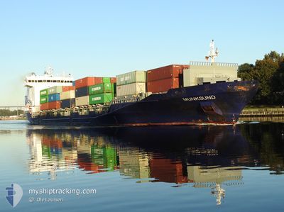
MUNKSUND
Container Ship

Current Trip
| Time Travelled | 7 h, 20 mins |
|---|---|
| Remaining Time | 7 h, 3 mins |
| Distance Travelled | 75.83 nm |
| Remaining Distance | 47.24 nm |
| AVG Speed | 10.4 Knots |
| MAX Speed | 16.8 Knots |
| AVG Wind | 8.4 knots |
| MAX Wind | 14.9 knots |
| MIN Temp | 8.9°C / 48.02°F |
| MAX Temp | 16.5°C / 61.7°F |
| Dybgang | 8.5 m |
| Position Modtaget | 1 m siden |
Current Position
| Longitude | 9.22436° |
|---|---|
| Latitude | 53.94201° |
| Status | Under way using engine |
| Fart | 0.2 Knots |
| Kurs | 38° |
| Område | North Sea |
| Station | T-AIS |
| Position Modtaget | 1 m siden |
Information
The current position of MUNKSUND is in North Sea with coordinates 53.94201° / 9.22436° as reported on 2025-06-02 22:33 by AIS to our vessel tracker app. The vessel's current speed is 0.2 Knots and is heading at the port of KIEL. The estimated time of arrival as calculated by MyShipTracking vessel tracking app is 2025-06-03 07:37 LT
The vessel MUNKSUND (IMO: 9429223, MMSI: 636020532) is a Container Ship that was built in 2012 ( 13 år gamle ). It's sailing under the flag of [LR] Liberia.
In this page you can find informations about the vessels current position, last detected port calls, and current voyage information. If the vessels is not in coverage by AIS you will find the latest position.
The current position of MUNKSUND is detected by our AIS receivers and we are not responsible for the reliability of the data. The last position was recorded while the vessel was in Coverage by the Ais receivers of our vessel tracking app.
The current draught of MUNKSUND as reported by AIS is 8.5 meters
Weather
| Temperature | 8.9°C / 48.02°F |
|---|---|
| Wind Speed | 3 knots |
| Direction | 321° NW |
| Pressure | 1015.4 hPa |
| Humidity | 95.2 % |
| Cloud Coverage | 5 % |


Featured Company
Last Port Calls
| Port | Arrival | Departure | Time In Port |
|---|---|---|---|
| 2025-06-01 09:47 | 2025-06-02 17:14 | 1 d | |
| 2025-05-31 18:41 | 2025-05-31 20:03 | 1 h | |
| 2025-05-28 19:58 | 2025-05-29 22:24 | 1 d | |
| 2025-05-27 02:26 | 2025-05-27 10:27 | 8 h | |
| 2025-05-22 05:26 | 2025-05-23 11:45 | 1 d | |
| 2025-05-19 01:44 | 2025-05-20 05:57 | 1 d | |
| 2025-05-18 09:37 | 2025-05-18 10:41 | 1 h | |
| 2025-05-15 17:09 | 2025-05-17 09:25 | 1 d | |
| 2025-05-12 18:36 | 2025-05-13 22:27 | 1 d | |
| 2025-05-09 12:23 | 2025-05-10 06:25 | 18 h |
Most Visited Ports (Last year)
| Port | Arrivals | |
|---|---|---|
| 26 | ||
| 23 | ||
| 19 | ||
| 17 | ||
| 14 | ||
| 9 |
Last Trips
| Origin | Departure | Destination | Arrival | Distance | |
|---|---|---|---|---|---|
| 2025-05-31 20:03 | 2025-06-01 09:47 | 76.26 nm | |||
| 2025-05-29 22:24 | 2025-05-31 18:41 | 415.13 nm | |||
| 2025-05-27 10:27 | 2025-05-28 19:58 | 414.96 nm | |||
| 2025-05-23 11:45 | 2025-05-27 02:26 | 453.64 nm | |||
| 2025-05-20 05:57 | 2025-05-22 05:26 | 485.52 nm | |||
| 2025-05-18 10:41 | 2025-05-19 01:44 | 126.91 nm | |||
| 2025-05-17 09:25 | 2025-05-18 09:37 | 361.77 nm | |||
| 2025-05-13 22:27 | 2025-05-15 17:09 | 418.18 nm | |||
| 2025-05-10 06:25 | 2025-05-12 18:36 | 418.43 nm | |||
| 2025-05-07 20:45 | 2025-05-09 12:23 | 486.47 nm |
Events
| Tid | Hændelsen | Detaljer | Position / Dest | Info |
|---|---|---|---|---|
| 2025-06-02 22:32 | STOP Sejllads | 1.87 nm, North East of OSTERMOOR |
53.94206 / 9.22438
DENOK
|
Fart: 0.2 kn Kurs: 37° |
| 2025-06-02 21:49 | START Sejllads | 0.68 nm, South West of BRUNSBUETTEL |
53.89468 / 9.14709
DENOK
|
Fart: 3.3 kn Kurs: 48° |
| 2025-06-02 21:41 | Status er ændret | Under way using engine Moored |
53.89316 / 9.14404
DENOK
|
Fart: Kurs: 47° |
| 2025-06-02 21:22 | Status er ændret | Moored Under way using engine |
53.89315 / 9.14404
DENOK
|
Fart: Kurs: 47° |
| 2025-06-02 21:21 | STOP Sejllads | 0.82 nm, South West of BRUNSBUETTEL |
53.89315 / 9.14405
DENOK
|
Fart: 0.1 kn Kurs: 47° |
| 2025-06-02 18:37 | Status er ændret | Under way using engine Default |
53.97495 / 8.47460
DENOK
|
Fart: 13.2 kn Kurs: 100° |
| 2025-06-02 18:23 | Status er ændret | Default Under way using engine |
53.98460 / 8.38519
DENOK
|
Fart: 13.6 kn Kurs: 100.4° |
| 2025-06-02 18:02 | Status er ændret | Under way using engine Default |
53.99233 / 8.25311
DENOK
|
Fart: 10.5 kn Kurs: 90° |
| 2025-06-02 17:58 | Status er ændret | Default Under way using engine |
53.99227 / 8.23599
DENOK
|
Fart: 10.3 kn Kurs: 84.8° |
| 2025-06-02 17:52 | Status er ændret | Under way using engine Default |
53.99224 / 8.20513
DENOK
|
Fart: 14.2 kn Kurs: 84° |