
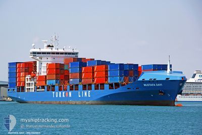
MUSTAFA DAYI
Container Ship
Current Trip
| Time Travelled | 2 days |
|---|---|
| Remaining Time | 2 days |
| Distance Travelled | 861.07 nm |
| Remaining Distance | 785.63 nm |
| AVG Speed | 14 Knots |
| MAX Speed | 16.3 Knots |
| AVG Wind | 20.7 knots |
| MAX Wind | 28.2 knots |
| MIN Temp | 6°C / 42.8°F |
| MAX Temp | 15.3°C / 59.54°F |
| Dybgang | 11.3 m |
| Position Modtaget | 12 h, 23 m siden |
Current Position
| Longitude | 13.89933° |
|---|---|
| Latitude | 36.79499° |
| Status | Under way using engine |
| Fart | 13.7 Knots |
| Kurs | 287.8° |
| Område | Mediterranean Sea - Eastern Basin |
| Station | T-AIS |
| Position Modtaget | 12 h, 23 m siden |
Info
Information
The current position of MUSTAFA DAYI is in Mediterranean Sea - Eastern Basin with coordinates 36.79499° / 13.89933° as reported on 2025-02-07 15:01 by AIS to our vessel tracker app. The vessel's current speed is 13.7 Knots and is heading at the port of ALGECIRAS. The estimated time of arrival as calculated by MyShipTracking vessel tracking app is 2025-02-10 13:18 LT
The vessel MUSTAFA DAYI (IMO: 9365855, MMSI: 271042433) is a Container Ship that was built in 2011 ( 14 år gamle ). It's sailing under the flag of [TR] Turkey.
In this page you can find informations about the vessels current position, last detected port calls, and current voyage information. If the vessels is not in coverage by AIS you will find the latest position.
The current position of MUSTAFA DAYI is detected by our AIS receivers and we are not responsible for the reliability of the data. The last position was recorded while the vessel was in Coverage by the Ais receivers of our vessel tracking app.
The current draught of MUSTAFA DAYI as reported by AIS is 11.3 meters
Weather
| Temperature | 12.9°C / 55.22°F |
|---|---|
| Wind Speed | 5 knots |
| Direction | 321° NW |
| Pressure | 1021 hPa |
| Humidity | 83.2 % |
| Cloud Coverage | 100 % |
Featured Company
Last Port Calls
| Port | Arrival | Departure | Time In Port |
|---|---|---|---|
| 2025-02-05 00:42 | 2025-02-05 14:36 | 13 h | |
| 2025-02-02 18:16 | 2025-02-03 16:14 | 21 h | |
| 2025-02-02 03:12 | 2025-02-02 11:01 | 7 h | |
| 2025-02-01 00:59 | 2025-02-01 23:36 | 22 h | |
| 2025-01-27 10:04 | 2025-01-28 14:39 | 1 d | |
| 2025-01-09 04:10 | 2025-01-10 01:07 | 20 h | |
| 2025-01-06 15:12 | 2025-01-07 05:10 | 13 h | |
| 2025-01-03 03:35 | 2025-01-04 04:43 | 1 d | |
| 2024-12-24 10:09 | 2024-12-24 16:17 | 6 h | |
| 2024-12-18 18:41 | 2024-12-19 13:39 | 18 h |
Last Trips
| Origin | Departure | Destination | Arrival | Distance | |
|---|---|---|---|---|---|
| 2025-02-03 16:14 | 2025-02-05 00:42 | 338.19 nm | |||
| 2025-02-02 11:01 | 2025-02-02 18:16 | 73.15 nm | |||
| 2025-02-01 23:36 | 2025-02-02 03:12 | 45.92 nm | |||
| 2025-01-28 14:39 | 2025-02-01 00:59 | 808.70 nm | |||
| 2025-01-10 01:07 | 2025-01-27 10:04 | 6232.14 nm | |||
| 2025-01-07 05:10 | 2025-01-09 04:10 | 531.27 nm | |||
| 2025-01-04 04:43 | 2025-01-06 15:12 | 301.75 nm | |||
| 2024-12-24 16:17 | 2025-01-03 03:35 | 3291.99 nm | |||
| 2024-12-19 13:39 | 2024-12-24 10:09 | 1686.71 nm | |||
| 2024-12-17 19:34 | 2024-12-18 18:41 | 287.54 nm |
Events
| Tid | Hændelsen | Detaljer | Position / Dest | Info |
|---|---|---|---|---|
| 2025-02-07 15:04 | Status er ændret | Default Under way using engine |
36.79845 / 13.88594
ESALG
|
Fart: 13.7 kn Kurs: 287.8° |
| 2025-02-07 15:01 | Udenfor Dækning |
36.79499 / 13.89933
Mediterranean Sea - Eastern Basin
ESALG
|
Fart: 13.7 kn Kurs: 287.8° |
|
| 2025-02-07 14:29 | ETA er ændret | 2025/02/10 13:00 2025/02/10 02:00 |
36.75843 / 14.04225
ESALG
|
Fart: 13.7 kn Kurs: 287.8° |
| 2025-02-07 14:28 | Status er ændret | Under way using engine Default |
36.75696 / 14.04811
ESALG
|
Fart: 13.3 kn Kurs: 287° |
| 2025-02-07 13:58 | Status er ændret | Default Under way using engine |
36.72306 / 14.18210
ESALG
|
Fart: 13.2 kn Kurs: 287° |
| 2025-02-07 13:49 | Status er ændret | Under way using engine Default |
36.71345 / 14.22148
ESALG
|
Fart: 13.2 kn Kurs: 287° |
| 2025-02-07 13:27 | Status er ændret | Default Under way using engine |
36.69179 / 14.31428
ESALG
|
Fart: 13.3 kn Kurs: 287.4° |
| 2025-02-07 11:49 | Fundet i havområde | Italian part of the Mediterranean Sea - Eastern Basin |
36.58453 / 14.74220
Mediterranean Sea - Eastern Basin
ESALG
|
Fart: 12.9 kn Kurs: 286.2° |
| 2025-02-07 11:49 | Status er ændret | Under way using engine Default |
36.58453 / 14.74220
ESALG
|
Fart: 12.8 kn Kurs: 286° |
| 2025-02-07 11:49 | Indenfor Dækning |
36.58453 / 14.74220
Mediterranean Sea - Eastern Basin
ESALG
|
Fart: 12.9 kn Kurs: 286.2° |