

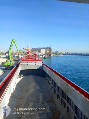
MV KAPTAN CEVDET
General Cargo

Current Trip
TR MAL
| Time Travelled | 12 h, 40 mins |
|---|---|
| Remaining Time | --- |
| Distance Travelled | 86.21 nm |
| Remaining Distance | --- |
| AVG Speed | 8.8 Knots |
| MAX Speed | 9.3 Knots |
| AVG Wind | 14.6 knots |
| MAX Wind | 19 knots |
| MIN Temp | 21.1°C / 69.98°F |
| MAX Temp | 28.1°C / 82.58°F |
| Dybgang | 0 m |
| Position Modtaget | 2 h, 10 m siden |
Current Position
| Longitude | 27.33683° |
|---|---|
| Latitude | 40.39922° |
| Status | Under way using engine |
| Fart | |
| Kurs | --- |
| Område | Sea of Marmara |
| Station | T-AIS |
| Position Modtaget | 2 h, 10 m siden |
Information
The current position of MV KAPTAN CEVDET is in Sea of Marmara with coordinates 40.39922° / 27.33683° as reported on 2025-06-12 21:48 by AIS to our vessel tracker app. The vessel's current speed is 0 Knots
The vessel MV KAPTAN CEVDET (IMO: 9005895, MMSI: 271002103) is a General Cargo that was built in 1992 ( 33 år gamle ). It's sailing under the flag of [TR] Turkey.
In this page you can find informations about the vessels current position, last detected port calls, and current voyage information. If the vessels is not in coverage by AIS you will find the latest position.
The current position of MV KAPTAN CEVDET is detected by our AIS receivers and we are not responsible for the reliability of the data. The last position was recorded while the vessel was in Coverage by the Ais receivers of our vessel tracking app.
Weather
| Temperature | 21°C / 69.8°F |
|---|---|
| Wind Speed | 14 knots |
| Direction | 58° ENE |
| Pressure | 1016.5 hPa |
| Humidity | 81.3 % |
| Cloud Coverage | --- |


Featured Company
Last Port Calls
| Port | Arrival | Departure | Time In Port |
|---|---|---|---|
| 2025-06-11 09:16 | 2025-06-12 14:19 | 1 d | |
| 2025-06-10 07:10 | 2025-06-10 22:05 | 14 h | |
| 2025-06-03 10:05 | 2025-06-03 21:22 | 11 h | |
| 2025-06-01 10:59 | 2025-06-03 03:09 | 1 d | |
| 2025-05-31 08:12 | 2025-06-01 01:12 | 16 h | |
| 2025-05-27 13:19 | 2025-05-28 17:28 | 1 d | |
| 2025-05-26 10:58 | 2025-05-27 03:23 | 16 h | |
| 2025-05-24 11:08 | 2025-05-25 13:39 | 1 d | |
| 2025-05-22 08:07 | 2025-05-23 05:38 | 21 h | |
| 2025-05-21 01:43 | 2025-05-21 21:10 | 19 h |
Last Trips
| Origin | Departure | Destination | Arrival | Distance | |
|---|---|---|---|---|---|
| 2025-06-10 22:05 | 2025-06-11 09:16 | 17.45 nm | |||
| 2025-06-03 21:22 | 2025-06-10 07:10 | 90.09 nm | |||
| 2025-06-03 03:09 | 2025-06-03 10:05 | 69.61 nm | |||
| 2025-06-01 01:12 | 2025-06-01 10:59 | 69.52 nm | |||
| 2025-05-28 17:28 | 2025-05-31 08:12 | 81.53 nm | |||
| 2025-05-27 03:23 | 2025-05-27 13:19 | 79.97 nm | |||
| 2025-05-25 13:39 | 2025-05-26 10:58 | 69.46 nm | |||
| 2025-05-23 05:38 | 2025-05-24 11:08 | 58.75 nm | |||
| 2025-05-21 21:10 | 2025-05-22 08:07 | 8.21 nm | |||
| 2025-05-20 14:45 | 2025-05-21 01:43 | 84.06 nm |
Events
| Tid | Hændelsen | Detaljer | Position / Dest | Info |
|---|---|---|---|---|
| 2025-06-12 21:55 | Status er ændret | Default Under way using engine |
40.39912 / 27.33690
TR MAL
|
Fart: Kurs: 511° |
| 2025-06-12 21:48 | Status er ændret | Under way using engine Default |
40.39922 / 27.33683
TR MAL
|
Fart: 0.3 kn Kurs: -1° |
| 2025-06-12 21:48 | Udenfor Dækning |
40.39922 / 27.33683
Sea of Marmara
|
Fart: Kurs: 150.7° |
|
| 2025-06-12 21:36 | STOP Sejllads | 1.26 nm, East of KARABIGA |
40.39995 / 27.33708
TR MAL
|
Fart: 0.3 kn Kurs: -1° |
| 2025-06-12 21:36 | Indenfor Dækning |
40.39922 / 27.33683
Sea of Marmara
|
Fart: Kurs: 150.7° |
|
| 2025-06-12 20:07 | Status er ændret | Default Under way using engine |
40.47184 / 27.53762
TR MAL
|
Fart: 8.5 kn Kurs: 211.8° |
| 2025-06-12 20:04 | Udenfor Dækning |
40.47675 / 27.54586
Sea of Marmara
|
Fart: 8.5 kn Kurs: 211.8° |
|
| 2025-06-12 17:10 | Status er ændret | Under way using engine Default |
40.64739 / 28.03537
TR MAL
|
Fart: 9.3 kn Kurs: 255° |
| 2025-06-12 17:06 | Status er ændret | Default Under way using engine |
40.65058 / 28.04893
TR MAL
|
Fart: 9.3 kn Kurs: 253° |
| 2025-06-12 17:01 | Status er ændret | Under way using engine Default |
40.65447 / 28.06591
TR MAL
|
Fart: 9.3 kn Kurs: 254° |