
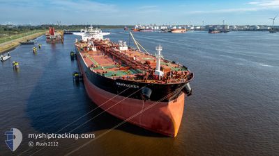
NANTUCKET
Tanker
Current Trip
| Time Travelled | --- |
|---|---|
| Remaining Time | 5 days |
| Distance Travelled | 5555.01 nm |
| Remaining Distance | 1599.67 nm |
| AVG Speed | 10 Knots |
| MAX Speed | 14.8 Knots |
| AVG Wind | 8.2 knots |
| MAX Wind | 23.8 knots |
| MIN Temp | 24.8°C / 76.64°F |
| MAX Temp | 30.8°C / 87.44°F |
| Dybgang | 16.2 m |
| Position Modtaget | 5 h, 40 m siden |
Current Position
| Longitude | -2.47577° |
|---|---|
| Latitude | 36.33663° |
| Status | Under way using engine |
| Fart | 12.9 Knots |
| Kurs | 87.5° |
| Område | Alboran Sea |
| Station | T-AIS |
| Position Modtaget | 5 h, 40 m siden |
Info
Information
The current position of NANTUCKET is in Alboran Sea with coordinates 36.33663° / -2.47577° as reported on 2025-02-26 08:01 by AIS to our vessel tracker app. The vessel's current speed is 12.9 Knots and is heading at the port of TRIESTE. The estimated time of arrival as calculated by MyShipTracking vessel tracking app is 2025-03-03 19:07 LT
The vessel NANTUCKET (IMO: 9600865, MMSI: 636021793) is a Tanker It's sailing under the flag of [LR] Liberia.
In this page you can find informations about the vessels current position, last detected port calls, and current voyage information. If the vessels is not in coverage by AIS you will find the latest position.
The current position of NANTUCKET is detected by our AIS receivers and we are not responsible for the reliability of the data. The last position was recorded while the vessel was in Coverage by the Ais receivers of our vessel tracking app.
The current draught of NANTUCKET as reported by AIS is 16.2 meters
Weather
| Temperature | 15.1°C / 59.18°F |
|---|---|
| Wind Speed | 5 knots |
| Direction | 110° ESE |
| Pressure | 1025.8 hPa |
| Humidity | 71.9 % |
| Cloud Coverage | 5 % |
Featured Company
Last Port Calls
Last Trips
| Origin | Departure | Destination | Arrival | Distance |
|---|
Events
| Tid | Hændelsen | Detaljer | Position / Dest | Info |
|---|---|---|---|---|
| 2025-02-26 08:07 | Status er ændret | Default Under way using engine |
36.33756 / -2.44974
ITTRS
|
Fart: 12.9 kn Kurs: 87.5° |
| 2025-02-26 08:01 | Udenfor Dækning |
36.33663 / -2.47577
Alboran Sea
ITTRS
|
Fart: 12.9 kn Kurs: 87.5° |
|
| 2025-02-26 07:59 | Status er ændret | Under way using engine Default |
36.33617 / -2.48758
ITTRS
|
Fart: 12.2 kn Kurs: 89° |
| 2025-02-26 07:16 | Status er ændret | Default Under way using engine |
36.32933 / -2.66957
ITTRS
|
Fart: 11.9 kn Kurs: 83.1° |
| 2025-02-26 07:09 | Status er ændret | Under way using engine Default |
36.32679 / -2.69788
ITTRS
|
Fart: 11.8 kn Kurs: 82° |
| 2025-02-26 06:46 | Status er ændret | Default Under way using engine |
36.31485 / -2.79164
ITTRS
|
Fart: 11.9 kn Kurs: 77.7° |
| 2025-02-26 06:37 | Status er ændret | Under way using engine Default |
36.30849 / -2.82998
ITTRS
|
Fart: 11.7 kn Kurs: 85° |
| 2025-02-26 06:11 | Status er ændret | Default Under way using engine |
36.29413 / -2.93491
ITTRS
|
Fart: 11.7 kn Kurs: 85.1° |
| 2025-02-26 05:25 | Status er ændret | Under way using engine Default |
36.28083 / -3.11777
ITTRS
|
Fart: 11.7 kn Kurs: 84° |
| 2025-02-26 05:25 | Indenfor Dækning |
36.28083 / -3.11777
Alboran Sea
ITTRS
|
Fart: 11.7 kn Kurs: 83.9° |