
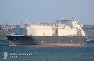
NOHSHU MARU
Tanker A
Current Trip
| Time Travelled | 12 h, 51 mins |
|---|---|
| Remaining Time | --- |
| Distance Travelled | 176.00 nm |
| Remaining Distance | --- |
| AVG Speed | 10.7 Knots |
| MAX Speed | 19 Knots |
| AVG Wind | 17.5 knots |
| MAX Wind | 20 knots |
| MIN Temp | 2.6°C / 36.68°F |
| MAX Temp | 5°C / 41°F |
| Dybgang | 9.5 m |
| Position Modtaget | 2 h, 44 m siden |
Current Position
| Longitude | -0.96793° |
|---|---|
| Latitude | 50.29744° |
| Status | Under way using engine |
| Fart | 15.8 Knots |
| Kurs | 253.7° |
| Område | English Channel |
| Station | T-AIS |
| Position Modtaget | 2 h, 44 m siden |
Info
Information
The current position of NOHSHU MARU is in English Channel with coordinates 50.29744° / -0.96793° as reported on 2025-02-10 22:02 by AIS to our vessel tracker app. The vessel's current speed is 15.8 Knots and is heading at the port of CORPUS CHRISTI. The estimated time of arrival as calculated by MyShipTracking vessel tracking app is 2025-02-24 18:00 LT
The vessel NOHSHU MARU (IMO: 9796781, MMSI: 311000579) is a Tanker A It's sailing under the flag of [BS] Bahamas.
In this page you can find informations about the vessels current position, last detected port calls, and current voyage information. If the vessels is not in coverage by AIS you will find the latest position.
The current position of NOHSHU MARU is detected by our AIS receivers and we are not responsible for the reliability of the data. The last position was recorded while the vessel was in Coverage by the Ais receivers of our vessel tracking app.
The current draught of NOHSHU MARU as reported by AIS is 9.5 meters
Weather
| Temperature | 5.3°C / 41.54°F |
|---|---|
| Wind Speed | 14 knots |
| Direction | 11° N |
| Pressure | 1020.9 hPa |
| Humidity | 78.9 % |
| Cloud Coverage | 100 % |
Featured Company
Last Trips
| Origin | Departure | Destination | Arrival | Distance |
|---|
Events
| Tid | Hændelsen | Detaljer | Position / Dest | Info |
|---|---|---|---|---|
| 2025-02-10 22:07 | Status er ændret | Default Under way using engine |
50.29142 / -1.00027
US CRP
|
Fart: 15.8 kn Kurs: 253.7° |
| 2025-02-10 22:02 | Udenfor Dækning |
50.29744 / -.96793
English Channel
US CRP
|
Fart: 15.8 kn Kurs: 253.7° |
|
| 2025-02-10 15:07 | Ændre havområde | United Kingdom part of the English Channel United Kingdom part of the North Sea |
51.06044 / 1.49472
English Channel
US CRP
|
Fart: 13.1 kn Kurs: 219.3° |
| 2025-02-10 14:13 | Ændre havområde | United Kingdom part of the North Sea French part of the North Sea |
51.08957 / 1.69329
North Sea
US CRP
|
Fart: 6.1 kn Kurs: 316.1° |
| 2025-02-10 11:56 | Afsejlet fra sidste havn |
|
51.04677 / 2.15030
US CRP
|
Fart: 9.4 kn Kurs: 308° |
| 2025-02-10 11:41 | START Sejllads |
51.03716 / 2.18389
[FR] DUNKERQUE
|
Fart: 3.4 kn Kurs: 250° |
|
| 2025-02-10 11:16 | Status er ændret | Under way using engine Moored |
51.03875 / 2.18830
[FR] DUNKERQUE
|
Fart: Kurs: 254° |
| 2025-02-10 11:14 | Status er ændret | Moored Default |
51.03879 / 2.18828
[FR] DUNKERQUE
|
Fart: Kurs: 254° |
| 2025-02-10 11:08 | Status er ændret | Default Moored |
51.03881 / 2.18829
[FR] DUNKERQUE
|
Fart: Kurs: 254° |
| 2025-02-10 10:59 | Status er ændret | Moored Default |
51.03876 / 2.18822
[FR] DUNKERQUE
|
Fart: Kurs: 254° |