
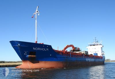
NORHOLM
General Cargo
Current Trip
RAUDSAND NO
| Time Travelled | 1 day |
|---|---|
| Remaining Time | --- |
| Distance Travelled | 407.88 nm |
| Remaining Distance | --- |
| AVG Speed | 10 Knots |
| MAX Speed | 11.9 Knots |
| AVG Wind | 9.5 knots |
| MAX Wind | 18.7 knots |
| MIN Temp | -0.7°C / 30.74°F |
| MAX Temp | 6.1°C / 42.98°F |
| Dybgang | 6.5 m |
| Position Modtaget | Nu |
Current Position
| Longitude | 6.19315° |
|---|---|
| Latitude | 58.25262° |
| Status | Under way using engine |
| Fart | 11.4 Knots |
| Kurs | 313.4° |
| Område | North Sea |
| Station | T-AIS |
| Position Modtaget | Nu |
Info
Information
The current position of NORHOLM is in North Sea with coordinates 58.25262° / 6.19315° as reported on 2025-02-01 10:06 by AIS to our vessel tracker app. The vessel's current speed is 11.4 Knots
The vessel NORHOLM (IMO: 9107136, MMSI: 258656000) is a General Cargo that was built in 1995 ( 30 år gamle ). It's sailing under the flag of [NO] Norway.
In this page you can find informations about the vessels current position, last detected port calls, and current voyage information. If the vessels is not in coverage by AIS you will find the latest position.
The current position of NORHOLM is detected by our AIS receivers and we are not responsible for the reliability of the data. The last position was recorded while the vessel was in Coverage by the Ais receivers of our vessel tracking app.
The current draught of NORHOLM as reported by AIS is 6.5 meters
Weather
| Temperature | 2°C / 35.6°F |
|---|---|
| Wind Speed | 7 knots |
| Direction | 89° E |
| Pressure | 1030 hPa |
| Humidity | 73.6 % |
| Cloud Coverage | 85 % |
Featured Company
Last Port Calls
| Port | Arrival | Departure | Time In Port |
|---|---|---|---|
| 2025-01-30 02:10 | 2025-01-30 17:39 | 15 h | |
| 2025-01-28 08:37 | 2025-01-29 03:25 | 18 h | |
| 2025-01-23 23:24 | 2025-01-24 21:07 | 21 h | |
| 2025-01-19 13:21 | 2025-01-20 05:04 | 15 h | |
| 2025-01-10 12:22 | 2025-01-13 04:56 | 2 d | |
| 2025-01-09 11:15 | 2025-01-09 19:15 | 8 h | |
| 2025-01-03 05:04 | 2025-01-04 04:49 | 23 h | |
| 2024-12-30 17:27 | 2024-12-30 19:11 | 1 h | |
| 2024-12-24 07:24 | 2024-12-28 08:51 | 4 d | |
| 2024-12-22 16:46 | 2024-12-22 20:54 | 4 h |
Last Trips
| Origin | Departure | Destination | Arrival | Distance | |
|---|---|---|---|---|---|
| 2025-01-29 04:25 | 2025-01-30 03:10 | 222.15 nm | |||
| 2025-01-24 22:07 | 2025-01-28 09:37 | 573.17 nm | |||
| 2025-01-20 06:04 | 2025-01-24 00:24 | 655.10 nm | |||
| 2025-01-13 06:56 | 2025-01-19 14:21 | 926.67 nm | |||
| 2025-01-09 20:15 | 2025-01-10 14:22 | 191.38 nm | |||
| 2025-01-04 05:49 | 2025-01-09 12:15 | 888.03 nm | |||
| 2024-12-30 20:11 | 2025-01-03 06:04 | 557.66 nm | |||
| 2024-12-28 09:51 | 2024-12-30 18:27 | 477.31 nm | |||
| 2024-12-22 21:54 | 2024-12-24 08:24 | 317.64 nm | |||
| 2024-12-19 07:09 | 2024-12-22 17:46 | 696.14 nm |
Events
| Tid | Hændelsen | Detaljer | Position / Dest | Info |
|---|---|---|---|---|
| 2025-02-01 07:03 | Ændre havområde | Norwegian part of the North Sea Norwegian part of the Skaggerak |
57.95090 / 7.07625
North Sea
RAUDSAND NO
|
Fart: 11 kn Kurs: 290° |
| 2025-02-01 00:16 | Fundet i havområde | Norwegian part of the Skaggerak |
57.88709 / 9.20809
Skaggerak
RAUDSAND NO
|
Fart: 9.9 kn Kurs: 269.4° |
| 2025-02-01 00:06 | Destination er ændret | RAUDSAND NO HARSTAD NO |
57.88729 / 9.26233
RAUDSAND NO
|
Fart: 9.8 kn Kurs: 269.6° |
| 2025-02-01 00:06 | ETA er ændret | 2025/02/03 04:00 2025/02/04 19:00 |
57.88729 / 9.26233
RAUDSAND NO
|
Fart: 9.8 kn Kurs: 269.6° |
| 2025-01-31 18:34 | Ændre havområde | Danish part of the Skaggerak Danish part of the Kattegat |
57.77523 / 10.79917
Skaggerak
HARSTAD NO
|
Fart: 9.1 kn Kurs: 333.2° |
| 2025-01-30 23:50 | Ændre havområde | Danish part of the Kattegat Danish part of the Baltic Sea |
54.75440 / 10.89102
Kattegat
HARSTAD NO
|
Fart: 10 kn Kurs: 344.2° |
| 2025-01-30 22:38 | Ændre havområde | Danish part of the Baltic Sea German part of the Baltic Sea |
54.62537 / 11.14567
Baltic Sea
HARSTAD NO
|
Fart: 10.5 kn Kurs: 300.5° |
| 2025-01-30 17:39 | Afsejlet fra sidste havn |
|
53.91247 / 11.43745
HARSTAD NO
|
Fart: 7.4 kn Kurs: 330° |
| 2025-01-30 17:28 | START Sejllads |
53.90212 / 11.45980
[DE] WISMAR
|
Fart: 3.5 kn Kurs: 274° |
|
| 2025-01-30 17:21 | Status er ændret | Under way using engine Moored |
53.90227 / 11.46298
[DE] WISMAR
|
Fart: Kurs: 278° |